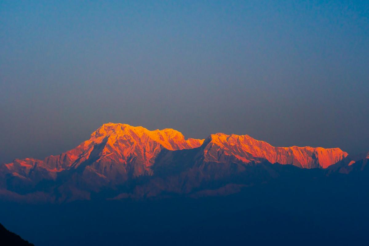
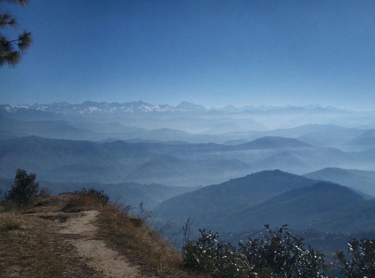
Walk out of Nagarkot under the prayer flags on the main street and the tarmac soon gives way to a dirt path through pine forest. The ridge falls away to terraced fields and farmhouses, and on a clear morning Langtang and Ganesh Himal stand along the skyline.
The Nagarkot panoramic hiking trail is a half-day loop of about 12 km around the Nagarkot ridge, which Wikivoyage, Wikipedia and a local guide's website put at about three to four hours. It links pine forest, villages and an open ridge, has no entry fee, and parts of it are not well marked, so walk it with someone who knows the paths.
Nagarkot, 32 km from Kathmandu, is one of the hill stations in Nepal you can reach in a morning. This guide covers the loop and the longer walks to Changu Narayan, Chisapani and Dhulikhel; for sunrise spots, see our Nagarkot travel guide.
Updated 18 Nov 2026
In this guide
- What is the Nagarkot panoramic hiking trail?
- Where does the loop start, and how do you follow it?
- Is there a short walk for sunrise?
- How long is the walk from Nagarkot to Changu Narayan?
- What is the Chisapani to Nagarkot walk like?
- Can you walk on from Nagarkot to Dhulikhel?
- Which Nagarkot walk suits you?
- When is the best time to hike around Nagarkot?
- How do you get to the trailheads?
- Is it safe to hike the Nagarkot trails?
- Frequently asked questions
- Plan your Nagarkot hike
Key facts
- Panoramic loop
- About 12 km, about three to four hours, no entry fee (Wikipedia and Wikivoyage, checked 19 Nov 2026)
- Nagarkot height
- About 2,100 to 2,200 m along the ridge; view tower 2,164 m (Wikivoyage, Wikipedia, Lonely Planet, checked 19 Nov 2026)
- Distance from Kathmandu
- 32 km (Nepal Tourism Board, checked 19 Nov 2026)
- Nagarkot to Changu Narayan
- About four to five hours on foot, mostly downhill (Hikers' reports and our trip pages, checked 19 Nov 2026)
- Telkot to Changu Narayan
- About one and a half to two and a half hours, depending on pace (Our trip pages and a local operator, checked 19 Nov 2026)
- Chisapani to Nagarkot
- About seven hours on foot (NETIF and our trip pages, checked 19 Nov 2026)
- Shivapuri Nagarjun National Park entry
- NPR 1,000 foreign, NPR 600 SAARC, NPR 100 Nepali, per person per entry; children below 10 free (NTB park entry fees and the park's fee page, checked 19 Nov 2026)
- Changu Narayan entry
- NPR 400 foreign, NPR 300 SAARC as reported in July 2025; NTB's older table is lower (RSS via Radio Nepal, 30 Jul 2025; NTB, checked 19 Nov 2026)
- Highest point on these walks
- Borlang Bhanjyang, about 2,430 m, below the 2,450 m altitude-risk level (UncoverNepal house figure; US CDC, checked 19 Nov 2026)
- Tourist Police
- Hotline 1144 (toll free); Nagarkot post 9851289447 (Nepal Police, checked 19 Nov 2026)
What is the Nagarkot panoramic hiking trail?
The Nagarkot panoramic hiking trail is a named walking loop of about 12 km on and below the ridge around Nagarkot, the hill village in Bhaktapur District. Most descriptions split it into three parts: the Nagarkot Nature Trail through pine forest, a village walk from Kartike, and an open ridge section towards Dhanda Gaun.
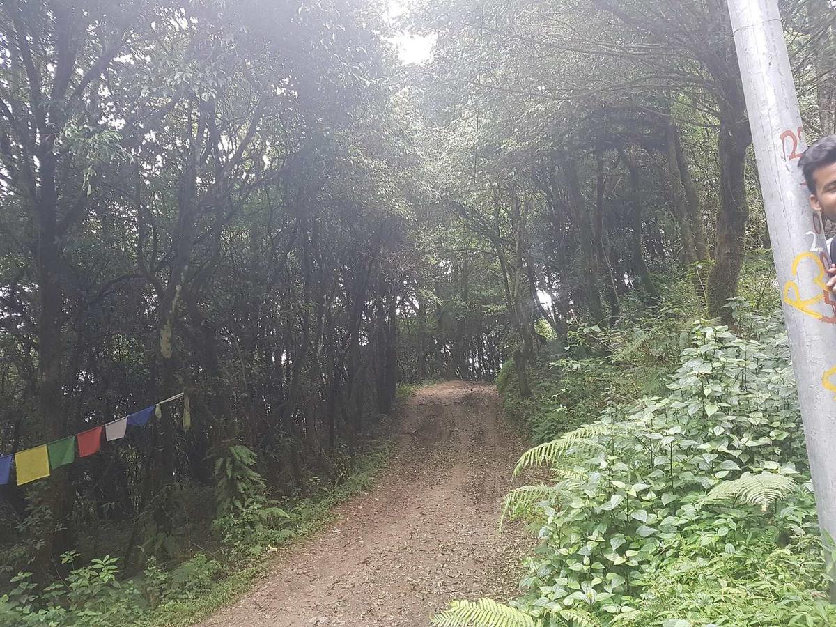
Wikivoyage adds that it passes Rohini Bhanjyang, terraced hillsides and farmhouses. On a clear day the ridge looks out to Langtang, Ganesh Himal and Rolwaling, with Everest only in exceptional conditions. It is a long mountain view rather than a close one, so binoculars help, and NTB's advice fits: "Take a walk around the nearby hills for better views."
The name appears in guidebooks and hotel guides from about 2015, and the earliest description we found is a 2015 post by a Nagarkot hotel. We could not find who first marked the trail. It is separate from the much longer Kathmandu Valley Cultural Trekking Trail, which runs from Sundarijal through Chisapani, Nagarkot, Dhulikhel and Namobuddha to Panauti and was developed in 2009 to 2010 by the Nepali NGO NETIF. In September 2021 Changunarayan Municipality also began a trail of about 5 km from Muhanpokhari to Nagarkot; we could not confirm it was finished.
Where does the loop start, and how do you follow it?
Descriptions differ on where the loop starts. One Nagarkot guide's website starts it near the view tower or bus station area and ends it in central Nagarkot, while the older hotel description begins with the Nature Trail into the pine forest.
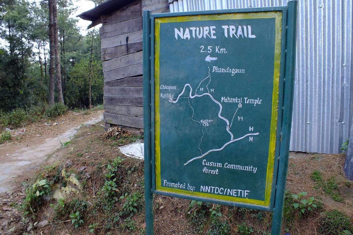
Reports on signs disagree. The 2015 hotel post warned walkers they "might get lost" because there were no clear signboards. Wikivoyage still says "The trail is not well-marked on the ground", and in 2019 a Nagarkot tourism committee secretary told Republica the municipalities had not put up "sign boards on the hiking routes". A local guide's website, updated in October 2026, now calls the loop marked, and a hiker's online post reports a route-map board near the Nature Trail entrance, like the one in our photo. Some junctions have boards; others do not.
How to follow the loop:
- Save an offline map or GPS track on your phone before you leave the hotel.
- Ask your hotel to show you the first turning, and tell them your route.
- Start in the morning; in late November the sun sets at about 17:08.
- Check the map at every fork, because forest junctions look alike.
- If you lose the path, go back to the last point you were sure of.
- Better still, walk with a licensed guide, which our team can arrange.
Is there a short walk for sunrise?
Yes. The view tower, which Lonely Planet calls the Geodetic Survey Lookout Tower, stands at 2,164 m on a ridge about 4 km south of the village, around an hour's walk. Walking up in the dark for sunrise is the shortest classic Nagarkot walk, and it needs a torch, warm layers and a route you have checked in daylight.
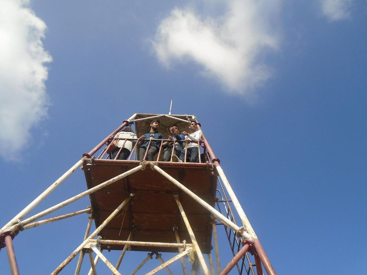
Lonely Planet warns that "rising vegetation can obscure the vista" from the tower, and no fee or opening hours are published. Sunrise is about 06:28 on 21 November and 06:54 in mid-January, with first light about 25 minutes earlier.
How long is the walk from Nagarkot to Changu Narayan?
Allow about four to five hours on foot from Nagarkot to Changu Narayan. The walk is mostly downhill, through villages and farmland to Telkot, then forest onto the temple hill. Start at Telkot, the village on the road below Nagarkot, and it shrinks to about one and a half to two and a half hours.
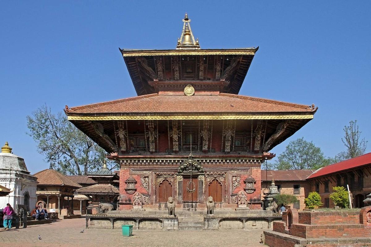
Tea shops are at Telkot and Changu Narayan village, with very little between. One local operator says there are direction boards at Telkot and the key junctions; in our experience village paths branch off often and signs are few. Our day hike walks it the other way, uphill to Nagarkot for sunset. NTB mentions the route on its Changu Narayan page:
"Some visitors also trek from Nagarkot to Changu Narayan and return to Kathmandu via Bhaktapur."
Nepal Tourism Board, "Changu Narayan Temple", undated page, checked 19 November 2026
Changu Narayan is one of the seven Monument Zones of the Kathmandu Valley World Heritage property, inscribed by UNESCO in 1979. UNESCO describes a Hindu temple complex with "one of the earliest inscriptions in the Valley from the fifth century AD": a pillar inscription of the Licchavi king Manadeva, dated AD 464. The temple is a two-tiered pagoda to Vishnu, rebuilt in 1702 after a fire.
Entry fee. Rastriya Samachar Samiti reported NPR 400 for most foreign visitors and NPR 300 for SAARC nationals in July 2025. NTB's older table shows NPR 300 and NPR 100, so check at the gate.
Getting back. NTB says microbuses leave regularly from Bhaktapur for Changu Narayan, and it puts the temple 12 km east of Kathmandu. Since 17 July 2025 Bhaktapur has charged NPR 2,000 for foreign visitors and NPR 500 for SAARC and Chinese visitors; see our Bhaktapur city guide.
What is the Chisapani to Nagarkot walk like?
It is a full day of about seven hours on foot, east along the rim of the Kathmandu Valley from Chisapani, at about 2,150 m, to Nagarkot. We walk it as the second day of a hike from Sundarijal. The first part of the day is still inside Shivapuri Nagarjun National Park.
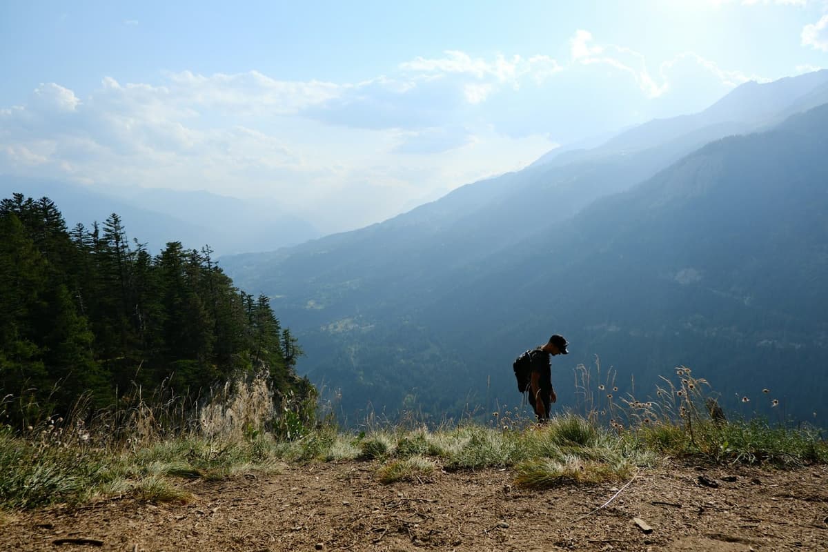
The day before. From Sundarijal the trail passes the park gate and Mulkharka, then crosses the forested pass of Borlang Bhanjyang, at about 2,430 m, to Chisapani, in five to six hours. Mulkharka is the last place for refreshments, with no water source between there and Chisapani. Our Kathmandu hiking guide covers this section.
Chisapani to Nagarkot. The route passes Dhap, a wetland, then Jhule, Chauki Bhanjyang, Jarsing Pauwa and Kartike Bhanjyang before the final climb to Nagarkot, with lunch usually around Chauki Bhanjyang or Jhule. The distance is roughly 18 to 23 km, depending on the route, and Wikivoyage gives 5 to 7.5 hours.
Park rules. The park charges NPR 1,000 for foreigners, NPR 600 for SAARC nationals and NPR 100 for Nepalis, per person per entry, payable at the entry points or in Kathmandu. Its fee schedule says foreign and SAARC visitors must be accompanied by a park-certified guide, and it lists the rates per day, per person and per entry, so if your walk spends two days in the park, ask us whether a second ticket applies. On our rim trips we arrange the park ticket. The park's rules ask you to fill in a form at the ticket counter listing the food you carry in, to leave before sunset, and to bring no meat-based food, alcohol, cigarettes, lighters or speakers.
Altitude is not a concern: Borlang Bhanjyang is just below the 2,450 m (8,000 ft) level the US CDC uses for altitude risk.
Can you walk on from Nagarkot to Dhulikhel?
Yes, but it is a long day of about six to seven hours, via Rohini Bhanjyang and Kashi Bhanjyang on the Kathmandu Valley Cultural Trekking Trail. NETIF warns there are very few options for food and water on the way, so carry both.
Dhulikhel is a hill town at 1,550 m, and the same trail continues to Namobuddha. See our Dhulikhel guide and our guide to Namo Buddha Stupa.
Which Nagarkot walk suits you?
Pick by the time you have. The view tower and the loop fit around a night in Nagarkot, the Changu Narayan walk fills a morning, and the rim and Dhulikhel walks are full days for regular walkers.
| Walk | Walking time | Character | Fees on the way | Suits |
|---|---|---|---|---|
| View tower at sunrise | Around an hour each way | Ridge path, often in the dark | None published | Anyone staying the night |
| Panoramic loop | About three to four hours | Pine forest, villages, open ridge | None | A half day after sunrise |
| Telkot to Changu Narayan | About one and a half to two and a half hours | Forest and village paths | Changu Narayan entry | Families, anyone short on time |
| Nagarkot to Changu Narayan | About four to five hours | Mostly downhill | Changu Narayan entry | A morning ending at a temple |
| Chisapani to Nagarkot | About seven hours | Valley rim, park forest, villages | National park entry | Multi-day rim walkers |
| Nagarkot to Dhulikhel | About six to seven hours | Village trails, few supplies | Check locally | Experienced day walkers |
When is the best time to hike around Nagarkot?
October to April is the walking season, and October and November give the clearest skies, according to NTB. December and January are colder, but NTB notes "compensating bright sun and brilliant views". The monsoon normally runs from about mid-June to early October, bringing mud and leeches to the forest paths.
| Month | Mean daily max / min at Nagarkot | What to expect |
|---|---|---|
| October | 20.6 / 11.3 °C | Clearing after the monsoon; in 2026 it withdrew on 14 October |
| November | 17.5 / 7.3 °C | Clear and dry; 9.1 mm of rain in an average November |
| December | 14.3 / 4.3 °C | Cold dawns, bright days |
| January | 12.9 / 2.9 °C | The coldest dawns in this table |
| February | 15.3 / 4.6 °C | Cold at sunrise, warming by midday |
| March | 19.3 / 7.6 °C | Haze and forest-fire smoke can hide the mountains |
| April | 22.5 / 10.8 °C | Warm walking; haze can last for days |
Temperatures are DHM normals for 1991 to 2020 from the Nagarkot station at 2,147 m; the rain figure is from an older 1976 to 2005 series. For the rest of the country, see our best time to visit Nepal guide.
If the view matters, stay two nights: spring haze can hide the peaks for days.
How do you get to the trailheads?
Nagarkot is usually about 1.5 to 2 hours from Kathmandu by car with traffic, or about an hour to an hour and a half on quiet pre-dawn roads. By public transport you change at Bhaktapur, because there is no tourist bus on this road.
- Bus to Nagarkot. Local buses leave from the Kamal Binayak area of Bhaktapur and take about one and a half to two hours, in daytime only.
- The road. It is about 15 to 18 km from Bhaktapur, depending on where you start. Changunarayan Municipality began upgrading it in 2025, so expect roadworks in places.
- Telkot. It sits on the Bhaktapur to Nagarkot road, so a car or bus can drop you there for the short walk to Changu Narayan.
Is it safe to hike the Nagarkot trails?
For most walkers, yes, if you respect the forest sections. The main risks are losing the path at junctions that look alike, slippery stone steps after rain, road sections near villages, cold early mornings, dogs and, in the monsoon, leeches.
In August 2024 three Indian tourists and their Nepali guide lost their way near Muhan Pokhari and Rani Jhula in the afternoon; an Armed Police Force team and local people reached them around midnight, with leech bites.
"They had gone missing as they could not locate the way to the Rani Jhula area and mistakenly moved towards the nearby forest area, police said."
The Tribune (PTI), "Three missing Indians rescued from Nepal's Nagarkot forest after 10 hours", 18 August 2024
Getting lost. Carry an offline map or GPS track, check it at every fork, and walk with someone who knows the paths. Finish in daylight.
Dogs and rabies. The US CDC says: "Dogs infected with rabies are commonly found in Nepal." Ask your doctor about rabies vaccination before you travel, and give dogs space. If one bites or scratches you, wash the wound well with soap and running water and go to a larger hospital in Kathmandu the same day, because the CDC warns rabies vaccine may only be available at larger medical facilities in towns and cities.
Leeches, wet steps and cold. In the monsoon, tuck long trousers into socks and check your ankles at each stop. Wear shoes with grip, and start in a warm layer; January lows average 2.9 °C.
Who to call. Save the Nagarkot tourist police post, 9851289447, and the toll-free hotline, 1144. In the park, go to the nearest park, army or police post.
Walking alone. Outside the national park no rule we found requires a guide on these paths, and walking alone is not illegal. Inside it, the park's fee schedule requires foreign and SAARC visitors to be accompanied by a park-certified guide.
What to carry.
- An offline map on a charged phone, and a power bank
- Water and snacks; supplies are thin between villages
- A torch, warm layer, hat and gloves
- A rain jacket outside the dry months
- Cash in Nepali rupees for entry fees
Frequently asked questions
Where does the Nagarkot Panoramic Hiking Trail start?
Descriptions differ. One local guide's website starts the loop near the view tower or bus station area and ends it in central Nagarkot, while the 2015 hotel description starts with the Nature Trail into the pine forest. Wikivoyage says the trail is not well marked on the ground, so ask your hotel for the first turning and carry an offline map.
How many hours does the Nagarkot Panoramic Hiking Trail take?
About three to four hours for a loop of about 12 km, so a half-day walk. Wikipedia gives 3 to 3.5 hours and a Nagarkot guide up to 4.5 hours. Add time for stops, photos and the odd wrong turning at unmarked junctions.
How far is Chisapani to Nagarkot?
Roughly 18 to 23 km, depending on the route. NETIF gives 18 km and 20 km on two of its pages, and a GPS track on 10Adventures measures 22.7 km. Plan on about seven hours of walking, with lunch around Chauki Bhanjyang or Jhule.
Do I need a permit or a guide to hike around Nagarkot?
Not for the panoramic loop, which has no entry fee, and no rule we found requires a guide on paths outside the national park. The Chisapani section is different: Shivapuri Nagarjun National Park needs an entry ticket, and its fee schedule says foreign and SAARC visitors must be accompanied by a park-certified guide.
How high is the Nagarkot Panoramic Hiking Trail?
The loop stays on and below the Nagarkot ridge, at about 2,100 to 2,200 m, though published figures differ. The view tower stands at 2,164 m. That is below the 2,450 m (8,000 ft) level the US CDC uses for altitude risk, so altitude sickness is not a concern, but early mornings are cold.
What is the weather like on the Nagarkot hiking trails?
Mild by day and cold at dawn. November averages highs of 17.5 °C and lows of 7.3 °C, and January highs of 12.9 °C and lows of 2.9 °C. October and November bring the clearest skies, and the monsoon turns forest paths muddy.
Plan your Nagarkot hike
These walks pair well with Bhaktapur and a night on the ridge. For other hill towns, see our guide to hill stations in Nepal, and for more ideas near the city, our day trips from Kathmandu and easy treks in Nepal.
If you would like a licensed guide and transport arranged, these are our trips on these trails:
- Changu Narayan to Nagarkot hike with sunset, one day
- Chisapani to Nagarkot hike, 3 days, from Sundarijal
- Kathmandu Valley rim hike, four days, adding Telkot to Changu Narayan
Tell us your dates and how much you like to walk, and we will suggest a route. Message us on WhatsApp or use the enquiry form on any trip page.