




Explore by activity
Not listed yet

We run Motorbiking & Overland trips — we just haven’t put the itinerary on the site yet. Tell us your dates and we’ll send a costed day-by-day plan.

Explore by experience
Explore by region
by gomayu
Search Tours or Places

Kathmandu Hiking: Day Hikes on the Valley Rim

21 min read Posted 12 Oct 2026Updated 27 Oct 2026
Kathmandu Hiking: Day Hikes on the Valley Rim

By Uncover Nepal Team · Checked by our Kathmandu travel team · Last checked 12 Oct 2026

The path out of the Panimuhan gate climbs into forest almost at once, and within minutes the traffic of Budhanilkantha is only a murmur behind the trees. Higher up the forest turns to oak, the air cools, and the only sounds are birds and your own breathing. At the top, the whole valley lies below you as a spread of rooftops and terraces.

Kathmandu hiking means day walks on the hills that ring the valley, with the hill stations in Nepal as overnight options. The best known are Shivapuri Peak (2,732 m), Nagarjun, Champadevi, Chandragiri, Chisapani, Nagarkot and Phulchowki. Most park trails take four to six hours, according to the park. October and November give the clearest skies.

Key facts

Number of trails
"over 50 hiking trails" in the Kathmandu Valley (Nepal Tourism Board, ntb.gov.np/en/hiking, 11 Oct 2026)
Highest point on the rim
Phulchowki, about 2,760 m (BirdLife International IBA factsheet; Onlinekhabar 2023, 11 Oct 2026)
Highest point in the national park
Shivapuri Peak, 2,732 m (SNNP Management Plan 2024 to 2029; Gokarneshwor Municipality, 11 Oct 2026)
Valley floor
Kathmandu airport weather station, 1,337 m (DHM normals via WMO, 11 Oct 2026)
Park entry fee
NPR 1,000 foreign, NPR 600 SAARC, NPR 100 Nepali, per person per entry (NTB park entry fees; snnp.gov.np/pages/fees, 11 Oct 2026)
Children
Under 10 enter free (NTB park entry fees, 11 Oct 2026)
Guide rule
Park fee schedule says foreign and SAARC visitors must be accompanied by a park-certified guide (snnp.gov.np/pages/fees, 11 Oct 2026)
Closing rule
Visitors "must leave the National Park" before sunset (SNNP Management Plan 2024 to 2029, Annex 16, 11 Oct 2026)
Clearest months
October and November (Nepal Tourism Board climate page, 11 Oct 2026)

The valley rim in one minute

The Kathmandu Valley floor sits at about 1,400 m in the centre, and the hills around it rise from just over 2,000 m at Kakani to about 2,760 m at Phulchowki. The Nepal Tourism Board lists Shivapuri, Sundarijal, Namobuddha, Champadevi, Nagarkot, Kakani, Phulchowki and Nagarjun as the main options around the city.

The rim falls into three parts:

  • Northern rim: Shivapuri, Nagarjun (Jamacho), Sundarijal to Chisapani and Kakani. Shivapuri, Nagarjun and the Sundarijal to Chisapani trail sit inside Shivapuri Nagarjun National Park, so you pay the park fee there and follow the park's rules. For Kakani, ask locally whether a park ticket applies on your route.
  • Southern rim: Champadevi and Chandragiri in the south-west, and Phulchowki in the south-east. These are outside the national park, so no park ticket applies.
  • Eastern rim and beyond: Changu Narayan, Nagarkot, Dhulikhel and Namobuddha, which make good linked walks through villages and farmland.

Kathmandu hiking routes compared

Walking times below are one way unless stated. Difficulty is our own grading, based on the climb and the length of the day.

Hike Start point Top or end point Walking time Difficulty Fee or permit Best for
Shivapuri Peak via Nagi Gumba and Bagdwar Panimuhan gate, Budhanilkantha Shivapuri Peak, 2,732 m About 4 to 5 hours up; allow a full day Strenuous SNNP ticket The biggest climb in the park, temples, forest
Nagarjun (Jamacho) Fulbari gate, Balaju side Jamacho, about 2,100 m About 3 hours up by the park's timing Moderate SNNP ticket A forest climb close to the city
Champadevi Pharping or Hattiban Champadevi, about 2,280 m About 2 to 3.5 hours up Moderate No SNNP ticket A quieter summit with prayer flags
Chandragiri Thankot cable car base, 1,550 m Top station, 2,551 m 4 to 5 hours up on foot, or about 10 minutes by cable car Strenuous on foot, easy by cable car Cable car ticket, check before you go Families, or a long ridge day from Champadevi
Sundarijal to Chisapani Sundarijal Chisapani, about 2,150 m Five to seven hours Moderate to strenuous SNNP ticket A first taste of trekking with a night at a lodge
Changu Narayan to Nagarkot Changu Narayan temple Nagarkot, about 2,100 to 2,200 m Four to five hours Moderate Changu Narayan entry fee, check at the gate Heritage plus a sunset hill town
Nagarkot to Dhulikhel Nagarkot Dhulikhel, 1,550 m About six hours of walking, most of a day Moderate, long None we could confirm A ridge walk ending at a bus stop home
Namobuddha Dhulikhel or Panauti Namobuddha stupa and monastery About three hours each way Easy to moderate None we could confirm Buddhist pilgrimage and farmland
Phulchowki Godawari Phulchowki, about 2,760 m About 4 to 6 hours up Strenuous Small local fees may apply, check on the day Birdwatchers and the highest view on the rim

Shivapuri Nagarjun National Park: what to know before you go

Several of the hikes in this guide start inside one protected area, so the rules matter. Shivapuri Nagarjun National Park covers 159 km² on the northern rim of the valley. It was gazetted as the country's ninth national park in 2002, and the Nagarjun forest was added in 2009, when the park took its present name.

In the words of the Department of National Parks and Wildlife Conservation, "Shivapuri is one of the main sources of drinking water for Kathmandu Valley". The park is also an Important Bird Area, with more than 300 bird species, according to the park office, including the spiny babbler, Nepal's endemic bird.

The park names day hikes to Shivapuri Peak as its most popular activity, followed by birdwatching, nature walks and cycling.

Fees

Rates from the park office and the Nepal Tourism Board:

Visitor Entry fee
Foreign (non-SAARC) NPR 1,000
SAARC nationals, including India NPR 600
Nepali citizens NPR 100
Children under 10 Free

The fee is per person, per entry, valid for the day. You can pay at the Tourist Service Centre in Bhrikutimandap, Kathmandu, or at the entry points, and the park site links to online ticketing.

The guide rule

Shivapuri Nagarjun National Park's own fee schedule says foreign and SAARC visitors must be accompanied by a park-certified guide, and gate staff usually ask for one. How strictly this is applied varies from gate to gate, according to hiker reports. Hikes outside the park, such as Champadevi or Phulchowki, have no such rule, but a licensed guide still helps on trails with many unsigned forks. If you want to check the current position before you go, call the park office on +977-01-4370355.

Park rules worth knowing

The park's visitor code of conduct is short and practical:

  • Buy a ticket and keep it until you leave the park.
  • Fill in a form at the counter listing the food you carry in.
  • Do not bring meat-based food, alcohol, cigarettes, lighters, or sound devices such as guitars and speakers.
  • Enter and leave only by the designated routes.
  • Do not enter, bathe in or pollute water sources.
  • Do not pick fruit or flowers, break branches or make loud noise.
  • Leave the park before sunset.

Shivapuri Peak via Nagi Gumba and Bagdwar

Shivapuri Peak, at 2,732 m, is the highest point in the national park and the hardest of the northern-rim day hikes. The classic route leaves the Panimuhan gate at Budhanilkantha, climbs to Nagi Gumba, a nunnery with a tea shop, then continues to Bagdwar and the summit. Bagdwar is the source of the holy Bagmati river, and nearby Bishnudwar is the source of the Bishnumati. In the month of Baishakh (April to May), pilgrims gather at Bagdwar and Bishnudwar for fairs, especially around Nepali New Year in mid-April.
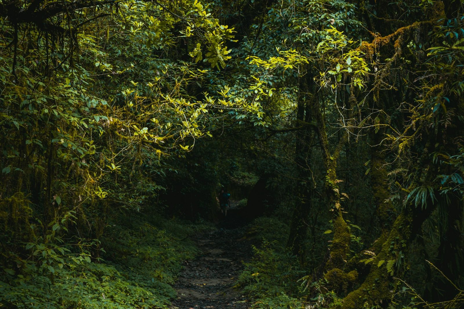
Forest trail in Shivapuri Nagarjun National Park on a Kathmandu hiking day
The forest trail in Shivapuri Nagarjun National Park, north of Kathmandu.

The park's management plan gives about four hours from Panimuhan to the summit via Nagi Gumba and Bagdwar, and five hours by the Dhoka Bhanjyang route. Those are the park's "tentative" times, so allow a full day for the round trip. Budhanilkantha is about 11 km by road from the city centre. Winter brings occasional snow to the summit area.

Practical takeaway: Start at the gate as early as you can, carry all your food and water from Nagi Gumba upwards, and turn round in time to be out of the park before sunset.

Nagarjun and Jamacho

Nagarjun is the forested hill on the north-west side of the city, joined to the national park in 2009. The trail starts at the Fulbari gate near the Balaju bypass and climbs to Jamacho, about 2,100 m, where there is a gumba, a stupa and a viewing tower. The park's own timing is about three hours from Fulbari gate to Jamacho, or five hours by the longer route through Raniban. There are no tea houses on the way, so carry food and water for the whole day.

Practical takeaway: Jamacho is the closest summit hike to Thamel, but it is a steady climb with no shops, so pack it like a full day out.

Champadevi

Champadevi rises to about 2,280 m on the southern rim of the valley. Walkers usually start from Pharping or Hattiban, or take the Dakshinkali road and get off at the Khahare stop beyond Taudaha. From Hattiban it is about two to three and a half hours up and under an hour and a half down. At the top are the Champadevi temple, dedicated to a Hindu goddess, a small stupa and strings of prayer flags. Champadevi is outside the national park, so no park ticket applies.

Strong walkers continue west along the ridge to Chandragiri, which takes five to six hours in total.

Practical takeaway: Champadevi suits a first hike in Kathmandu because there is no park fee or park guide rule, but the trail has several forks, so go with someone who knows it.

Chandragiri

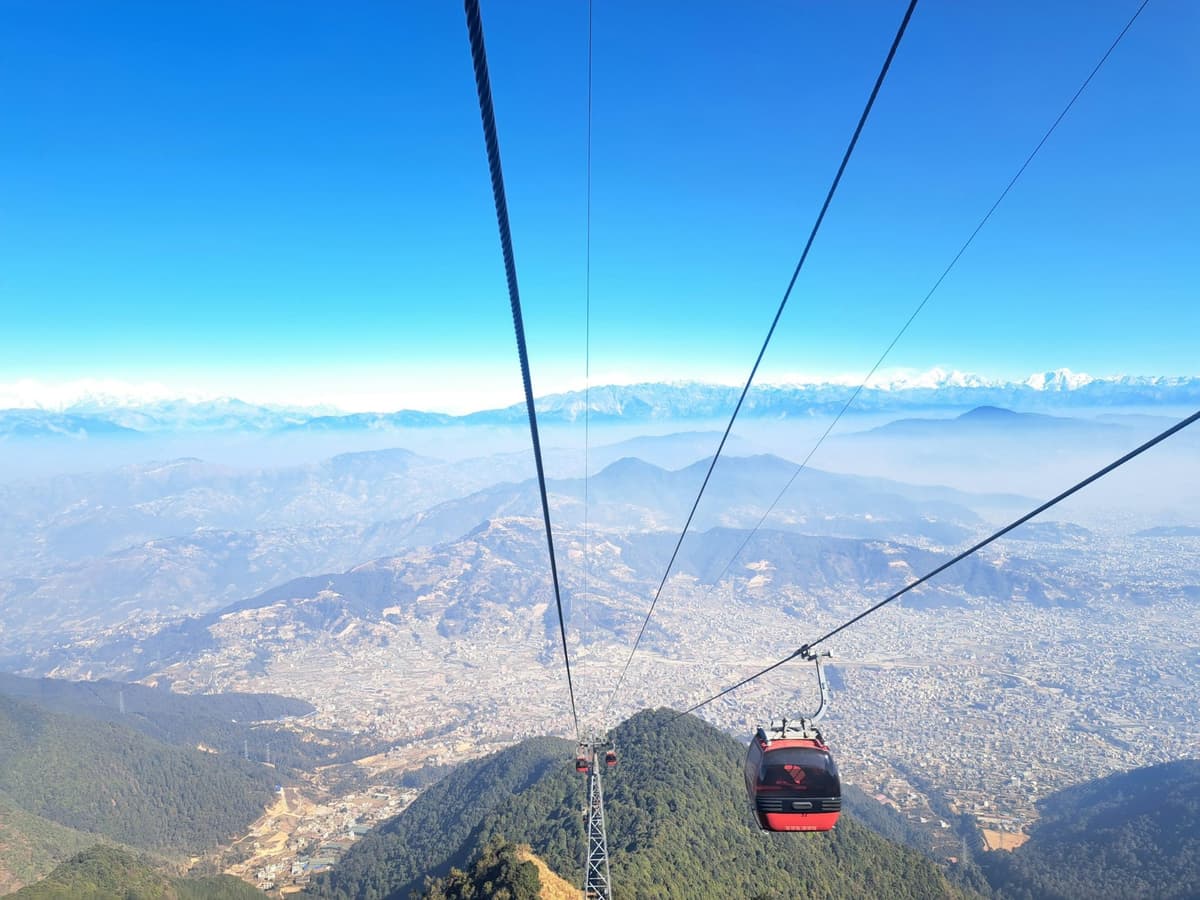
Chandragiri's top station stands at 2,551 m on the south-western rim. Most people ride the cable car, which runs about 2.5 km from the base at Thankot (1,550 m) in about 10 minutes. On foot, the climb from Thankot takes four to five hours. Ticket prices and opening hours change, so check before you go; our Chandragiri cable car guide covers the practical details.

Practical takeaway: Walk up and ride down if you want the exercise without the knee-jarring descent, and keep to the main trail: in June 2022, Nepal Police used ropes to rescue three foreign hikers stuck below a hilltop in the Chandragiri forest.

Sundarijal to Chisapani

This walk works as a long day or the start of an overnight trip, and the park's management plan lists the route through Mulkharka and Deurali among its heritage trails. Sundarijal is about 15 km from Kathmandu. The first stretch climbs past the Sundari waterfall above the bus stop, beside the reservoir and pipeline that carry drinking water to the city.
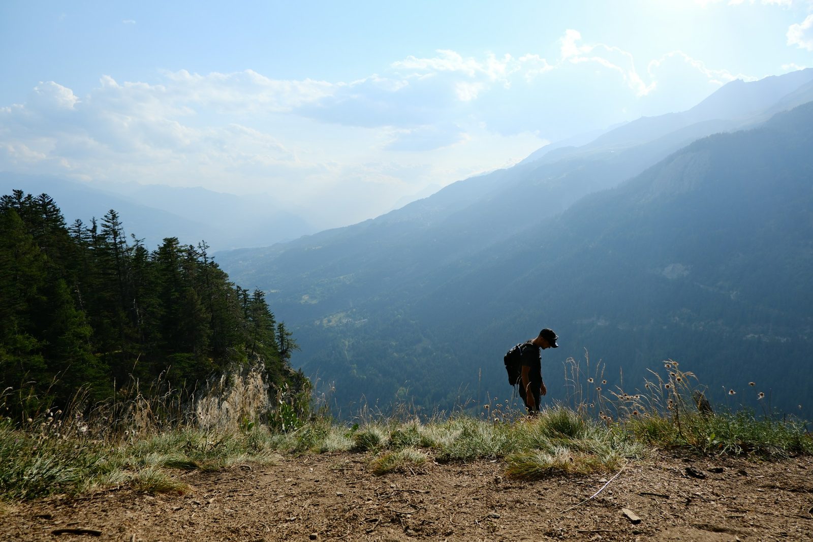
A hiker on the forested ridge trail on the Sundarijal to Chisapani hike
The ridge trail on the way up from Sundarijal to Chisapani.

The park's management plan gives five hours from Sundarijal to Chisapani via Mulkharka and Dhap, or six hours via Manichud. Allow five to seven hours. There is no drinking-water source between Mulkharka and Chisapani and few shops after Mulkharka, so carry enough water for the whole climb. Chisapani, about 2,150 m, sits where Kathmandu, Nuwakot and Sindhupalchowk districts meet, on the park boundary, and is also a park gate. The park plan notes that guest houses and lodges are in the buffer zone, not inside the park, and Chisapani's lodges fill up at weekends.

Many people stay the night at Chisapani and walk out the next day.

Practical takeaway: Fill your bottles at Sundarijal or Mulkharka, avoid shortcuts (people get lost on them every year), and book a Chisapani lodge ahead if you go on a Friday or Saturday.

Changu Narayan to Nagarkot

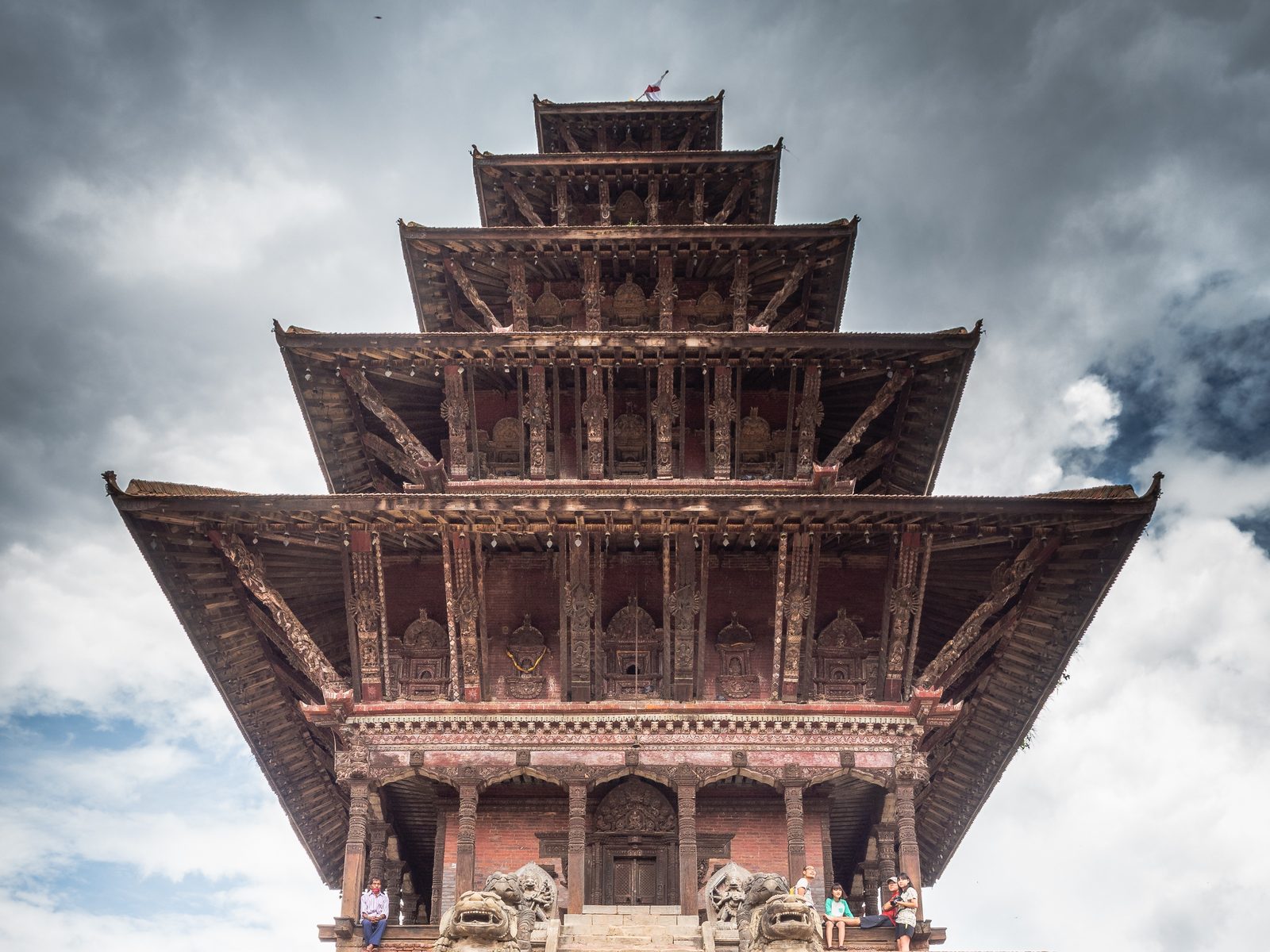
This walk links a temple and a hill town on the eastern side of the valley. Changu Narayan is one of the seven Monument Zones of the Kathmandu Valley World Heritage Site, inscribed by UNESCO in 1979. Foreign visitors pay an entry fee at the temple; check the amount at the gate. From the temple the trail runs by way of Telkot and the Jalapa Devi temple to Nagarkot in about four to five hours. Nagarkot sits at about 2,100 to 2,200 m, roughly 32 km by road from Kathmandu, which is usually 1.5 to 2 hours by car. Our Nagarkot guide covers where to stay and when the views are clearest.

Practical takeaway: Visit the temple in the morning, walk in the middle of the day, and arrive in Nagarkot in time for the evening light.

Nagarkot to Dhulikhel

From Nagarkot, a ridge trail leads south-east through Kashi Bhanjyang and Rabi Bhanjyang to Dhulikhel. Expect most of a day, about six hours of walking. Dhulikhel sits at 1,550 m, about 30 km south-east of Kathmandu, and regular buses run back to the city in about an hour.
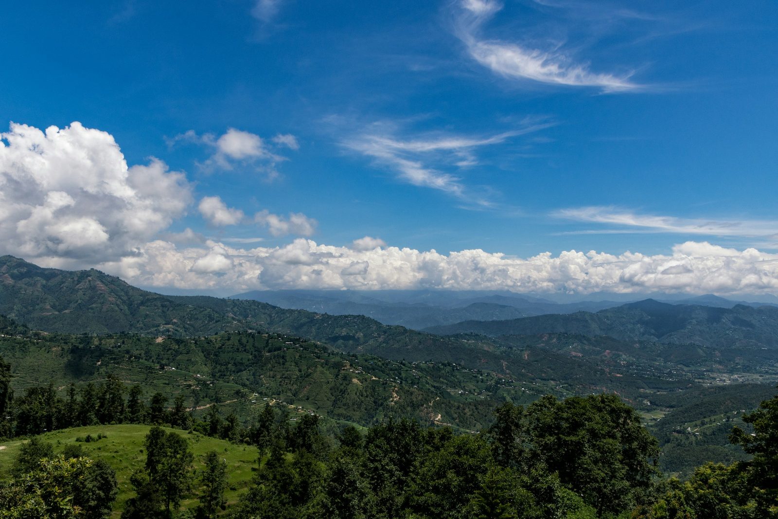
Terraced hills and forest around Dhulikhel at the end of the Nagarkot to Dhulikhel walk
Terraced hills around Dhulikhel, where the ridge walk from Nagarkot ends.

Practical takeaway: Walking downhill from Nagarkot to Dhulikhel is the easier direction, and it ends in a town with buses home.

Namobuddha

Namobuddha is a Buddhist pilgrimage site reached on foot from Dhulikhel or Panauti. According to the legend told by the Nepal Tourism Board, one of the earlier Buddhas gave his body to a starving tigress and her cubs, and a small stupa marks the place. Above it stands Thrangu Tashi Yangtse, a Kagyu monastery founded by Khenchen Thrangu Rinpoche and consecrated in 2008; the Kathmandu Post put its community at 250 to 400 monks in 2019.
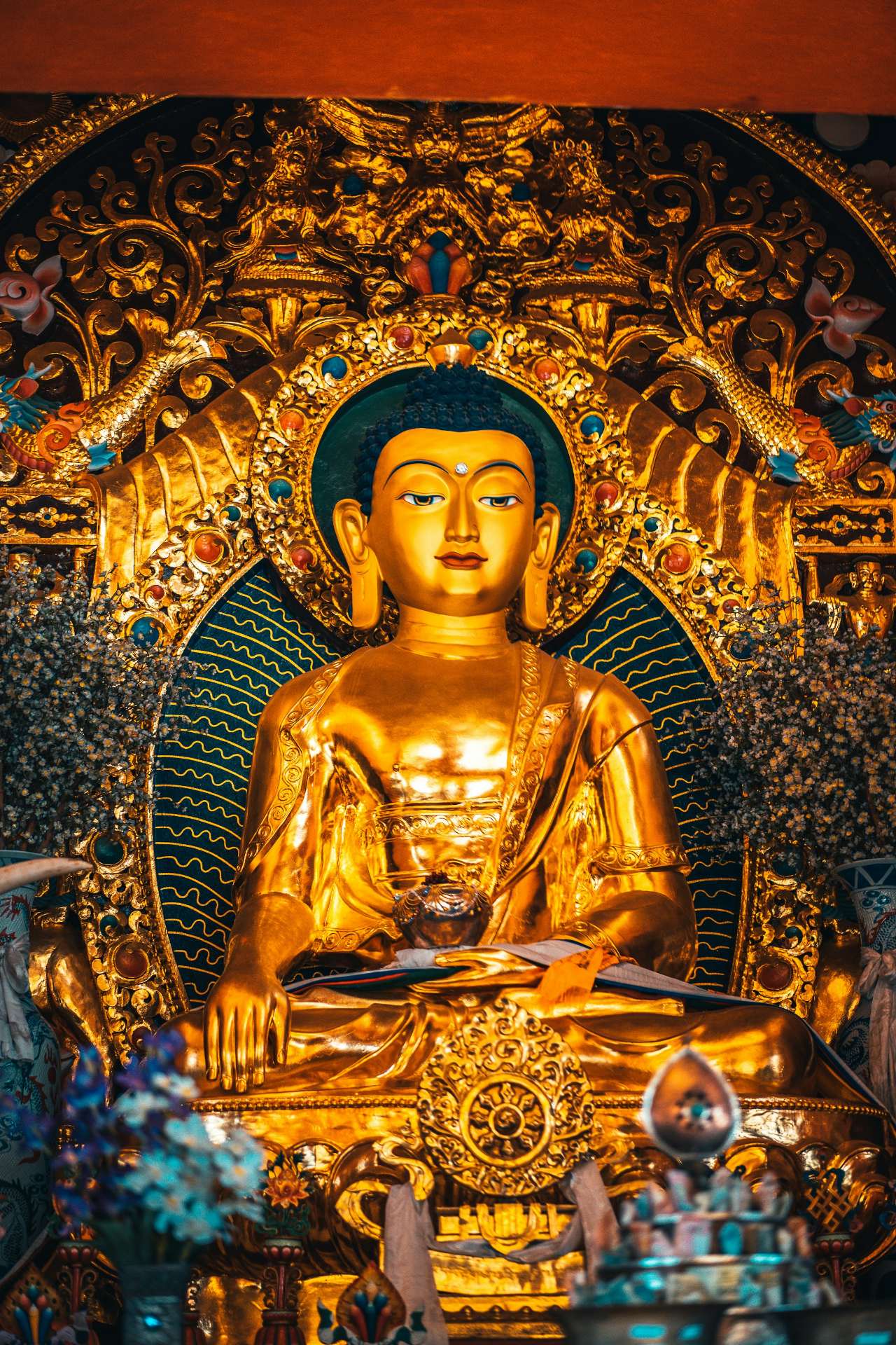
Golden Buddha inside Thrangu Tashi Yangtse monastery at Namobuddha
Inside Thrangu Tashi Yangtse monastery at Namobuddha.

Dhulikhel Municipality calls the walk "an interesting and pleasant three-hour hike from the town", and NTB gives the same three hours from Dhulikhel or Panauti. Both towns are about an hour from Kathmandu by regular bus.

Practical takeaway: Combine Namobuddha with a night in Dhulikhel, walk out in the morning and return by road, so you are not racing the light.

Phulchowki

BirdLife International describes Phulchoki Mountain as "the highest peak on the rim of the Kathmandu Valley". It rises to about 2,760 m, some 16 km south-east of the city. Walkers start at Godawari, where the National Botanical Garden, inaugurated in 1962, sits at the foot of the mountain. A rough road of about 12 to 13 km winds to the summit, and on foot the climb takes about four to six hours. At the top you find a telecom mast and a small temple.

For birdwatchers this is the best hike near the city: BirdLife records 288 species on Phulchoki. Small local fees may apply on the mountain; check on the day.

Practical takeaway: Phulchowki is the longest climb in this guide, so start at first light, take the road only where the trail is unclear, and save it until you have a shorter hike or two in your legs.

When is the best time for Kathmandu hiking?

October and November are the best months for Kathmandu hiking: the monsoon has passed, rain is rare and the skies are at their clearest. December to February is dry and clear but cold on the summits, and March to May is pleasant but often hazy. June to September brings heavy rain, leeches and slippery trails.

The park's own management plan puts it plainly: "The autumn season (September to November) is the most pleasant season, with clear skies and cool temperatures". NTB gives September to May as the best season for the park, with June to August as the rainy months.

The table compares the valley floor with the rim. Kathmandu airport figures are 1991 to 2020 averages at 1,337 m; Kakani figures are 1976 to 2005 averages at about 2,060 m. Summits at 2,500 m to 2,760 m are colder again than Kakani.

Month Valley floor (Kathmandu airport): average high / low, rain Rim (Kakani): average high / low, rain Hiking verdict
January 19.2 / 2.8 °C, 15.2 mm 13.6 / 3.0 °C, 19.5 mm Dry, cold mornings; possible snow on Shivapuri
February 22.1 / 5.3 °C, 23.6 mm 15.4 / 4.7 °C, 25.6 mm Good, still cold at the top
March 26.0 / 8.8 °C, 38.0 mm 19.6 / 8.3 °C, 41.3 mm Good walking, views often hazy
April 28.6 / 12.3 °C, 62.9 mm 22.6 / 11.4 °C, 68.7 mm Warm, hazy; Bagdwar festival season
May 29.2 / 16.1 °C, 128.8 mm 22.8 / 13.5 °C, 202.1 mm Hot, pre-monsoon showers
June 29.5 / 19.3 °C, 241.4 mm 22.7 / 15.4 °C, 483.8 mm Monsoon; short routes only
July 28.7 / 20.3 °C, 384.1 mm 22.3 / 16.0 °C, 737.5 mm Wettest; leeches, slippery trails
August 29.0 / 20.2 °C, 342.7 mm 22.6 / 15.8 °C, 753.2 mm Very wet; leeches, slippery trails
September 28.6 / 18.8 °C, 207.8 mm 22.0 / 14.9 °C, 400.7 mm Improving late in the month
October 27.2 / 13.9 °C, 43.3 mm 20.8 / 11.7 °C, 80.4 mm Best: clear skies
November 23.6 / 8.4 °C, 6.4 mm 18.0 / 8.0 °C, 9.0 mm Best: dry and clear
December 20.2 / 4.2 °C, 7.8 mm 14.9 / 4.8 °C, 18.1 mm Dry, short days, cold summits

On the valley floor, July and August each average about 23 days with measurable rain, while November and December average less than one. The monsoon normally arrives around 13 June and withdraws around 2 October, though this varies year to year.

Nepal sees its worst air pollution in the dry season, especially winter and spring. On a hazy day in January 2026, DHM meteorologist David Dhakal told the Kathmandu Post: "Haze covered the Kathmandu Valley, but visibility is not so poor". On such days, mountain views from the rim may be faint.

Getting to the trailheads

The park lists these public transport routes from the city centre:

  • Budhanilkantha and the Panimuhan gate (Shivapuri): via Jamal and Maharajgunj; the park headquarters is about 12 km from Sundhara.
  • Sundarijal (Chisapani): via Chabahil.
  • Fulbari gate (Jamacho) and Kakani: via the Balaju bypass.
  • Gurje Bhanjyang: via Tokha.

Buses from Ratna Park serve Budhanilkantha, Sundarijal and the Dakshinkali road for Champadevi. For Chandragiri, go to the cable car base at Thankot. For Dhulikhel and Panauti, regular buses take about an hour. Ride-hailing apps such as Pathao and inDrive operate in Kathmandu, though at provincial level they remain unregulated.

If you would rather not juggle buses and gate rules, browse our day tours and day hikes for guided options.

How to stay safe on Kathmandu day hikes

The rim forests are large and quiet, and people do get lost. The park's code of conduct for visitors is clear:

Visitors "must leave the National Park" before sunset.

Shivapuri Nagarjun National Park and Buffer Zone Management Plan 2024 to 2029, Annex 16

Follow these steps on every hike:

  1. Do not hike alone. Go with a companion, and inside the national park, go with a park-certified guide, as the park office requires for foreign and SAARC visitors.
  2. Start early and leave before sunset. Sunset in Kathmandu is around 5:35 pm in mid-October, around 5:10 pm in early December and around 6:15 pm in mid-March. Plan your turnaround so you are out of the forest well before it.
  3. Stay on the main trail. Shortcuts on routes such as Sundarijal to Chisapani get people lost every year.
  4. Carry enough water for the whole day. Some trails, including Jamacho and the climb above Mulkharka, have no reliable water or shops.
  5. Expect leeches in the monsoon. From June to September, wear long socks and closed shoes, tuck trousers in and check your legs at every stop.
  6. Save the right numbers. Note the park office (+977-01-4370355) before you set out.
  7. If something goes wrong, contact the nearest post. In its notice of 23 September 2026, issued ahead of heavy rain forecast by DHM and the national disaster authority, the park asked visitors to stay alert, avoid risky areas, shelter safely and contact the nearest park post, Nepal Army post or police office if they get into trouble.

Shivapuri, Chandragiri and Phulchowki are high enough that you will feel the climb. If you have had altitude trouble before, read how to avoid altitude sickness before you plan anything higher.

What to pack for a day hike near Kathmandu

  • Water for the whole day, plus a bottle you can refill where water is safe
  • Vegetarian lunch and snacks: meat-based food is not allowed in the national park
  • Cash in Nepali rupees for park and temple fees
  • Your passport or a copy, since the park fee depends on nationality
  • A warm layer: the rim is much cooler than the valley floor
  • A light rain jacket, all year round
  • Walking shoes with good grip, and long socks in the monsoon
  • A head torch, in case you are slower than planned
  • A charged phone with an offline map and the park office number
  • Binoculars if you are interested in birds

Planning a guided hike

If you want a guided day out, our Shivapuri Peak hike is a guided version of the Shivapuri walk, and our four-day Kathmandu valley rim hike links Sundarijal, Chisapani, Nagarkot and Changu Narayan; each page lists what is included. For more ideas in and around the city, see places to visit in Kathmandu.

Read next: day trips from Kathmandu and White Gumba visiting guide.

Frequently asked questions

Do you need a guide to hike Shivapuri?

The park office's fee schedule says foreign and SAARC visitors must be accompanied by a park-certified guide inside Shivapuri Nagarjun National Park. In practice, gate staff usually ask for one, though how strictly the rule is applied varies by gate, according to hiker reports. To check the current position, call the park office on +977-01-4370355 before you go.

How much is the Shivapuri National Park entry fee?

The entry fee is NPR 1,000 for foreign visitors, NPR 600 for SAARC nationals and NPR 100 for Nepali citizens, per person per entry. Children under 10 enter free. You can pay at the Tourist Service Centre in Bhrikutimandap, at the park gates, or through the online ticketing linked from the park's website.

What is the hardest day hike near Kathmandu?

Phulchowki and Shivapuri are the hardest. Phulchowki, about 2,760 m, is the highest point on the valley rim and takes about four to six hours to climb from Godawari. Shivapuri Peak, 2,732 m, takes about four to five hours from the Panimuhan gate, according to the park. Both need a full day and a fit pair of legs.

What is the best season for hiking around Kathmandu?

October and November are the best months: the monsoon is over, rain is rare and NTB says the clearest skies come after the monsoon. The park's management plan calls autumn "the most pleasant season". December to February is also dry, but cold on the summits, while June to August is the rainy season.

Can you see the Himalayas on day hikes near Kathmandu?

Yes, on clear days, and most reliably in October and November, when NTB says skies are clearest. Shivapuri, Nagarkot and Phulchowki are among the higher viewpoints. In the dry season, especially winter and spring, haze can soften or hide the mountains, so set out early and keep your expectations flexible.

Is it safe to hike alone around Kathmandu?

We do not recommend it. The forests on the rim are large and quiet, shortcuts get people lost every year, and police have had to rescue stranded hikers. Inside the national park, the park office says foreign and SAARC visitors must be accompanied by a park-certified guide. Go with a companion or a licensed guide, start early, and leave the park before sunset.

Start planning

The hills around Kathmandu give you forest, temples and mountain views without a flight or a long drive. Choose your hike by season, start early, and be out before sunset. For hill towns where you can stay the night, read our hill stations in Nepal guide, and if you want a guide to arrange the day, our team in Kathmandu is happy to help.
Tags
Kathmandu hikingDay hikesShivapuri Nagarjun National ParkKathmandu Valley rimNagarkotPhulchowki
Share
U
Uncover Nepal Team
Writer at Uncover Nepal
More in PlacesSee all Places

Kathmandu Hiking: Day Hikes on the Valley Rim

21 min read Posted 12 Oct 2026Updated 27 Oct 2026
Kathmandu Hiking: Day Hikes on the Valley Rim

By Uncover Nepal Team · Checked by our Kathmandu travel team · Last checked 12 Oct 2026

The path out of the Panimuhan gate climbs into forest almost at once, and within minutes the traffic of Budhanilkantha is only a murmur behind the trees. Higher up the forest turns to oak, the air cools, and the only sounds are birds and your own breathing. At the top, the whole valley lies below you as a spread of rooftops and terraces.

Kathmandu hiking means day walks on the hills that ring the valley, with the hill stations in Nepal as overnight options. The best known are Shivapuri Peak (2,732 m), Nagarjun, Champadevi, Chandragiri, Chisapani, Nagarkot and Phulchowki. Most park trails take four to six hours, according to the park. October and November give the clearest skies.

Key facts

Number of trails
"over 50 hiking trails" in the Kathmandu Valley (Nepal Tourism Board, ntb.gov.np/en/hiking, 11 Oct 2026)
Highest point on the rim
Phulchowki, about 2,760 m (BirdLife International IBA factsheet; Onlinekhabar 2023, 11 Oct 2026)
Highest point in the national park
Shivapuri Peak, 2,732 m (SNNP Management Plan 2024 to 2029; Gokarneshwor Municipality, 11 Oct 2026)
Valley floor
Kathmandu airport weather station, 1,337 m (DHM normals via WMO, 11 Oct 2026)
Park entry fee
NPR 1,000 foreign, NPR 600 SAARC, NPR 100 Nepali, per person per entry (NTB park entry fees; snnp.gov.np/pages/fees, 11 Oct 2026)
Children
Under 10 enter free (NTB park entry fees, 11 Oct 2026)
Guide rule
Park fee schedule says foreign and SAARC visitors must be accompanied by a park-certified guide (snnp.gov.np/pages/fees, 11 Oct 2026)
Closing rule
Visitors "must leave the National Park" before sunset (SNNP Management Plan 2024 to 2029, Annex 16, 11 Oct 2026)
Clearest months
October and November (Nepal Tourism Board climate page, 11 Oct 2026)

The valley rim in one minute

The Kathmandu Valley floor sits at about 1,400 m in the centre, and the hills around it rise from just over 2,000 m at Kakani to about 2,760 m at Phulchowki. The Nepal Tourism Board lists Shivapuri, Sundarijal, Namobuddha, Champadevi, Nagarkot, Kakani, Phulchowki and Nagarjun as the main options around the city.

The rim falls into three parts:

  • Northern rim: Shivapuri, Nagarjun (Jamacho), Sundarijal to Chisapani and Kakani. Shivapuri, Nagarjun and the Sundarijal to Chisapani trail sit inside Shivapuri Nagarjun National Park, so you pay the park fee there and follow the park's rules. For Kakani, ask locally whether a park ticket applies on your route.
  • Southern rim: Champadevi and Chandragiri in the south-west, and Phulchowki in the south-east. These are outside the national park, so no park ticket applies.
  • Eastern rim and beyond: Changu Narayan, Nagarkot, Dhulikhel and Namobuddha, which make good linked walks through villages and farmland.

Kathmandu hiking routes compared

Walking times below are one way unless stated. Difficulty is our own grading, based on the climb and the length of the day.

Hike Start point Top or end point Walking time Difficulty Fee or permit Best for
Shivapuri Peak via Nagi Gumba and Bagdwar Panimuhan gate, Budhanilkantha Shivapuri Peak, 2,732 m About 4 to 5 hours up; allow a full day Strenuous SNNP ticket The biggest climb in the park, temples, forest
Nagarjun (Jamacho) Fulbari gate, Balaju side Jamacho, about 2,100 m About 3 hours up by the park's timing Moderate SNNP ticket A forest climb close to the city
Champadevi Pharping or Hattiban Champadevi, about 2,280 m About 2 to 3.5 hours up Moderate No SNNP ticket A quieter summit with prayer flags
Chandragiri Thankot cable car base, 1,550 m Top station, 2,551 m 4 to 5 hours up on foot, or about 10 minutes by cable car Strenuous on foot, easy by cable car Cable car ticket, check before you go Families, or a long ridge day from Champadevi
Sundarijal to Chisapani Sundarijal Chisapani, about 2,150 m Five to seven hours Moderate to strenuous SNNP ticket A first taste of trekking with a night at a lodge
Changu Narayan to Nagarkot Changu Narayan temple Nagarkot, about 2,100 to 2,200 m Four to five hours Moderate Changu Narayan entry fee, check at the gate Heritage plus a sunset hill town
Nagarkot to Dhulikhel Nagarkot Dhulikhel, 1,550 m About six hours of walking, most of a day Moderate, long None we could confirm A ridge walk ending at a bus stop home
Namobuddha Dhulikhel or Panauti Namobuddha stupa and monastery About three hours each way Easy to moderate None we could confirm Buddhist pilgrimage and farmland
Phulchowki Godawari Phulchowki, about 2,760 m About 4 to 6 hours up Strenuous Small local fees may apply, check on the day Birdwatchers and the highest view on the rim

Shivapuri Nagarjun National Park: what to know before you go

Several of the hikes in this guide start inside one protected area, so the rules matter. Shivapuri Nagarjun National Park covers 159 km² on the northern rim of the valley. It was gazetted as the country's ninth national park in 2002, and the Nagarjun forest was added in 2009, when the park took its present name.

In the words of the Department of National Parks and Wildlife Conservation, "Shivapuri is one of the main sources of drinking water for Kathmandu Valley". The park is also an Important Bird Area, with more than 300 bird species, according to the park office, including the spiny babbler, Nepal's endemic bird.

The park names day hikes to Shivapuri Peak as its most popular activity, followed by birdwatching, nature walks and cycling.

Fees

Rates from the park office and the Nepal Tourism Board:

Visitor Entry fee
Foreign (non-SAARC) NPR 1,000
SAARC nationals, including India NPR 600
Nepali citizens NPR 100
Children under 10 Free

The fee is per person, per entry, valid for the day. You can pay at the Tourist Service Centre in Bhrikutimandap, Kathmandu, or at the entry points, and the park site links to online ticketing.

The guide rule

Shivapuri Nagarjun National Park's own fee schedule says foreign and SAARC visitors must be accompanied by a park-certified guide, and gate staff usually ask for one. How strictly this is applied varies from gate to gate, according to hiker reports. Hikes outside the park, such as Champadevi or Phulchowki, have no such rule, but a licensed guide still helps on trails with many unsigned forks. If you want to check the current position before you go, call the park office on +977-01-4370355.

Park rules worth knowing

The park's visitor code of conduct is short and practical:

  • Buy a ticket and keep it until you leave the park.
  • Fill in a form at the counter listing the food you carry in.
  • Do not bring meat-based food, alcohol, cigarettes, lighters, or sound devices such as guitars and speakers.
  • Enter and leave only by the designated routes.
  • Do not enter, bathe in or pollute water sources.
  • Do not pick fruit or flowers, break branches or make loud noise.
  • Leave the park before sunset.

Shivapuri Peak via Nagi Gumba and Bagdwar

Shivapuri Peak, at 2,732 m, is the highest point in the national park and the hardest of the northern-rim day hikes. The classic route leaves the Panimuhan gate at Budhanilkantha, climbs to Nagi Gumba, a nunnery with a tea shop, then continues to Bagdwar and the summit. Bagdwar is the source of the holy Bagmati river, and nearby Bishnudwar is the source of the Bishnumati. In the month of Baishakh (April to May), pilgrims gather at Bagdwar and Bishnudwar for fairs, especially around Nepali New Year in mid-April.

Forest trail in Shivapuri Nagarjun National Park on a Kathmandu hiking day
The forest trail in Shivapuri Nagarjun National Park, north of Kathmandu.

The park's management plan gives about four hours from Panimuhan to the summit via Nagi Gumba and Bagdwar, and five hours by the Dhoka Bhanjyang route. Those are the park's "tentative" times, so allow a full day for the round trip. Budhanilkantha is about 11 km by road from the city centre. Winter brings occasional snow to the summit area.

Practical takeaway: Start at the gate as early as you can, carry all your food and water from Nagi Gumba upwards, and turn round in time to be out of the park before sunset.

Nagarjun and Jamacho

Nagarjun is the forested hill on the north-west side of the city, joined to the national park in 2009. The trail starts at the Fulbari gate near the Balaju bypass and climbs to Jamacho, about 2,100 m, where there is a gumba, a stupa and a viewing tower. The park's own timing is about three hours from Fulbari gate to Jamacho, or five hours by the longer route through Raniban. There are no tea houses on the way, so carry food and water for the whole day.

Practical takeaway: Jamacho is the closest summit hike to Thamel, but it is a steady climb with no shops, so pack it like a full day out.

Champadevi

Champadevi rises to about 2,280 m on the southern rim of the valley. Walkers usually start from Pharping or Hattiban, or take the Dakshinkali road and get off at the Khahare stop beyond Taudaha. From Hattiban it is about two to three and a half hours up and under an hour and a half down. At the top are the Champadevi temple, dedicated to a Hindu goddess, a small stupa and strings of prayer flags. Champadevi is outside the national park, so no park ticket applies.

Strong walkers continue west along the ridge to Chandragiri, which takes five to six hours in total.

Practical takeaway: Champadevi suits a first hike in Kathmandu because there is no park fee or park guide rule, but the trail has several forks, so go with someone who knows it.

Chandragiri

Chandragiri's top station stands at 2,551 m on the south-western rim. Most people ride the cable car, which runs about 2.5 km from the base at Thankot (1,550 m) in about 10 minutes. On foot, the climb from Thankot takes four to five hours. Ticket prices and opening hours change, so check before you go; our Chandragiri cable car guide covers the practical details.

Practical takeaway: Walk up and ride down if you want the exercise without the knee-jarring descent, and keep to the main trail: in June 2022, Nepal Police used ropes to rescue three foreign hikers stuck below a hilltop in the Chandragiri forest.

Sundarijal to Chisapani

This walk works as a long day or the start of an overnight trip, and the park's management plan lists the route through Mulkharka and Deurali among its heritage trails. Sundarijal is about 15 km from Kathmandu. The first stretch climbs past the Sundari waterfall above the bus stop, beside the reservoir and pipeline that carry drinking water to the city.

A hiker on the forested ridge trail on the Sundarijal to Chisapani hike
The ridge trail on the way up from Sundarijal to Chisapani.

The park's management plan gives five hours from Sundarijal to Chisapani via Mulkharka and Dhap, or six hours via Manichud. Allow five to seven hours. There is no drinking-water source between Mulkharka and Chisapani and few shops after Mulkharka, so carry enough water for the whole climb. Chisapani, about 2,150 m, sits where Kathmandu, Nuwakot and Sindhupalchowk districts meet, on the park boundary, and is also a park gate. The park plan notes that guest houses and lodges are in the buffer zone, not inside the park, and Chisapani's lodges fill up at weekends.

Many people stay the night at Chisapani and walk out the next day.

Practical takeaway: Fill your bottles at Sundarijal or Mulkharka, avoid shortcuts (people get lost on them every year), and book a Chisapani lodge ahead if you go on a Friday or Saturday.

Changu Narayan to Nagarkot

This walk links a temple and a hill town on the eastern side of the valley. Changu Narayan is one of the seven Monument Zones of the Kathmandu Valley World Heritage Site, inscribed by UNESCO in 1979. Foreign visitors pay an entry fee at the temple; check the amount at the gate. From the temple the trail runs by way of Telkot and the Jalapa Devi temple to Nagarkot in about four to five hours. Nagarkot sits at about 2,100 to 2,200 m, roughly 32 km by road from Kathmandu, which is usually 1.5 to 2 hours by car. Our Nagarkot guide covers where to stay and when the views are clearest.

Practical takeaway: Visit the temple in the morning, walk in the middle of the day, and arrive in Nagarkot in time for the evening light.

Nagarkot to Dhulikhel

From Nagarkot, a ridge trail leads south-east through Kashi Bhanjyang and Rabi Bhanjyang to Dhulikhel. Expect most of a day, about six hours of walking. Dhulikhel sits at 1,550 m, about 30 km south-east of Kathmandu, and regular buses run back to the city in about an hour.

Terraced hills and forest around Dhulikhel at the end of the Nagarkot to Dhulikhel walk
Terraced hills around Dhulikhel, where the ridge walk from Nagarkot ends.

Practical takeaway: Walking downhill from Nagarkot to Dhulikhel is the easier direction, and it ends in a town with buses home.

Namobuddha

Namobuddha is a Buddhist pilgrimage site reached on foot from Dhulikhel or Panauti. According to the legend told by the Nepal Tourism Board, one of the earlier Buddhas gave his body to a starving tigress and her cubs, and a small stupa marks the place. Above it stands Thrangu Tashi Yangtse, a Kagyu monastery founded by Khenchen Thrangu Rinpoche and consecrated in 2008; the Kathmandu Post put its community at 250 to 400 monks in 2019.

Golden Buddha inside Thrangu Tashi Yangtse monastery at Namobuddha
Inside Thrangu Tashi Yangtse monastery at Namobuddha.

Dhulikhel Municipality calls the walk "an interesting and pleasant three-hour hike from the town", and NTB gives the same three hours from Dhulikhel or Panauti. Both towns are about an hour from Kathmandu by regular bus.

Practical takeaway: Combine Namobuddha with a night in Dhulikhel, walk out in the morning and return by road, so you are not racing the light.

Phulchowki

BirdLife International describes Phulchoki Mountain as "the highest peak on the rim of the Kathmandu Valley". It rises to about 2,760 m, some 16 km south-east of the city. Walkers start at Godawari, where the National Botanical Garden, inaugurated in 1962, sits at the foot of the mountain. A rough road of about 12 to 13 km winds to the summit, and on foot the climb takes about four to six hours. At the top you find a telecom mast and a small temple.

For birdwatchers this is the best hike near the city: BirdLife records 288 species on Phulchoki. Small local fees may apply on the mountain; check on the day.

Practical takeaway: Phulchowki is the longest climb in this guide, so start at first light, take the road only where the trail is unclear, and save it until you have a shorter hike or two in your legs.

When is the best time for Kathmandu hiking?

October and November are the best months for Kathmandu hiking: the monsoon has passed, rain is rare and the skies are at their clearest. December to February is dry and clear but cold on the summits, and March to May is pleasant but often hazy. June to September brings heavy rain, leeches and slippery trails.

The park's own management plan puts it plainly: "The autumn season (September to November) is the most pleasant season, with clear skies and cool temperatures". NTB gives September to May as the best season for the park, with June to August as the rainy months.

The table compares the valley floor with the rim. Kathmandu airport figures are 1991 to 2020 averages at 1,337 m; Kakani figures are 1976 to 2005 averages at about 2,060 m. Summits at 2,500 m to 2,760 m are colder again than Kakani.

Month Valley floor (Kathmandu airport): average high / low, rain Rim (Kakani): average high / low, rain Hiking verdict
January 19.2 / 2.8 °C, 15.2 mm 13.6 / 3.0 °C, 19.5 mm Dry, cold mornings; possible snow on Shivapuri
February 22.1 / 5.3 °C, 23.6 mm 15.4 / 4.7 °C, 25.6 mm Good, still cold at the top
March 26.0 / 8.8 °C, 38.0 mm 19.6 / 8.3 °C, 41.3 mm Good walking, views often hazy
April 28.6 / 12.3 °C, 62.9 mm 22.6 / 11.4 °C, 68.7 mm Warm, hazy; Bagdwar festival season
May 29.2 / 16.1 °C, 128.8 mm 22.8 / 13.5 °C, 202.1 mm Hot, pre-monsoon showers
June 29.5 / 19.3 °C, 241.4 mm 22.7 / 15.4 °C, 483.8 mm Monsoon; short routes only
July 28.7 / 20.3 °C, 384.1 mm 22.3 / 16.0 °C, 737.5 mm Wettest; leeches, slippery trails
August 29.0 / 20.2 °C, 342.7 mm 22.6 / 15.8 °C, 753.2 mm Very wet; leeches, slippery trails
September 28.6 / 18.8 °C, 207.8 mm 22.0 / 14.9 °C, 400.7 mm Improving late in the month
October 27.2 / 13.9 °C, 43.3 mm 20.8 / 11.7 °C, 80.4 mm Best: clear skies
November 23.6 / 8.4 °C, 6.4 mm 18.0 / 8.0 °C, 9.0 mm Best: dry and clear
December 20.2 / 4.2 °C, 7.8 mm 14.9 / 4.8 °C, 18.1 mm Dry, short days, cold summits

On the valley floor, July and August each average about 23 days with measurable rain, while November and December average less than one. The monsoon normally arrives around 13 June and withdraws around 2 October, though this varies year to year.

Nepal sees its worst air pollution in the dry season, especially winter and spring. On a hazy day in January 2026, DHM meteorologist David Dhakal told the Kathmandu Post: "Haze covered the Kathmandu Valley, but visibility is not so poor". On such days, mountain views from the rim may be faint.

Getting to the trailheads

The park lists these public transport routes from the city centre:

  • Budhanilkantha and the Panimuhan gate (Shivapuri): via Jamal and Maharajgunj; the park headquarters is about 12 km from Sundhara.
  • Sundarijal (Chisapani): via Chabahil.
  • Fulbari gate (Jamacho) and Kakani: via the Balaju bypass.
  • Gurje Bhanjyang: via Tokha.

Buses from Ratna Park serve Budhanilkantha, Sundarijal and the Dakshinkali road for Champadevi. For Chandragiri, go to the cable car base at Thankot. For Dhulikhel and Panauti, regular buses take about an hour. Ride-hailing apps such as Pathao and inDrive operate in Kathmandu, though at provincial level they remain unregulated.

If you would rather not juggle buses and gate rules, browse our day tours and day hikes for guided options.

How to stay safe on Kathmandu day hikes

The rim forests are large and quiet, and people do get lost. The park's code of conduct for visitors is clear:

Visitors "must leave the National Park" before sunset.

Shivapuri Nagarjun National Park and Buffer Zone Management Plan 2024 to 2029, Annex 16

Follow these steps on every hike:

  1. Do not hike alone. Go with a companion, and inside the national park, go with a park-certified guide, as the park office requires for foreign and SAARC visitors.
  2. Start early and leave before sunset. Sunset in Kathmandu is around 5:35 pm in mid-October, around 5:10 pm in early December and around 6:15 pm in mid-March. Plan your turnaround so you are out of the forest well before it.
  3. Stay on the main trail. Shortcuts on routes such as Sundarijal to Chisapani get people lost every year.
  4. Carry enough water for the whole day. Some trails, including Jamacho and the climb above Mulkharka, have no reliable water or shops.
  5. Expect leeches in the monsoon. From June to September, wear long socks and closed shoes, tuck trousers in and check your legs at every stop.
  6. Save the right numbers. Note the park office (+977-01-4370355) before you set out.
  7. If something goes wrong, contact the nearest post. In its notice of 23 September 2026, issued ahead of heavy rain forecast by DHM and the national disaster authority, the park asked visitors to stay alert, avoid risky areas, shelter safely and contact the nearest park post, Nepal Army post or police office if they get into trouble.

Shivapuri, Chandragiri and Phulchowki are high enough that you will feel the climb. If you have had altitude trouble before, read how to avoid altitude sickness before you plan anything higher.

What to pack for a day hike near Kathmandu

  • Water for the whole day, plus a bottle you can refill where water is safe
  • Vegetarian lunch and snacks: meat-based food is not allowed in the national park
  • Cash in Nepali rupees for park and temple fees
  • Your passport or a copy, since the park fee depends on nationality
  • A warm layer: the rim is much cooler than the valley floor
  • A light rain jacket, all year round
  • Walking shoes with good grip, and long socks in the monsoon
  • A head torch, in case you are slower than planned
  • A charged phone with an offline map and the park office number
  • Binoculars if you are interested in birds

Planning a guided hike

If you want a guided day out, our Shivapuri Peak hike is a guided version of the Shivapuri walk, and our four-day Kathmandu valley rim hike links Sundarijal, Chisapani, Nagarkot and Changu Narayan; each page lists what is included. For more ideas in and around the city, see places to visit in Kathmandu.

Read next: day trips from Kathmandu and White Gumba visiting guide.

Frequently asked questions

Do you need a guide to hike Shivapuri?

The park office's fee schedule says foreign and SAARC visitors must be accompanied by a park-certified guide inside Shivapuri Nagarjun National Park. In practice, gate staff usually ask for one, though how strictly the rule is applied varies by gate, according to hiker reports. To check the current position, call the park office on +977-01-4370355 before you go.

How much is the Shivapuri National Park entry fee?

The entry fee is NPR 1,000 for foreign visitors, NPR 600 for SAARC nationals and NPR 100 for Nepali citizens, per person per entry. Children under 10 enter free. You can pay at the Tourist Service Centre in Bhrikutimandap, at the park gates, or through the online ticketing linked from the park's website.

What is the hardest day hike near Kathmandu?

Phulchowki and Shivapuri are the hardest. Phulchowki, about 2,760 m, is the highest point on the valley rim and takes about four to six hours to climb from Godawari. Shivapuri Peak, 2,732 m, takes about four to five hours from the Panimuhan gate, according to the park. Both need a full day and a fit pair of legs.

What is the best season for hiking around Kathmandu?

October and November are the best months: the monsoon is over, rain is rare and NTB says the clearest skies come after the monsoon. The park's management plan calls autumn "the most pleasant season". December to February is also dry, but cold on the summits, while June to August is the rainy season.

Can you see the Himalayas on day hikes near Kathmandu?

Yes, on clear days, and most reliably in October and November, when NTB says skies are clearest. Shivapuri, Nagarkot and Phulchowki are among the higher viewpoints. In the dry season, especially winter and spring, haze can soften or hide the mountains, so set out early and keep your expectations flexible.

Is it safe to hike alone around Kathmandu?

We do not recommend it. The forests on the rim are large and quiet, shortcuts get people lost every year, and police have had to rescue stranded hikers. Inside the national park, the park office says foreign and SAARC visitors must be accompanied by a park-certified guide. Go with a companion or a licensed guide, start early, and leave the park before sunset.

Start planning

The hills around Kathmandu give you forest, temples and mountain views without a flight or a long drive. Choose your hike by season, start early, and be out before sunset. For hill towns where you can stay the night, read our hill stations in Nepal guide, and if you want a guide to arrange the day, our team in Kathmandu is happy to help.
Tags
Kathmandu hikingDay hikesShivapuri Nagarjun National ParkKathmandu Valley rimNagarkotPhulchowki
Share
U
Uncover Nepal Team
Writer at Uncover Nepal
More in PlacesSee all Places