North-east of Kathmandu, the Araniko Highway leaves the hills behind and follows a narrow, fast river up a steep gorge towards Tibet. Rafts set off from the gravel banks, a suspension bridge hangs high above the water, and at weekends the riverside hotels at Sukute fill up.
The Bhote Koshi River in Sindhupalchok flows out of Tibet at Kodari and runs beside the Araniko Highway. It offers what Rough Guides calls probably the steepest and hardest commercial rafting in Nepal, a 160 m bungee at The Last Resort and beach camps at Sukute, about 70 km from Kathmandu. For more short escapes from the city, see our guide to hill stations in Nepal.
One point first: Nepal has two rivers called the Bhote Koshi. This guide is about the one in Sindhupalchok. The other, in Rasuwa, is the upper Trishuli, the river in the news after the floods of 8 July 2025 and 26 August 2026; it has a short section below.
Updated 17 Nov 2026
In this guide
- Which Bhote Koshi is this?
- Where it runs and what the name means
- Rafting: the upper and lower runs
- When to raft
- Safety and who can go
- The Last Resort bungee and swing
- Sukute
- Getting there and the Araniko Highway
- The Bhote Koshi in Rasuwa
- Floods and dams
- What to pack
- Combining it with other trips
- Frequently asked questions
Key facts
- Location
- Sindhupalchok district, beside the Araniko Highway, from the Tibet border at Kodari (Rough Guides; Kathmandu Post, 5 Aug 2026; checked 18 Nov 2026)
- Not to be confused with
- The Bhote Koshi in Rasuwa district, the upper Trishuli (Kathmandu Post, 11 Jul 2025; checked 18 Nov 2026)
- Name
- "Bhote" is someone from Bhot, from "Bod", the Tibetan name for Tibet (Himal, 1 Sep 1993; checked 18 Nov 2026)
- River system
- A northern tributary of the Sun Koshi, part of the Sapta Koshi system (Wikipedia "Kosi River" citing Nepal (2012); checked 18 Nov 2026)
- Rafting grade
- 4 to 5 on NTB's six-point scale; the lower day run is mostly class III, according to operators (NTB trade site; Ultimate Descents Nepal; checked 18 Nov 2026)
- Lower run
- About 15 km, Khadichaur or Balefi to Sukute, about three hours on the water (The Last Resort FAQ; Ultimate Descents Nepal; checked 18 Nov 2026)
- Rafting seasons
- October to mid-December and March to early May (NTB) (NTB trade site; checked 18 Nov 2026)
- Bungee
- From a suspension bridge 160 m above the gorge at The Last Resort (Kathmandu Post, 11 May 2018; operator blog, 28 Jun 2026; checked 18 Nov 2026)
- Kathmandu to Sukute
- About 70 km by road (nepalnews, 3 Sep 2023; Sukute Beach Resorts; checked 18 Nov 2026)
- Araniko Highway
- 112 km from Kathmandu to the Tatopani customs point at Kodari (Kathmandu Post, 22 Jan 2025; checked 18 Nov 2026)
- Tatopani border
- Still closed to trade in mid-November 2026 (Kathmandu Post, 16 Nov 2026; Radio Nepal, 17 Nov 2026; checked 18 Nov 2026)
Which Bhote Koshi River is this guide about?
This guide covers the Bhote Koshi in Sindhupalchok, north-east of Kathmandu, which crosses from Tibet at Kodari and runs beside the Araniko Highway. A second Bhote Koshi, in Rasuwa district, is the upper Trishuli. Both come out of Tibet and share a name, and news reports do not always say which one they mean.
The deadly floods of 2025 and 2026 were on the Rasuwa river. The Sindhupalchok valley's problems in 2026 were landslides on the highway and a closed border crossing.
| Bhote Koshi, Sindhupalchok (this guide) | Bhote Koshi, Rasuwa | |
|---|---|---|
| District | Sindhupalchok | Rasuwa |
| Crosses from Tibet at | Kodari, opposite Zhangmu | Rasuwagadhi |
| Further downstream it becomes | The Sun Koshi, from around Barhabise | The Trishuli, below Dhunche |
| What brings visitors | Rafting, The Last Resort bungee, Sukute camps | Langtang and Gosaikunda treks, which we currently do not recommend |
| 2025 to 2026 | Monsoon landslides on the highway; Tatopani border closed to trade | Glacial lake outburst flood on 8 July 2025; flood on 26 August 2026 |
Where does the Bhote Koshi run, and what does its name mean?
The Bhote Koshi rises in Tibet, where it is known as the Poiqu (also given as Matsang Tsangpo), and takes its Nepali name at Kodari, where the Araniko Highway crosses it on the Sino-Nepal Friendship Bridge opposite Zhangmu. It then runs down through Sindhupalchok beside the highway. "Bhote" points to Tibet.
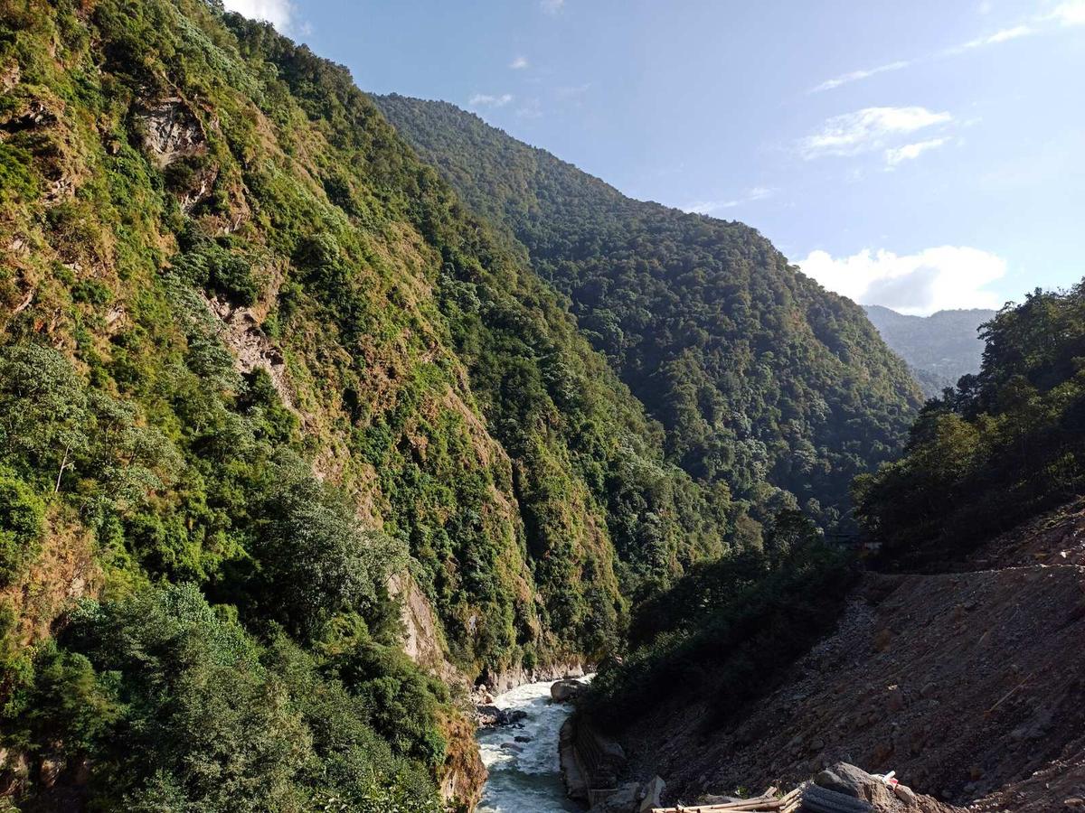
"Bhot" comes from the late Sanskrit "Bhotah", which derives from "Bod", the Tibetan name for Tibet; a "Bhote" is literally someone from Bhot, as Charles Ramble wrote in Himal magazine in 1993. Near the border, Tatopani means "hot water", after its hot springs.
From around Barhabise the river is usually called the Sun Koshi on maps, though rafting companies still sell the stretch down to Sukute as the lower Bhote Koshi. If you are looking for a Bhote Koshi River map, these are the places named along it, roughly from the border downstream.
| Part of the valley | Place | Why it matters |
|---|---|---|
| Near the border | Kodari and Tatopani | Border point, customs point and hot springs, in Bhotekoshi Rural Municipality |
| Near the border | Larcha | Bailey bridge swept away in autumn 2024 |
| Near the border | Eco, Daklang and Liping | Landslide spots that blocked the highway in 2026 |
| Near the border | Panglang | The Last Resort bungee and canyon swing |
| Middle | Barhabise | Roughly where maps start calling it the Sun Koshi |
| Middle | Lamosangu | Dam where the upper rafting run ends |
| Lower | Khadichaur or Balefi | Usual put-in for the lower run; the Kalinchowk road turns off at Khadichaur |
| Lower | Sukute | Beach camps and resorts; usual take-out |
| Lower | Dolalghat | The Indrawati joins the Sun Koshi |
What is Bhote Koshi rafting like?
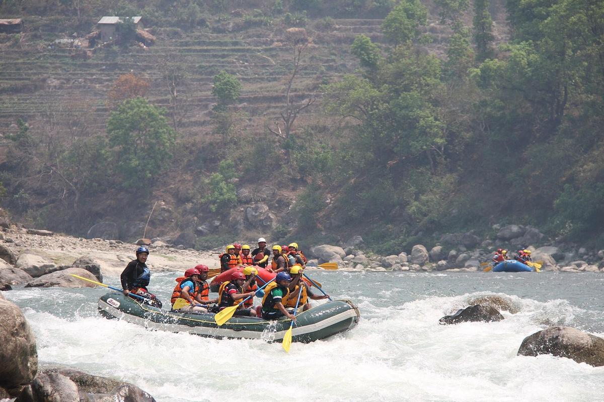
Bhote Koshi rafting is steep, technical and cold. NTB grades the river 4 to 5 on the six-point scale used for Nepal's rivers; the lower stretch most day trips use is mostly class III, with a few harder rapids, according to operators. It asks more of you than a gentle float, even on the easier section.
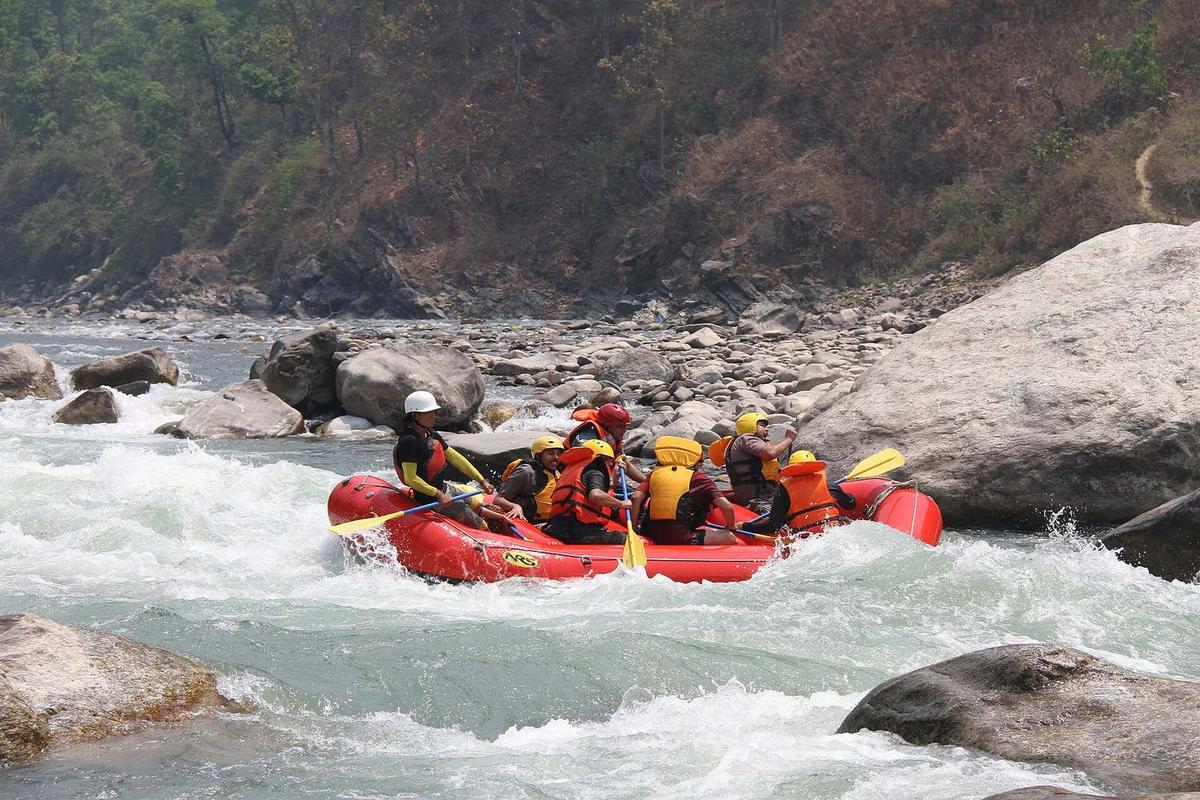
NTB's brochure describes the rapids as class III at lower levels and class IV to V at higher flows, and calls them "all highly technical". Rough Guides is blunter:
"probably the steepest and hardest commercial rafting river in Nepal"
Rough Guides, The Bhote Koshi, undated
The lower run, Khadichaur to Sukute. This is the section most visitors on a short break do. It starts at Khadichaur or Balefi, depending on the water, and Ultimate Descents grades it "III- (-IV)". It is at its best at medium flows; in low water it becomes too rocky for some companies to run, or, as Rough Guides puts it, "In low water it's like a pinball machine (and you're the ball)". Below Sukute, Rough Guides describes calm flat water suited to a half-day float, a better choice if you want to be on the water without the rapids.
The upper run, Baseri to Lamosangu. This is the section for rafters with experience; one operator runs only the lower section from June to August.
| Upper run | Lower run | |
|---|---|---|
| Start and finish | Baseri to the Lamosangu dam | Khadichaur or Balefi to Sukute |
| Length | About 25 km | About 15 km |
| Time | Usually two days | About three hours on the water |
| Grade | About 5- from September to December, 4+ from January to May (one operator) | Mostly class III, a few harder rapids (operators) |
| Our view of who it suits | Rafters with experience, at the right water level | Fit beginners with a good company, at medium flows |
When is the best time to raft the Bhote Koshi?
NTB names autumn and spring as the rafting seasons: October to mid-December and March to early May on its current site. Its older brochure stretches them to September and early June, when the water is very high. We lean towards October and November, though no month promises a particular water level.
At higher flows in late October and November, many companies run the gentler Upper Sun Koshi first as a warm-up.
Do not plan a Bhote Koshi rafting day in the monsoon. From July to mid-September Nepal's rivers carry ten or more times the water of February and March, and NTB says the monsoon floods make most rivers too risky. For winter runs, December to late February, Rough Guides advises a company that supplies wetsuits and paddle jackets.
| Season | Months | What to expect |
|---|---|---|
| Autumn | October to mid-December (NTB) | Main season; higher flows early, falling later |
| Winter | December to late February | Cold water; ask for wetsuits and paddle jackets |
| Spring | March to early May (NTB) | Second main season; very high water by May and June |
| Monsoon | July to mid-September | Ten or more times the dry-season water; not a time to plan this river |
Is Bhote Koshi rafting safe, and who can go?
Bhote Koshi rafting is as safe as the company, the kit and the water level on the day. NTB says each rafter gets a life jacket, helmet and paddle, and that every rafter must book through a registered agency. Age limits vary: one operator takes rafters aged 15 to 70 on this river, so ask before you book.
"All rafters must go through a registered rafting agency."
Nepal Tourism Board, Rafting in Nepal brochure, 2009 edition
The Nepal Association of Rafting Agents (NARA) is the umbrella body of registered agencies, and Nepal's Rafting Rules, 2063 (2006), require rafting businesses to hold a licence and to provide safety gear such as life jackets and helmets.
When you choose a company, look for:
- life jackets that are not old, and helmets
- a full first-aid kit
- at least two rafts, in case one capsizes
- guides who are trained and hold first-aid qualifications
- safety kayakers on harder water (Ultimate Descents runs the Bhote Koshi with at least two)
On the day, NTB says it is "very important to listen to the guide's instructions". Keep the life jacket and helmet on, and tell the crew if you cannot swim.
If you book through The Last Resort, note that it needs at least 10 people to run a rafting trip and merges individual bookings into groups, and its rafting page said, when we read it on 18 November 2026, "Transportation is available only on Saturdays at the moment." Check that your travel insurance covers rafting and bungee; our guide to travel insurance for Nepal explains what to look for.
Is The Last Resort bungee running after the 2026 monsoon?
The operator's website was taking bookings when we checked on 18 November 2026 and showed no closure notice. The latest report we found of jumps is from early September 2026. Check with the operator before you travel. A single landslide on the Araniko Highway can still stop the trip, so ask about the road as well.
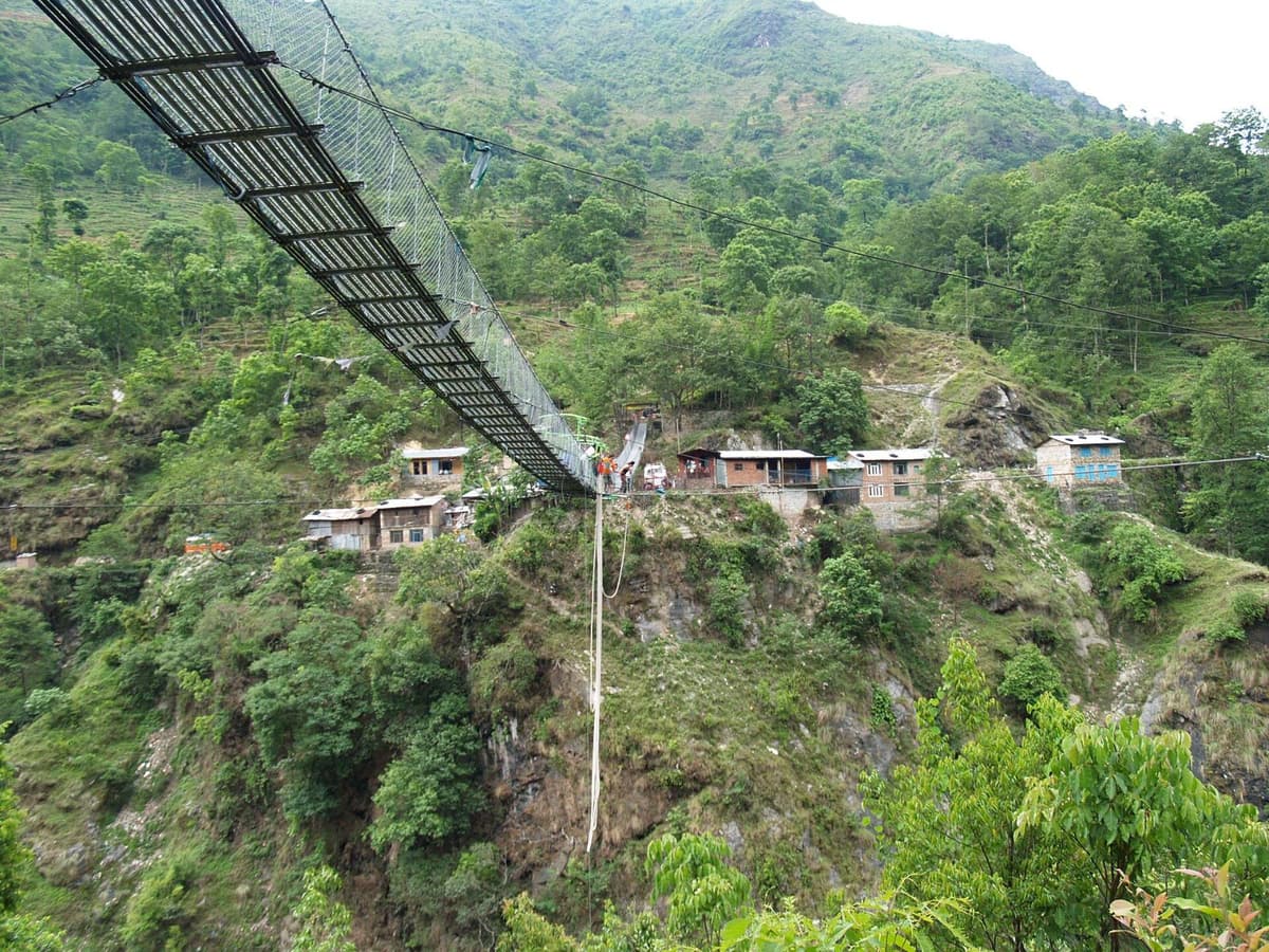
The bungee jump is from a suspension bridge 160 m above the Bhote Koshi gorge. The resort is in Panglang, Bhotekoshi Rural Municipality, near the Tibet border, around 100 km east of Kathmandu, and has run since the early 2000s.
- The Kathmandu Post reported in 2018 that the bridge was built with a four-times safety factor and that a medical check is mandatory.
- Weight limits: bungee 40 to 98 kg; canyon swing 40 to 120 kg; tandem swing 40 to 140 kg.
- There is no fixed age limit, but under-18s must come with a parent who signs the liability form; sports or hiking shoes are compulsory.
- You declare conditions such as asthma, recent surgery, epilepsy, heart disease, high blood pressure, orthopaedic problems and pregnancy.
- After the jump you walk about 30 minutes back to the resort.
The resort also sells canyoning, rafting, tented camping and rooms, and says the bungee and the swing "run year-round, weather permitting". Claims that this is the highest bungee or swing of its kind are the operator's marketing; we have not found them independently verified. Our guide to bungee jumping in Nepal compares it with the other sites.
What is Sukute like?
Sukute is a riverside stop in Sindhupalchok, about 70 km from Kathmandu by road, lined with hotels and resorts on both the Sun Koshi and the Bhote Koshi. Most lower Bhote Koshi day runs finish here, and many riverside camps also offer canyoning, kayaking and mountain biking. It is a weekend escape for Kathmandu.
Spring 2026 was busy:
"With winter over and the rafting season underway, tourist numbers have doubled."
President of the Sindhu Sukute Tourism Association, quoted in the Kathmandu Post, April 2026
Hotels at Sukute are often fully booked on Fridays and Saturdays, so go midweek if you can. The "beach" is a river bank, not the sea, and the water is fast and cold: swim only where the camp or your guide says it is safe.
How do you get there, and is the Araniko Highway open?
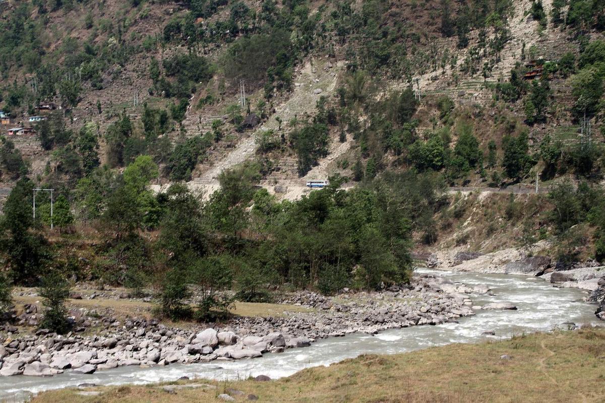
By road on the Araniko Highway, 112 km from Kathmandu to the Tatopani customs point at Kodari. Khadichaur, the usual lower put-in, is about two and a half to three hours by bus; The Last Resort, around 100 km out, three to four hours. Landslides blocked the highway several times in 2026; we found no blockage reported after late September.
| From Kathmandu to | Distance | Drive time |
|---|---|---|
| Dhulikhel | About 30 km | About an hour (NTB) |
| Sukute | About 70 km | Not separately sourced |
| Khadichaur put-in (lower run) | Not separately sourced | About two and a half to three hours by bus |
| Bhote Koshi put-in (NTB, 2009) | About 96 km | About three hours |
| The Last Resort | Around 100 km | Three to four hours |
| Tatopani customs point, Kodari | 112 km | Varies with the road; the last stretch, Barhabise to Kodari, is 27 km |
Built in the 1960s with Chinese help, the highway is the oldest road link between Nepal and China. From mid-July 2026 landslides repeatedly blocked it near the border, at Eco, Daklang and Liping, and on 5 August the Kathmandu Post reported the Tatopani route cut off for three weeks, with little repair work on the 26 km Barhabise to Tatopani stretch. It reopened for limited traffic in late August after about a month to 40 days, then the Kodari section was blocked again on 2 September. On 27 September a landslide near Dhulikhel blocked the whole highway, Kantipur reported.
Heavy rain also brings night-travel bans. Sindhupalchok's District Administration Office stopped all vehicles on the district's highways and roads from 8 pm to 5 am between 24 and 26 September 2026, Nepal News reported on 25 September. Orders like this can come at short notice in wet weather, so travel by daylight.
The Tatopani border: information only
China closed the Tatopani crossing to imports and exports at the end of August 2026, citing landslide risk at Liping. It opened for cargo for three days, 18 to 20 October, then shut to cargo again. The Tatopani crossing was still closed to trade in mid-November 2026, and Sindhupalchok's business chamber said about 26 km of the highway needed maintenance. It has been closed repeatedly since the 2015 earthquake.
Do not assume this is an open route into Tibet for foreign visitors. We could not confirm the current rules for crossing, we do not arrange border crossings, and nothing here is advice on entering Tibet. The valley is worth the trip for the river itself.
What happened on the Bhote Koshi in Rasuwa?
The Bhote Koshi in Rasuwa is the upper Trishuli, which enters Nepal at Rasuwagadhi. It was hit by a glacial lake outburst flood from Tibet on 8 July 2025 and by a far deadlier flood on 26 August 2026. Neither disaster was on the Sindhupalchok river this guide covers.
On 8 July 2025 an outburst from a supraglacial lake in Tibet swept away the Friendship Bridge at Rasuwagadhi; at least nine people died and 19 were missing, according to Nepal Police. On 26 August 2026 a flood on the same river swept away much of the Timure border settlement and put the Rasuwagadhi crossing out of operation. When Nepal ended the search in early October 2026, the bodies of at least 1,455 people had been recovered and 5,285 people were still missing, the Associated Press reported on 7 October 2026.
Our Trishuli River guide covers that flood in more detail. Our Langtang, Gosaikunda and Tamang Heritage trips are currently marked "not recommended": the road link to Rasuwa reopened on 11 October 2026, but we do not recommend those treks until the route is confirmed safe.
Which floods and dams have shaped the Bhote Koshi?
The Sindhupalchok river has a long record of floods and landslides: a glacial lake outburst in 1981, the Jure landslide in 2014, the 2015 earthquakes, another outburst flood in 2016 and a deadly flood in 2020. Three hydropower plants sit on the river and its continuation, and the oldest has been damaged more than once.
- 2014. On 2 August a landslide at Jure, Mankha, dammed the Sun Koshi; OCHA put the death toll at 156.
- 2015. The April earthquakes closed the Araniko Highway until early August and badly damaged the Barhabise to Liping section.
- 2016. On the night of 5 July a flood came down the river; the Department of Hydrology and Meteorology later found it was caused by an outburst from a glacial lake near the Nepal-China border. It swept away dozens of riverside houses and damaged the road and the Upper Bhote Koshi dam and powerhouse; no deaths were reported.
- 2020. On 9 July the rain-swollen river washed away 36 houses near Barhabise, and 20 people were reported missing.
- 2024. In autumn the river swept away the Bailey bridge at Larcha, and for a time Tatopani could be reached only by ropeway.
After the 2016 flood, ICIMOD named Tatopani, Barhabise, Lamosangu and Khadichaur as settlements at high risk of inundation from such floods, the last two of them rafting points.
The plants are the Upper Bhote Koshi (45 MW, at Phulpingkatti, running since about 2001), the Middle Bhote Koshi (102 MW, commercial operation from 6 October 2025) and the Nepal Electricity Authority's Sun Koshi station (10.05 MW).
What should you pack for the Bhote Koshi?
Pack for getting soaked in cold water and for a long day on a mountain highway. The rafting company supplies the life jacket, helmet and paddle; you bring the rest. For the bungee, sports or hiking shoes are compulsory, and in winter you want a company that lends wetsuits.
- Quick-drying clothes and shoes or sandals that strap on firmly
- A full dry change and a warm layer for the drive back
- Sun cream, a cap, a strap for glasses and a dry bag for your phone
- Your usual medicines, and a note of any conditions to declare at the bungee
How can you combine the Bhote Koshi with other trips from Kathmandu?
The Bhote Koshi pairs best with places on the same road. Dhulikhel, a hill town on the Araniko Highway at 1,550 m (5,085 ft) and about an hour from Kathmandu, makes an easy first or last night. At Khadichaur a road turns off for Charikot and Kalinchowk, so a river day can lead into the hills.
- A long day trip. Raft the lower run to Sukute and drive back the same evening. If that is too much road, our Kathmandu day trips guide has gentler options.
- Two days. Raft and sleep at a Sukute camp, then visit The Last Resort if the operator confirms it is running, or come back through Dhulikhel for a quieter night.
- River and hills. From Khadichaur, Kalinchowk trips head for Charikot; on our trip the drive to Kuri takes about 6 to 7 hours each way. Read our Kalinchowk guide first.
For more ideas, see our list of things to do in Nepal.
Frequently asked questions
Is the Bhote Koshi the same as the Trishuli?
One of them is. Nepal has two rivers called the Bhote Koshi. The one in Rasuwa is the upper Trishuli, called the Bhote Koshi above Dhunche. The one with the rafting, the bungee and the Sukute camps is in Sindhupalchok and is a different river.
Where is the Bhote Koshi River located?
The Bhote Koshi River most visitors mean is in Sindhupalchok district, north-east of Kathmandu, running beside the Araniko Highway to the Tibet border. It crosses from Tibet at Kodari, where the highway crosses it on the Sino-Nepal Friendship Bridge. Kodari and Tatopani lie in Bhotekoshi Rural Municipality.
How far is the Bhote Koshi River from Kathmandu?
Sukute, where most lower-river trips finish, is about 70 km from Kathmandu by road. The usual lower put-in at Khadichaur takes about two and a half to three hours by bus, depending on traffic. The Last Resort is around 100 km away, a drive of three to four hours.
Which river is the Bhote Koshi a tributary of?
The Bhote Koshi is one of the northern tributaries of the Sun Koshi, and from around Barhabise maps usually call it the Sun Koshi. The Sun Koshi later joins the Arun and the Tamur at Triveni to form the Sapta Koshi.
What does Bhote Koshi mean?
"Bhote" means someone from Bhot: the word comes from the late Sanskrit "Bhotah", which derives from "Bod", the Tibetan name for Tibet. The river comes from Tibet, where it is known as the Poiqu, and takes the name Bhote Koshi in Nepal.
How high is the Bhote Koshi bungee jump?
The Last Resort's bungee is from a suspension bridge 160 m above the Bhote Koshi gorge. The operator gives about 3 seconds of free fall on the bungee and about 7 seconds on the canyon swing. Its status after the 2026 monsoon is unconfirmed, so check with the operator before you travel.
Plan your visit with us
If you want to raft the Bhote Koshi, stay at Sukute or just know whether the Araniko Highway is clear on your travel day, ask us on WhatsApp or through the enquiry form on the trip page, and we will tell you what we know that week. Our Bhote Koshi bungee and rafting trip and Sukute beach rafting trip show how we run it, and our rafting and kayaking trips cover the other rivers. For more short escapes from the city, see our guide to hill stations in Nepal.