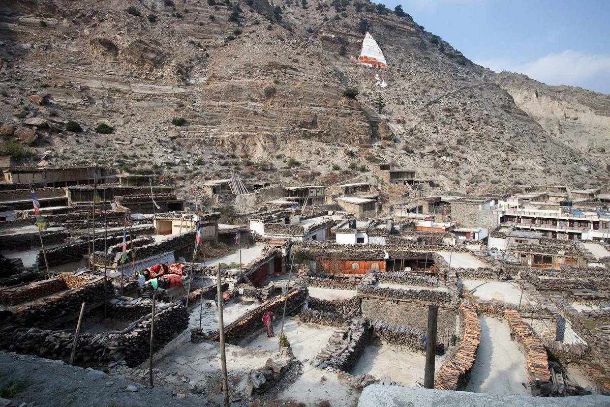
Early morning in Marpha. The lanes are paved with stone, firewood is stacked along the edges of the flat roofs, and the valley is still. By early afternoon the wind will be roaring up the Kali Gandaki towards Kagbeni. That rhythm, calm mornings and windy afternoons, shapes how you travel here.
By Uncover Nepal Guide · Checked by our Kathmandu travel team · Updated 15 Nov 2026
Lower Mustang is the part of Mustang district you can visit with the ACAP permit alone: the Kali Gandaki villages from around Ghasa and Lete, up through Tukuche, Marpha and Jomsom, to Kagbeni and Muktinath. North of Kagbeni, Upper Mustang needs a restricted-area permit as well. Definitions differ, so this guide shows where each line falls.
For the whole district, start with our guide to Mustang, Nepal and its two halves.
In this guide
- What is Lower Mustang?
- Lower and Upper Mustang: where the permit line runs
- Lower Mustang place by place
- Jomsom to Marpha and Jomsom to Kagbeni
- Getting to Lower Mustang
- Can you drive or ride a motorbike to Mustang?
- Altitude in Lower Mustang
- Frequently asked questions
- Plan your trip with us
Key facts
- Permit for Lower Mustang
- ACAP only: NPR 3,000 foreign, NPR 1,000 SAARC including Indians, under 10 free; double at a check post (NTB park entry fees page; NTNC e-permit portal; checked 16 November 2026)
- Permit north of Kagbeni
- Upper Mustang restricted-area permit, USD 50 per person per day (NTB trekking permit page; checked 16 November 2026)
- Jomsom to Marpha
- About 7 km (National Centre for Fruit Development; checked 16 November 2026)
- Jomsom to Kagbeni
- 13 km by road (OnlineKhabar, 22 May 2024; checked 16 November 2026)
- Pokhara to Jomsom flights
- Regular flights suspended since 19 to 21 October 2026; charters continue (Himal Press, 19 October; Bizness News, 20 October 2026; checked 16 November 2026)
What is Lower Mustang?
Lower Mustang has no legal boundary of its own. In everyday travel use it means the part of Mustang district outside the Upper Mustang restricted area, where the ACAP permit is all you need. Older regional names and press reports draw the line in slightly different places, especially at the southern end.
You will see "Lower Mustang" defined in three ways:
- By permit. Of Mustang's five rural municipalities, Gharapjhong (Jomsom), Thasang and most of Varagung Muktichhetra (Kagbeni) are outside the zone; only ward 3 and Satang village in ward 5 of Varagung Muktichhetra are inside, with all of Lomanthang and Lo-Ghekar Damodarkunda (Nepal Tourism Board).
- By old regions. Wikipedia counts Thak Satsae (Ghasa to Tukuche), Panchgaon (Tukuche to Muktinath, including Marpha, Syang and Thini) and Baragaon (centred on Kagbeni) as Lower Mustang, with Lo as Upper Mustang. A Nepal Army page draws these old divisions differently.
- By the press. The Kathmandu Post (2019) called Lete "the southernmost village in Lower Mustang", yet Ghasa, further south, is where Thak Satsae begins.
We use the permit definition and go from Ghasa in the south to Muktinath in the north.
Lower and Upper Mustang: where the permit line runs
The difference that matters on the ground is the permit. Lower Mustang, including Kagbeni and Muktinath, needs only the Annapurna Conservation Area Project (ACAP) entry permit. Going north of Kagbeni into Upper Mustang needs a restricted-area permit as well, issued only through a registered agency, with a licensed guide.
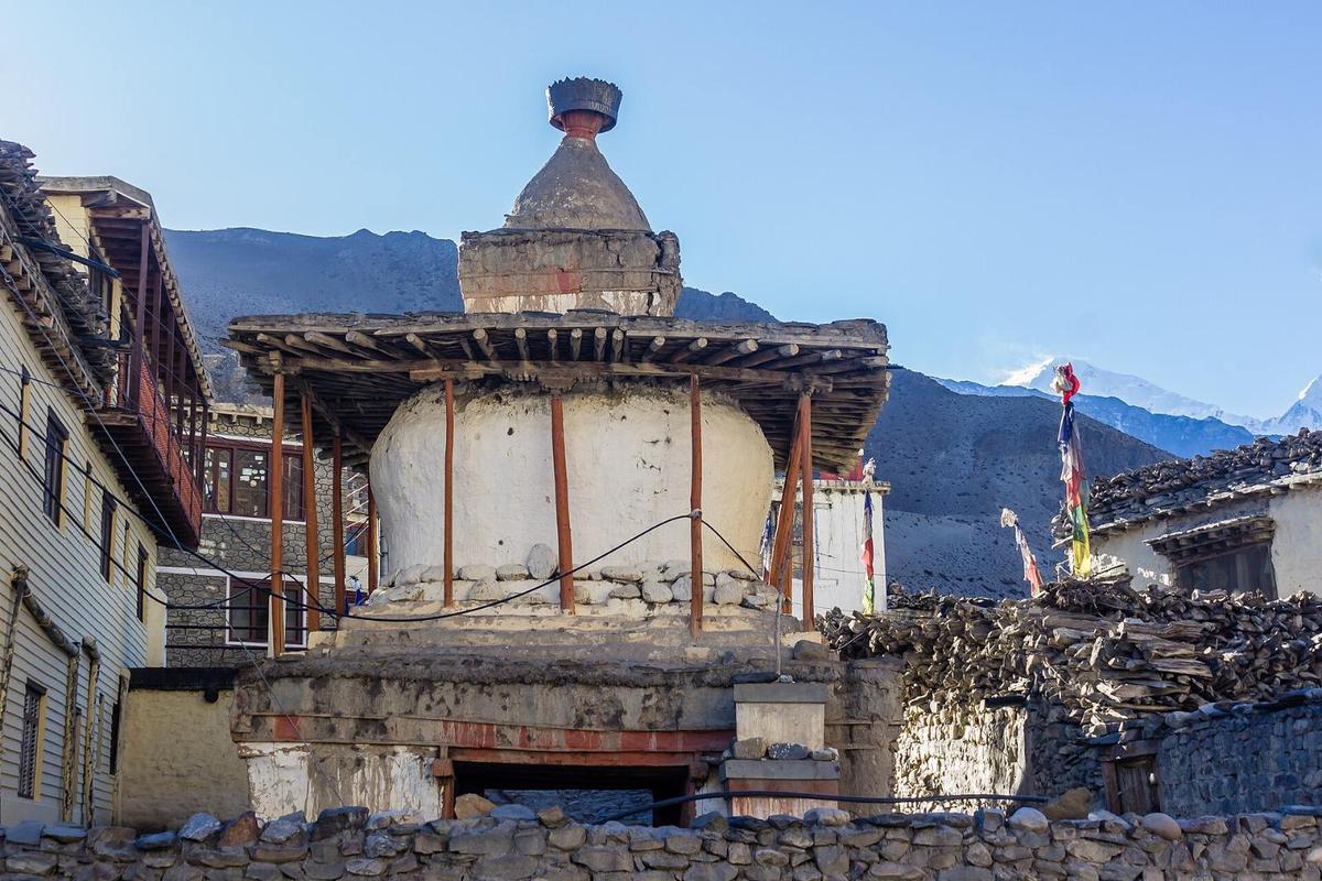
"This is the furthest trekkers are allowed to go towards Upper Mustang without a special permit"
Nepal Tourism Board, Jomsom-Muktinath page, on Kagbeni, checked 16 November 2026
The restricted area begins north of Kagbeni, at Chhusang in ward 3. Muktinath sits in ward 1 (The Kathmandu Post, May 2025) and Kagbeni in ward 4 (Wikipedia), so both are outside it.
ACAP permit. NPR 3,000 for foreign nationals and NPR 1,000 for SAARC nationals, including Indian citizens; children under 10 need none. NTNC, which runs ACAP, says "Double fees will be charged for permits issued at Check-Posts." Check posts include Ghasa, Jomsom, Kagbeni and Muktinath. We arrange the ACAP permit on our trips.
Upper Mustang permit. NTB lists "USD 50 or equivalent convertible currency / per person / Day" inside the zone, with no SAARC rate. This replaced the former USD 500 for 10 days (The Kathmandu Post, 20 November 2025). Since 22 March 2026, solo travellers can be issued one through a registered agency, but a licensed guide is still required (The Himalayan Times, 23 March 2026). Our Upper Mustang guide covers the land beyond the line.
Lower Mustang place by place
Lower Mustang follows the Kali Gandaki and its road, so we go south to north, the way you drive in.
Lower Mustang at a glance, south to north (heights and distances only where a published source gives one; sources in the text below; checked 16 November 2026)
| Place | What to see | Height | From Jomsom |
|---|---|---|---|
| Ghasa | Start of Thak Satsae; ACAP check post | Not published | Not published |
| Lete and Kalopani | Thak Satsae villages; Lete's lost apple trees | Lete about 2,480 m | Not published |
| Larjung and Tukuche | Thakali villages; Tukuche's white plastered houses | Not published | Not published |
| Marpha | Stone-paved lanes, orchards, apple brandy | About 2,650 m | About 7 km south |
| Syang and Thini | Panchgaon villages | Not published | Not published |
| Jomsom | District headquarters, airport, Eco Museum | About 2,740 m | Start point |
| Dhumba Lake | Lake below the Nilgiri peaks | About 2,830 m | Near Jomsom |
| Kagbeni | Old monastery, river meeting point, permit line | About 2,800 m | 13 km north |
| Lubra | Small Bon village | About 2,950 m | Not published |
| Jharkot | Red gompa, village near Muktinath | Not published | Not published |
| Muktinath and Ranipauwa | Temple, 108 waterspouts, Jwala Mai, old rest house | About 3,800 m | About 25 km |
Ghasa
Ghasa is the southern end of Thak Satsae, traditionally 13 villages running north to Tukuche (Wikipedia), and has an ACAP check post and permit counter (NTNC). Around it is the Kali Gandaki gorge, which NTB calls "the deepest gorge in the world", a disputed claim.
Lete and Kalopani
The Kathmandu Post described Lete in 2019 as "the southernmost village in Lower Mustang", and at 2,480 m its lowest. A lodge owner in the village told the paper: "We don't have apple trees here anymore." Kalopani sits a little further up the same stretch.
Larjung and Tukuche
Larjung lies in the same Thak Satsae stretch, with Tukuche at its northern end. Wikipedia describes Tukuche as a centre of the Thakali people, the community of this valley, with white plastered wooden houses. The Kathmandu Post (2019) named it, with Marpha, among Mustang's highest apple-producing villages.
Marpha
Marpha is the village most people remember. NTB says "The best example of the unique architecture of this region is found in the village of Marpha": stone-paved streets with drainage beneath, and flat-roofed houses round courtyards. It is in ward 2 of Gharapjhong, and the government fruit centre in the village gives its height as about 2,650 m.
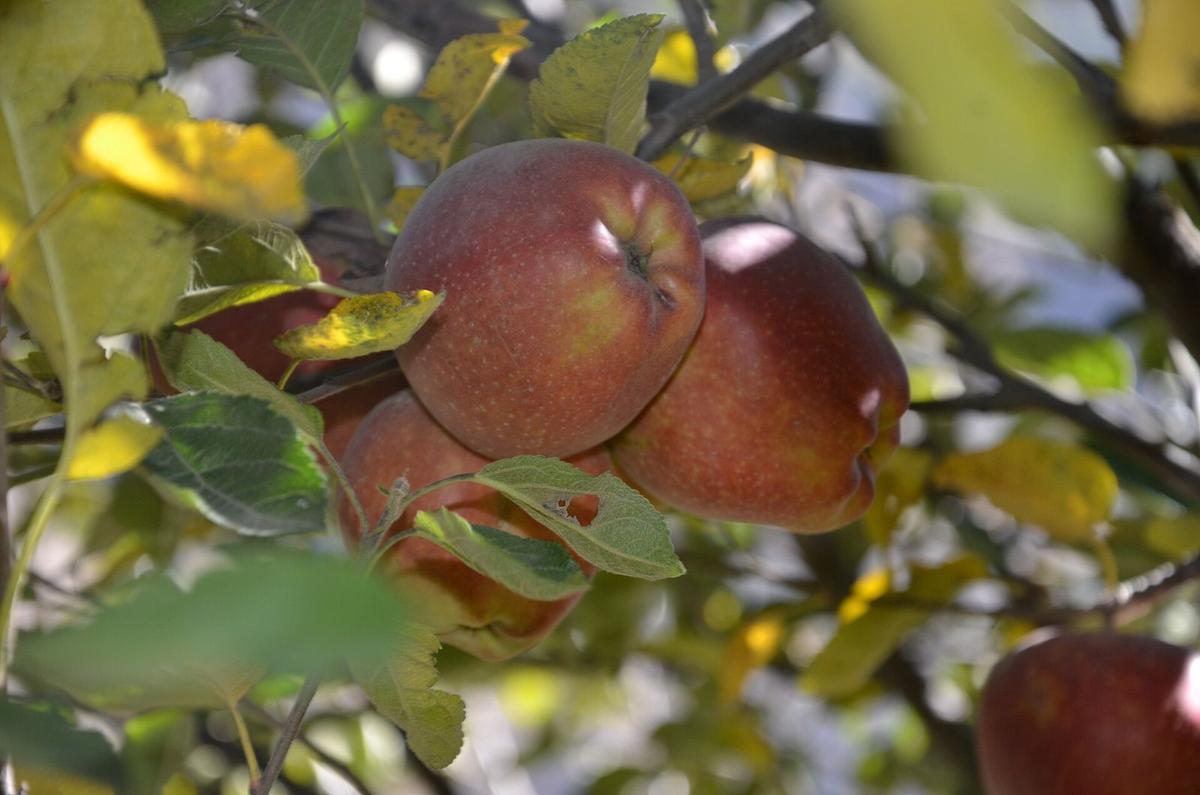
The Kathmandu Post calls Marpha "the apple capital of Nepal". A government horticulture centre set up here in 1966 conserves 44 apple varieties and makes apple and apricot brandy, cider, jam and dried fruit (National Centre for Fruit Development). Across the river, Chhairo gompa (a gompa is a Tibetan Buddhist monastery) is "one of the oldest monasteries in Thak Khola" (the old name for this valley), says OnlineKhabar (2016).
Syang and Thini
Syang and Thini belong to Panchgaon with Marpha, Chhairo and Chimang (Wikipedia), and the Film Development Board lists Thini as a destination.
Jomsom
Jomsom has been Mustang's district headquarters since the early 1970s, and its name comes from the Tibetan "Dzong Sampa", "New Fort" (Nepal Army page). The town is at about 2,740 m and the airport at 2,736 m (8,976 ft), according to the Civil Aviation Authority of Nepal (CAAN). The Eco Museum reopened under the local government in 2022 after six years closed (The Kathmandu Post), so check it is open. More in our Jomsom guide.
Dhumba Lake
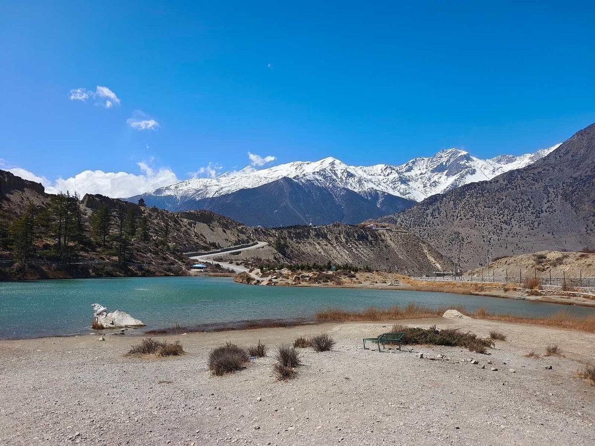
Dhumba Lake lies near Jomsom at the foot of the Nilgiri peaks, at about 2,830 m (Kantipur, May 2025).
Kagbeni
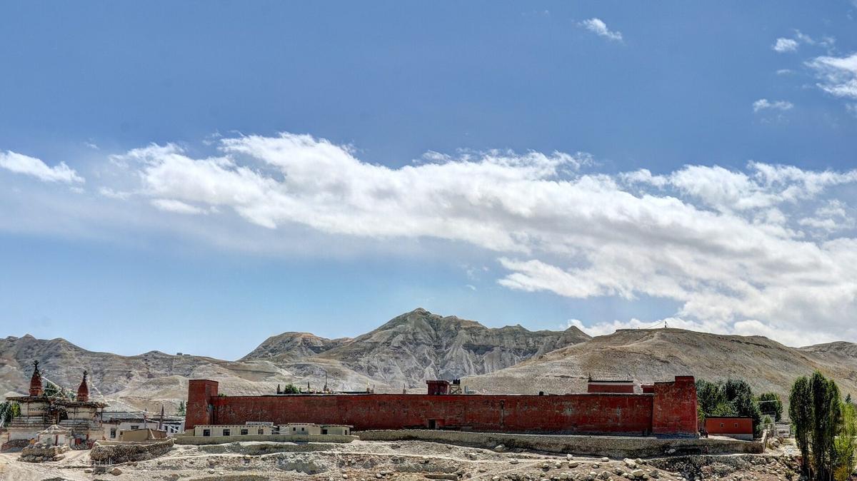
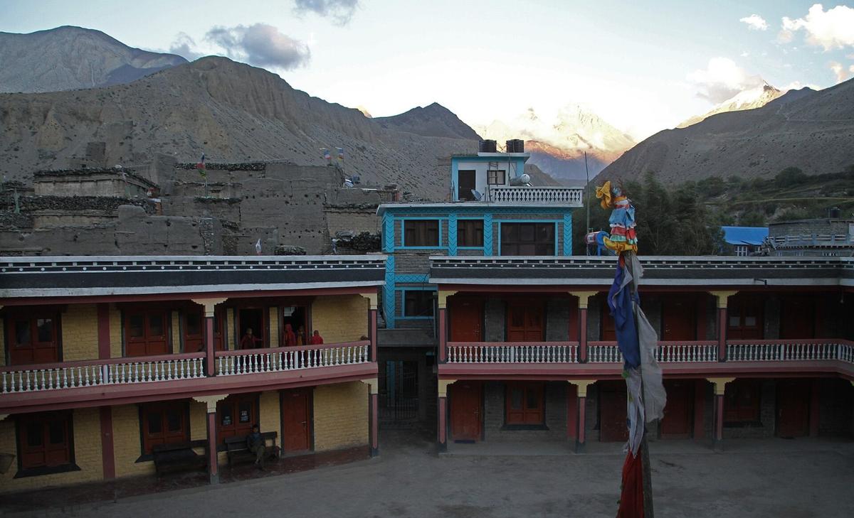
Kagbeni, at about 2,800 m, stands where the stream from Muktinath meets the Kali Gandaki. Its old monastery, Kag Chode, was founded in 1429, according to Lonely Planet. As the last village before the permit line, it is the natural turning point of a Lower Mustang trip.
Lubra
Lubra is a small village of the Bon religion, the faith that came before Buddhism in Tibet. A Kathmandu Post column (September 2026) puts it at 2,950 m and about 800 years old, with about 40 residents in nine households. Floods from the Panda Khola now come almost every year.
Jharkot
Jharkot is a village near Muktinath, in the same ward. Kantipur reported in December 2025 that the village, busy about 15 years ago, has largely emptied.
Muktinath and Ranipauwa
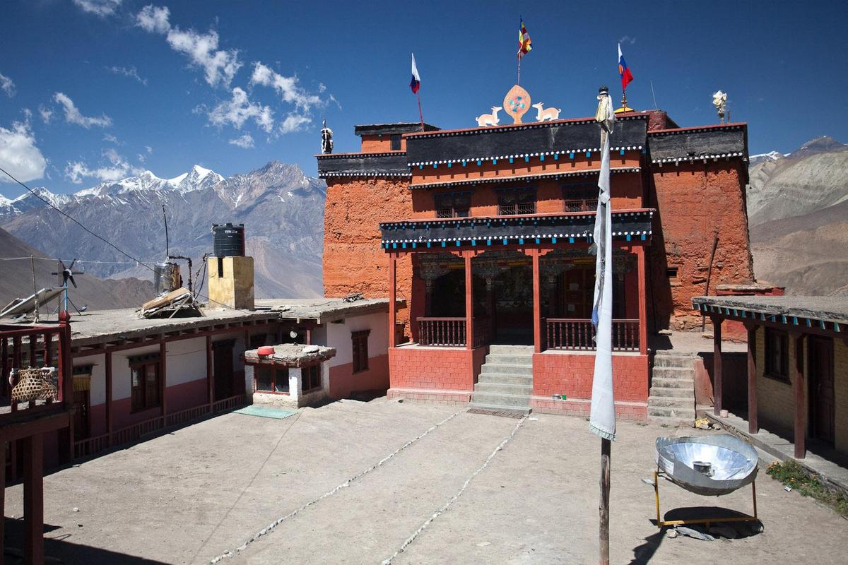
Muktinath is the highest stop on a Lower Mustang trip, at about 3,800 m according to NTB (other published figures run from 3,610 to 3,762 m). NTB says "The site is sacred to both Hindus and Buddhists" and that nearby "there are 108 sacred waterspouts (springs) where pilgrims take a ritual bath." In the Jwala Mai temple, worshipped by both faiths, an eternal blue flame keeps burning.
In Ranipauwa, the village at the temple, the dharmashala (pilgrims' rest house) dates from 1863 BS, about 1806 AD, by its stone inscription, and sleeps up to 200 (The Kathmandu Post, May 2025). Our Muktinath Temple guide goes deeper on the temple itself.
Jomsom to Marpha and Jomsom to Kagbeni
Both are short trips from Jomsom, on foot or by jeep. Go in the morning: the up-valley wind is strongest between Marpha and Chhusang, typically 15 to 20 m/s (Egger and others, Monthly Weather Review, 2000).
Jomsom to Marpha
The horticulture centre at Marpha is about 7 km south of Jomsom (National Centre for Fruit Development), and NTB calls Marpha about a two-hour walk down. Walking south to Marpha after lunch means walking into the up-valley wind. We found no dated, published jeep fare, so ask us.
Jomsom to Kagbeni
The Jomsom to Kagbeni road is 13 km long (OnlineKhabar, 22 May 2024, reporting its blacktopping). NTB puts Kagbeni at about a two-hour walk up the valley from Jomsom.
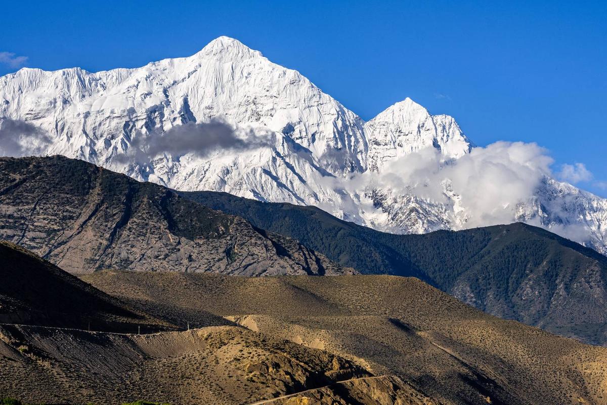
From Kagbeni the road climbs another 12 km, now blacktopped, to Muktinath (Khabarhub and The Rising Nepal, 30 January 2026), about 25 km from Jomsom in all. On foot, NTB gives three to four hours from Kagbeni to Muktinath. Our Jomsom to Muktinath guide covers that stretch in detail.
Getting to Lower Mustang
For now, Lower Mustang is a road trip. Regular Pokhara to Jomsom flights are suspended: Tara Air from 19 October 2026 "until further notice" and Summit Air from 21 October "until the next season"; charters continue (Himal Press; Bizness News). Nepal News (22 October) reported a five-month pause, and we found no restart report up to 16 November.
By road. NTB says "Beni is a 3 hour drive from Pokhara." From Beni, the 76 km to Jomsom is part of the Beni-Jomsom-Korala road (Khabarhub, May 2026). Operators quote about 7 to 10 hours for Pokhara to Jomsom in all. Most people change at Beni or book a through jeep. From Kathmandu, Pokhara is most of a day by road, often six to nine hours with traffic and roadworks, or about 30 minutes by air.
By air, when flights run. The regular route normally runs from August to November (Bizness News, October 2026) and paused last winter too. The flight takes about 20 minutes, in the morning, before the afternoon wind. This is information only; we do not sell flights. Thinking of a helicopter? Ask us first.
Routes and options in detail: our Pokhara to Mustang travel guide.
Can you drive or ride a motorbike to Mustang?
Yes, you can drive or ride to Lower Mustang, but the road beyond Beni is rough, and some flood-damaged stretches run one lane at a time. Indian-registered vehicles need a Nepal customs pass for their days in Nepal. For other nationalities we found no official self-drive or rental rules, so ask us.
Indian vehicles. Under rules the Embassy of India in Kathmandu published in 2019, Indian vehicles may enter temporarily after paying customs, for up to 30 days in a calendar year, with a customs pass (bhansar) for the number of days, shown to police on request. Check the latest Nepal Customs tariff.
The road. Meroauto's December 2025 ride report describes it as paved to Beni and rough off-road beyond, and warns: "The last reliable fuel station is in Beni". At the top end, Jomsom to Muktinath is now blacktopped. North of Kagbeni you need the restricted-area permit and a licensed guide like everyone else.
Altitude in Lower Mustang
Lower Mustang is higher than many people expect. Jomsom, Kagbeni and Marpha all sit above the roughly 2,450 m (8,000 ft) at which the US CDC says altitude illness can affect anyone, and Muktinath, at about 3,800 m, is about 1,000 m higher than Jomsom.
- Go up slowly. Above 3,000 m, gain no more than about 500 m of sleeping height a night, with a rest day every three to four days.
- Walk slowly: "bistarai, bistarai", Nepali for "slowly, slowly".
- Drink water and avoid alcohol early on, Marpha brandy included.
- Know the symptoms: headache, nausea, tiredness and poor sleep. Never go higher with symptoms; if they get worse, go down.
- Ask your doctor before the trip about preventive medicine, for example acetazolamide.
- Garlic soup is a comforting local tradition that helps you drink more, not a proven cure.
- Severe signs (confusion, breathlessness at rest, unsteady walking) mean descend at once and get medical help. Our team arranges a rescue if needed.
Frequently asked questions
What is the difference between Upper and Lower Mustang, and do I need the special permit for both?
No, only Upper Mustang needs the special permit. Lower Mustang, including Marpha, Jomsom, Kagbeni and Muktinath, needs the ACAP entry permit alone. Upper Mustang, the Lo region around Lo Manthang, begins north of Kagbeni and needs a restricted-area permit as well, issued only through a registered agency with a licensed guide.
What are the main places to visit in Mustang?
In Lower Mustang, the main stops are Muktinath, Kagbeni, Marpha, Jomsom and Dhumba Lake, with Tukuche, Lubra and Jharkot if you have more time. In Upper Mustang, which needs the restricted-area permit, the main goal is Lo Manthang, at about 3,800 m.
Can I go to Kagbeni without the Upper Mustang permit?
Yes. Kagbeni is in Lower Mustang and needs only the ACAP permit. NTB describes it as the furthest trekkers can go towards Upper Mustang without a special permit; the restricted area starts north of the village, at Chhusang. Going beyond Kagbeni, on foot or by jeep, needs the restricted-area permit and a licensed guide.
How do I get from Jomsom to Lo Manthang, and is the road open?
By jeep, in a long day on the road north from Jomsom, with the restricted-area permit and a licensed guide. The latest report we found (Gorkhapatra, 10 November 2026) says the Chhusang to Korala road has been temporarily repaired and traffic is back to normal, though floods can still cut it. Your sleeping height rises about 1,000 m that day, so plan for the altitude.
Can I ride a motorbike or drive to Mustang?
Yes, but beyond Beni the road is rough for long stretches until the blacktop between Jomsom and Muktinath, with some flood-damaged stretches running one lane at a time (Gorkhapatra, 3 November 2026). Indian-registered vehicles need a Nepal customs pass for their days in Nepal. Fill up in Beni, which Meroauto calls the last reliable fuel stop. Other nationalities should ask us.
Plan your trip with us
Lower Mustang suits a short trip: you can sleep below 3,000 m and visit Muktinath by day. Still choosing between the two halves? Our Mustang guide to Upper and Lower Mustang sets them side by side.
Our four-day Mustang and Pokhara tour by road starts in Kathmandu, sleeps in Jomsom and visits Muktinath as a day trip. The five-day Mustang tour with flight and road flies between Kathmandu and Pokhara and does the Jomsom leg by road. To go past Kagbeni, the seven-day Upper Mustang tour by road continues to Lo Manthang; your sleeping height rises about 1,000 m from Jomsom to Lo Manthang in one day.
Your visa (or, for Indian citizens, accepted ID) and your flight to Nepal are your own arrangements; the Nepal Tourism Board's tourist-visa page has the official details. Ask us on WhatsApp or through the enquiry form with your dates and group size, and we will tell you honestly which trip fits.