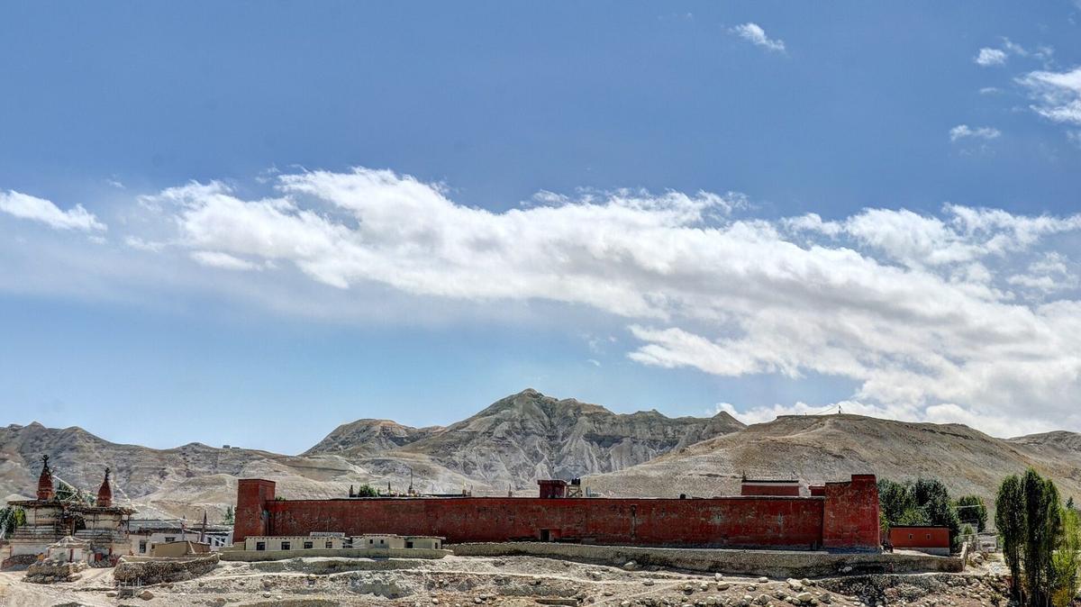
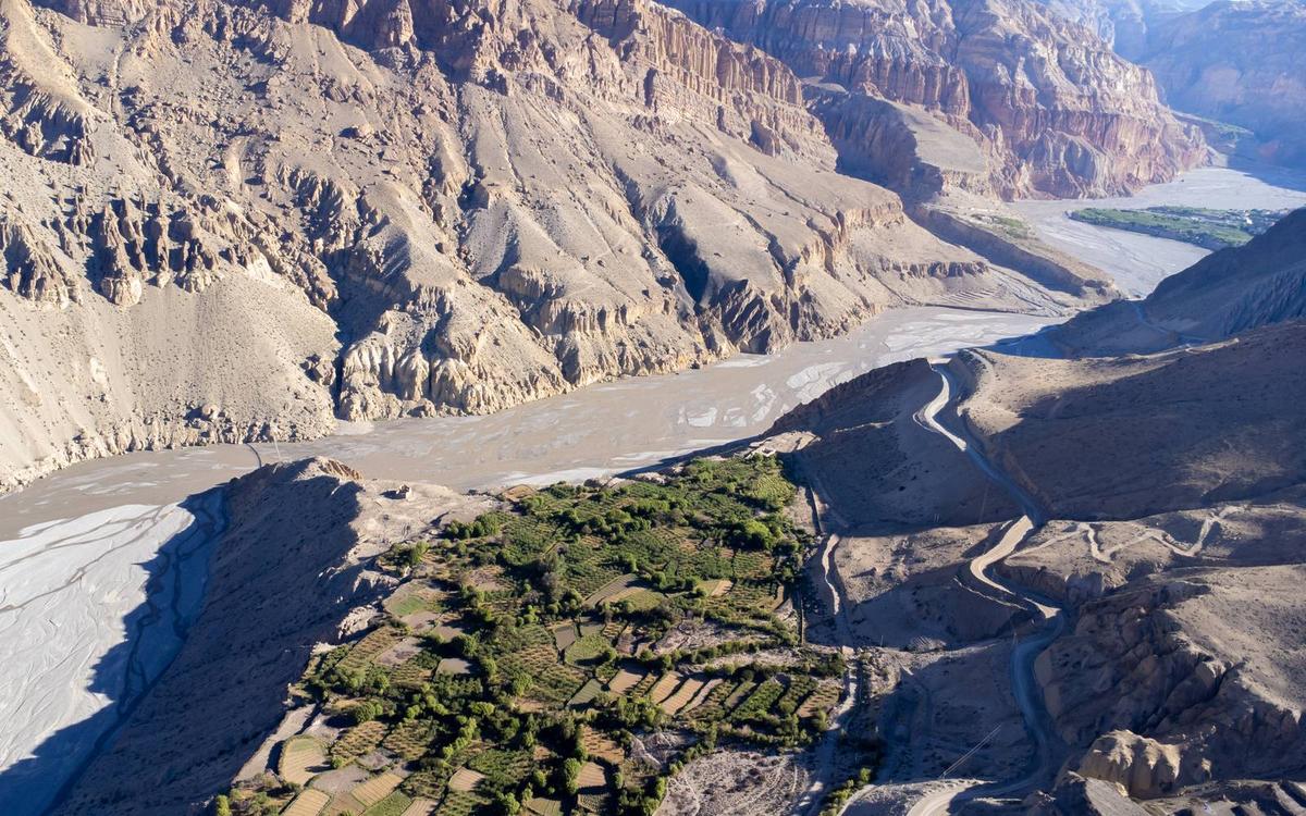
Near Ghami the hills turn a deep blood red, and a mani wall of carved mantra stones runs just outside the village. Further north the cliffs are cut with caves, and Lo Manthang's 6 m earthen walls still enclose the old capital of Lo.
By Uncover Nepal Guide · Checked by our Kathmandu travel team · Updated 16 Nov 2026
Upper Mustang is the restricted northern part of Nepal's Mustang district, beyond Kagbeni: the former Kingdom of Lo, with its walled capital, Lo Manthang, at about 3,800 m (about 12,470 ft). To go, you need a restricted-area permit at USD 50 per person per day, the ACAP permit, a registered agency and a licensed guide.
For Jomsom, Muktinath and the rest of the district, start with our Mustang guide.
In this guide
- Key facts
- What is Upper Mustang, and where does it begin?
- How does the Upper Mustang permit work?
- What was the Kingdom of Lo?
- What is there to see in Upper Mustang?
- How do you get to Upper Mustang now?
- Upper Mustang trek itinerary: how do the stages fit together?
- Upper Mustang trek cost: what are you paying for?
- When is the best time to visit Upper Mustang?
- How does the altitude affect an Upper Mustang trip?
- Frequently asked questions
- Plan your Upper Mustang trip with us
Key facts
- Where it begins
- Just north of Kagbeni, from Chhusang (ward 3) (Nepal Tourism Board, trekking permit page, 14 November 2026)
- Restricted-area permit
- USD 50 per person per day, for the days inside the zone (Nepal Tourism Board; The Annapurna Express, 14 November 2026)
- ACAP permit
- NPR 3,000 foreign; NPR 1,000 SAARC; under 10 free (Nepal Tourism Board, park entry fees page, 14 November 2026)
- Agency and guide
- Registered agency and licensed guide; solo permits since 22 March 2026 (The Kathmandu Post; The Himalayan Times, 14 November 2026)
- Lo Manthang
- About 3,800 m (about 12,470 ft); built in the 15th century (UNESCO World Heritage Centre, 14 November 2026)
- Korala
- About 4,660 m (about 15,290 ft); 21 km from Lo Manthang (Wikipedia, Korala (citing Peissel); The Kathmandu Post, 14 November 2026)
- Kingdom of Lo
- Royal line traditionally dated to 1380; the Raja's title ended in 2008 (American Himalayan Foundation; The Kathmandu Post, 14 November 2026)
- Visitors
- 3,872 foreigners in 2025; peak months October and April (The Rising Nepal (ACAP Lo Manthang), 14 November 2026)
- Flights
- Pokhara to Jomsom scheduled flights suspended since October 2026 (ekantipur, 14 November 2026)
What is Upper Mustang, and where does it begin?
Upper Mustang is the northern, restricted half of Mustang district, the land of the former Kingdom of Lo. The line falls just north of Kagbeni. Kagbeni, Jomsom, Marpha and Muktinath are Lower Mustang and need only the ACAP permit, while Chhusang and everything beyond it also need the restricted-area permit.
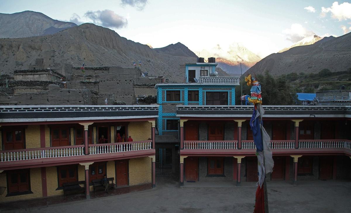
Officially, the restricted area covers Lomanthang Rural Municipality wards 1 to 5, Lo-Ghekar Damodarkunda Rural Municipality wards 1 to 5, and, in Baragung Muktichetra Rural Municipality, ward 3 plus Satang village in ward 5. Kagbeni is ward 4 and Muktinath ward 1, so neither is on the list; Chhusang is ward 3.
The people of the north are the Loba (also written Lopa or Lowa), who follow Tibetan Buddhism. Few outsiders come: 3,872 foreign visitors in 2025, down from 4,093 in 2024, by the ACAP office's count. If your trip is mainly a pilgrimage, Muktinath, at about 3,800 m according to NTB, sits outside the restricted area; our Muktinath Temple guide covers it.
| Question | Lower Mustang | Upper Mustang |
|---|---|---|
| Where | Jomsom, Marpha, Kagbeni, Muktinath | Chhusang, Ghami, Tsarang, Lo Manthang, Chhoser, Korala |
| Permits | ACAP only | Restricted-area permit plus ACAP |
| Heights | Jomsom airport 2,736 m (8,976 ft); Muktinath about 3,800 m | Lo Manthang about 3,800 m; Korala about 4,660 m |
How does the Upper Mustang permit work?
You need two permits for Upper Mustang: the restricted-area permit, which the Department of Immigration issues only through a registered trekking agency, and the ACAP entry permit. The restricted-area permit costs USD 50 per person per day, and you pay only for the days you spend inside the zone.
The daily fee
The Nepal Tourism Board lists Upper Mustang at USD 50 per person per day, payable in US dollars or an equivalent convertible currency. Our team read the same rate on the Department of Immigration's own page in a browser on 13 November 2026, and we confirm it again for your dates when we apply.
"The new provision allows trekkers to pay only for the number of days they actually spend inside the restricted zone."
The Annapurna Express, 20 November 2025, checked 14 November 2026
The daily rate followed a Cabinet decision in November 2025 amending the Immigration Rules. It replaced the former flat fee of USD 500 for a 10-day permit, which older pages still show. NTB lists no SAARC rate for Upper Mustang, so Indian travellers should not plan on a discount for this permit.
Registered agency, licensed guide and solo travellers
Since a Department of Immigration decision on 22 March 2026, a single traveller can get a restricted-area permit; before, permits went only to groups of two or more. The change covers restricted areas in 13 districts. The permit is still issued only through a registered agency, and every restricted-area trekker, solo or not, must be accompanied by a licensed guide, under the Department of Immigration rules as reported by The Kathmandu Post and The Himalayan Times. The agency is fully responsible for emergency rescue. Read more in our guide to solo trekking and the guide rule.
Press reports say travellers abroad can apply using the submission ID of their Nepal visa application; the visa itself is your own arrangement.
Carrying the permit, and the ACAP permit
Carry the permit at all times and show it to immigration staff or police when asked; NTB says trekking off the route on your permit is a violation of law. The ACAP permit costs NPR 3,000 for foreign nationals and NPR 1,000 for SAARC nationals, with children under 10 free. Buy it before you set off, because at a checkpost it costs double. We arrange both permits for our trips; for other regions, see our Nepal trekking permits guide.
What was the Kingdom of Lo?
Lo was a small kingdom whose royal line is traditionally dated to 1380, when Ame Pal became its first king. Its capital, Lo Manthang, was built in the 15th century on the old trade route along the Kali Gandaki, and its Raja kept his royal title until 2008, when Nepal abolished its monarchy.
The last Raja, Jigme Dorje Palbar Bista, was born in 1930, reigned for more than half a century and lived most of his life in Lo Manthang. He died on 16 December 2016, aged 86.
For outsiders, Lo stayed closed far longer. Foreign tourism began only in 1992, and Upper Mustang has been a restricted region ever since. Some voices, including a former member of parliament quoted by The Rising Nepal in November 2025, want the restricted status removed; that is a demand, not policy.
What is there to see in Upper Mustang?
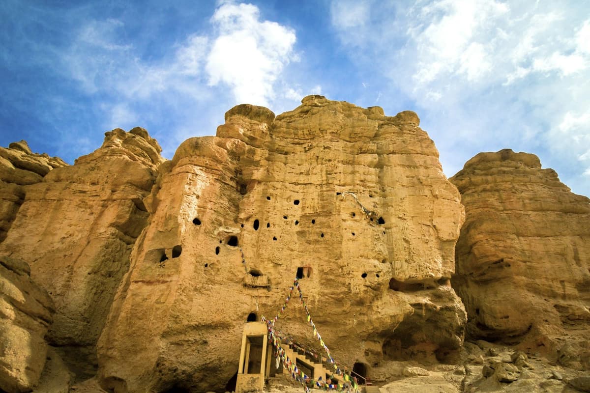
Upper Mustang's sights line the valley north of Kagbeni: the red cliffs of Dhakmar near Ghami, the palace and monastery of Tsarang, the Lo Gekar monastery, the walled city of Lo Manthang, the caves around Chhoser and Samdzong, and the Korala border point.
Ghami and the red cliffs of Dhakmar
Ghami lies about 40 km north of Chhusang, Ratopati reported in October 2026. Near the village, in the area called Dhakmar, the hills are a deep red, and a mani wall of carved mantra stones stands just outside Ghami.
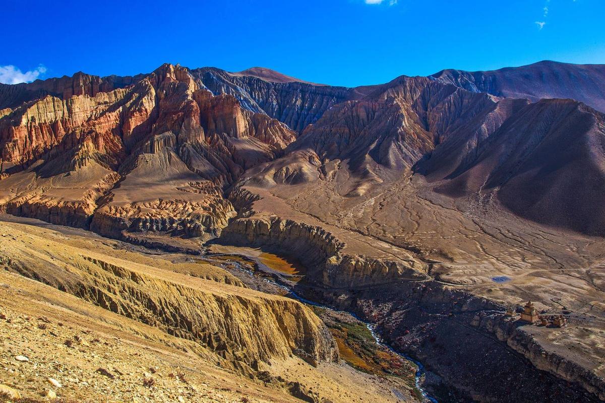
"The mountains here are red like blood and unique."
Ratopati, 8 October 2026, of Dhakmar near Ghami, checked 14 November 2026
Tsarang
Tsarang (also written Charang or Cherang) is about 10 to 12 km beyond Ghami. Ratopati describes a 14th-century five-storey palace of the Mustang kings, now used much like a museum, and a large red and white monastery believed to be the area's main centre of the Sakya school.
Lo Gekar (Ghar Gompa)
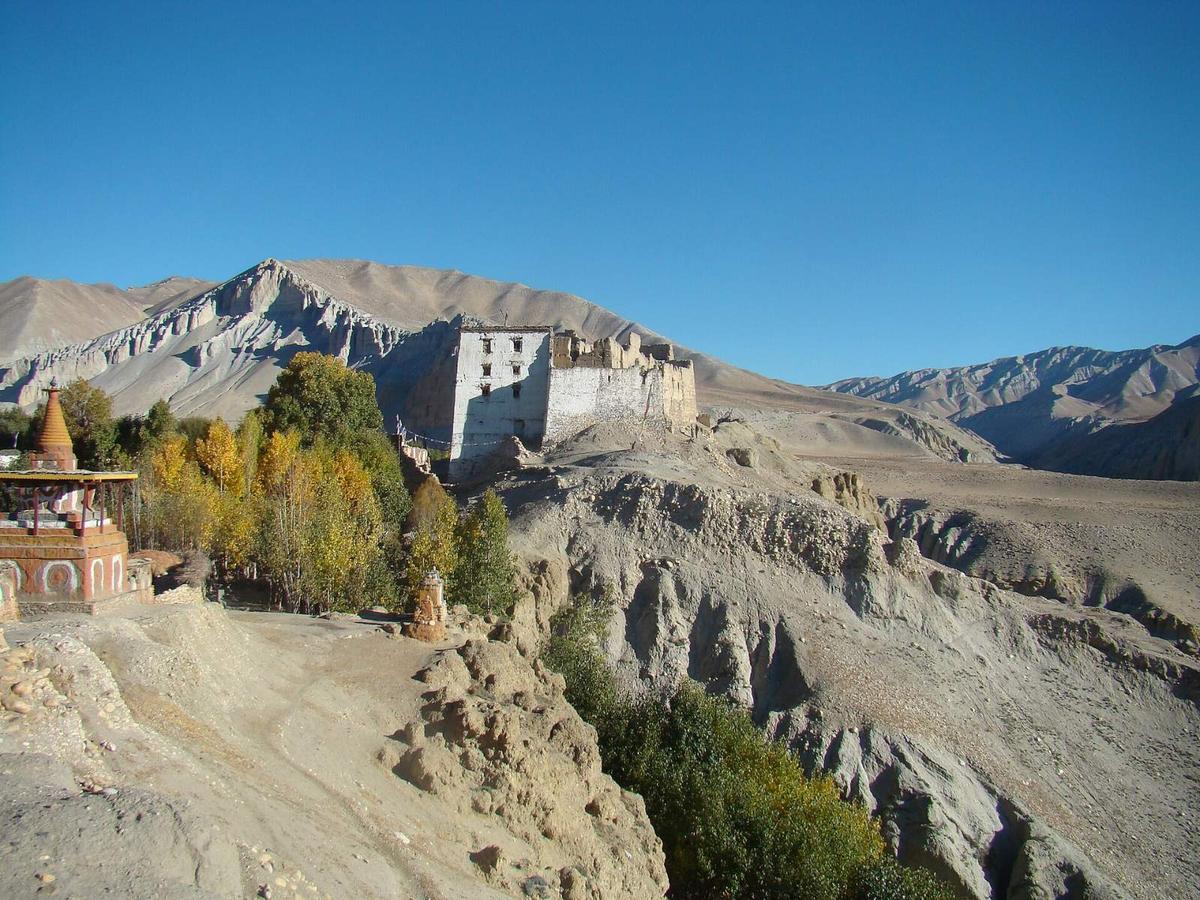
Lo Gekar, also called Ghar Gompa, is said to date from the 8th century, and tradition credits it to Padmasambhava. After the monastery was damaged in the 2015 earthquake, the US Embassy committed USD 285,000 to rebuilding it, Republica reported.
Lo Manthang
Lo Manthang is about 10 to 12 km beyond Tsarang. UNESCO describes a 15th-century walled city on a plateau at about 3,800 m, with Jampa and Thubchen lhakhangs from the 15th century and Choede from the 18th. It has been on UNESCO's Tentative List since 30 January 2008: a candidate, not an inscribed World Heritage Site.
Chhoser and the Jhong cave
Chhoser is a village near Nechung, beyond Lo Manthang, Ratopati reports. Its best-known site, the Sija Jhong cave, is a five-storey complex cut into the cliff, its rooms linked by ladders and tunnels.
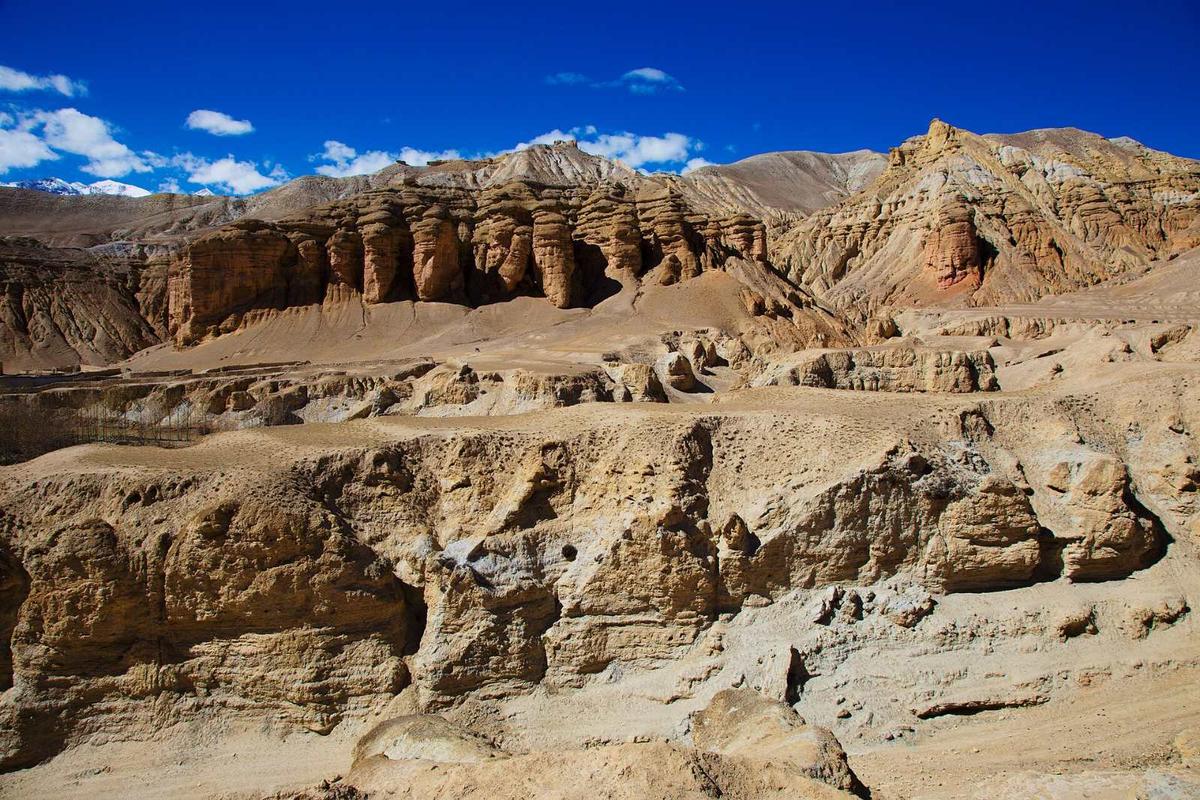
Published room counts disagree, so we do not give one. Our 7-day road trip visits the Chhoser caves on the same day as Korala.
The cliff caves and Samdzong
In caves high above Samdzong, at about 4,200 m (about 13,800 ft), archaeologists led by Mark Aldenderfer found the remains of 27 people placed there some 1,500 years ago, many of the bones carrying cut marks, National Geographic reported in 2011.
Korala
Korala, the border point with China, is at about 4,660 m (about 15,290 ft), 21 km from Lo Manthang according to The Kathmandu Post. It reopened in 2023 as a trade crossing; we found no source saying foreign tourists may cross, so we do not suggest it. Snow blocked the Kagbeni to Korala road from 28 January 2026, and clearing had begun by 31 January, ekantipur reported.
How do you get to Upper Mustang now?
In November 2026 you go by road. Scheduled Pokhara to Jomsom flights have been suspended since October, so the way in is Kathmandu to Pokhara, a long day's drive up the Kali Gandaki to Jomsom, then north past Kagbeni into the restricted area by vehicle or on foot.
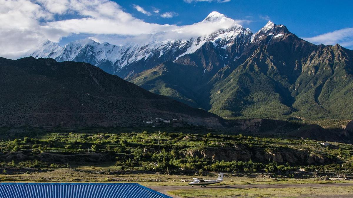
Kathmandu to Pokhara takes most of a day by road, often six to nine hours, or about 30 minutes by air. From Pokhara the road runs via Beni, and the Beni to Jomsom section alone is 76 km; operators quote about 7 to 10 hours for the whole drive, more after rain. Our Jomsom guide covers that road.
The road north of Kagbeni is part of the 435 km corridor from Sunauli on the Indian border to Kora La, or Korala, on the Chinese border. That corridor cut the journey from Pokhara into Mustang from about four days to one, The Kathmandu Post reported in 2023. Published times from Kagbeni to Lo Manthang run from about four hours to six, so plan on most of a day.
Upper Mustang trek itinerary: how do the stages fit together?
By road or on foot, Upper Mustang itineraries follow the same valley: Pokhara to Jomsom, Jomsom to Kagbeni, then north through Chhusang, Ghami and Tsarang to Lo Manthang, with side trips to Chhoser and Korala. A vehicle covers the restricted section in a day; on foot you split it into walks between villages.
| Stage | Distance | What to know |
|---|---|---|
| Pokhara to Jomsom | Beni to Jomsom 76 km | About 7 to 10 hours, operators say |
| Jomsom to Kagbeni | 13 km | ACAP permit only |
| Kagbeni to Lo Manthang | No single published figure | About four to six hours by road |
| Chhusang to Ghami | About 40 km | Red cliffs of Dhakmar |
| Ghami to Tsarang | About 10 to 12 km | Palace and Sakya monastery |
| Tsarang to Lo Manthang | About 10 to 12 km | Walled city, about 3,800 m |
| Lo Manthang to Korala | 21 km | About 4,660 m; snow can close it |
The village distances come from a single Ratopati report, so treat them as a rough guide.
By road: our 7-day trip
Our Upper Mustang tour by road starts in Kathmandu and ends in Pokhara:
- Day 1: Kathmandu to Pokhara.
- Day 2: Pokhara to Jomsom.
- Day 3: Jomsom to Lo Manthang, via Muktinath.
- Day 4: Korala and the Chhoser caves, then a walk in Lo Manthang with your licensed guide.
- Day 5: back to Jomsom via Kagbeni and Dhumba Lake.
- Day 6: Jomsom to Pokhara via Tatopani.
- Day 7: the trip ends in Pokhara.
The honest part is Day 3. You sleep in Jomsom, at about 2,740 m, and the next night in Lo Manthang, at about 3,800 m: a rise in sleeping height of about 1,000 m in one day. Above 3,000 m, the Wilderness Medical Society advises raising your sleeping height by no more than about 500 m a night, so this plan goes faster than that guideline. The Korala day then takes you to about 4,660 m before you sleep in Lo Manthang again. If that worries you, tell us and we will work out a slower plan with you.
On foot
On foot your sleeping height can rise a little each night rather than all at once, closer to the 500 m guideline.
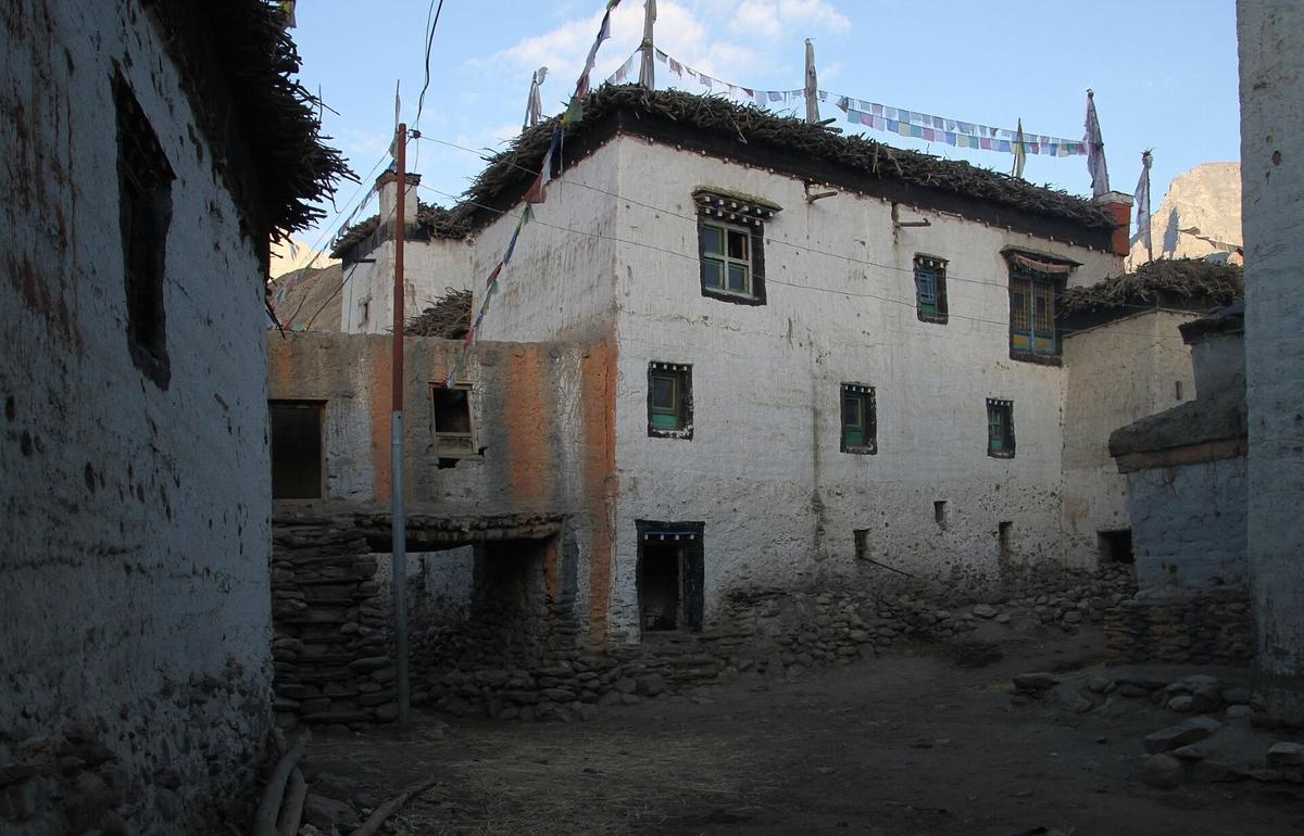
The trade-off is time and money: each extra day inside the zone adds USD 50 per person to the permit, plus a day of guide, lodging and food. Published walking itineraries vary widely, so we quote no standard length; tell us your days and we will plan stages that fit.
Upper Mustang trek cost: what are you paying for?
An Upper Mustang trip costs the sum of a few lines: the restricted-area permit at USD 50 per person for each day inside the zone, the ACAP permit, road transport, a licensed guide for the whole restricted section, and lodges and meals. Only the permits have official prices.
| Cost line | Official figure | What decides the total |
|---|---|---|
| Restricted-area permit | USD 50 per person per day | Days inside the zone; no SAARC rate |
| ACAP permit | NPR 3,000 foreign; NPR 1,000 SAARC | Per entry; double at a checkpost |
| Road transport | None published | Vehicle, driving days, road conditions |
| Licensed guide | None published | Every day in the restricted area |
| Lodges and meals | None published | Nights and season |
Four days inside the zone come to USD 200 per person in permit fees, far less than the old USD 500 for 10 days; ask us how your entry and exit days count.
We do not print package prices in our guides; send us your dates and we will quote in US dollars. Travel insurance that covers your maximum height and helicopter evacuation is your own arrangement, so budget for it separately.
When is the best time to visit Upper Mustang?
Spring and autumn are best: the ACAP office in Lo Manthang names October and April as the peak months. Upper Mustang lies in the Himalayan rain shadow, and NTB calls it one of the few regions suitable for trekking even in the monsoon, though floods cut the road below Jomsom until 9 October 2026.
Jomsom averages 292.4 mm of rain a year, against about 3,868 mm in Pokhara. We found no published weather normals for Lo Manthang, which is about 1,000 m higher than Jomsom and colder.
| Month | Average high (°C) | Average low (°C) | Rain (mm) |
|---|---|---|---|
| January | 10.4 | -1.9 | 14.4 |
| April | 18.6 | 4.4 | 21.4 |
| October | 18.0 | 5.5 | 18.2 |
| November | 14.8 | 1.5 | 4.6 |
Jomsom station (DHM, 2,741 m), 1991 to 2020 normals.
- Spring: Tiji, Lo Manthang's festival of ritual dances, follows the Tibetan calendar and usually falls in May.
- Monsoon: Jomsom's wettest month, July, averages 46.8 mm; the road in from Beni is the weak link.
- Autumn: storms happen. During Cyclone Arnab the Department of Immigration stopped issuing trekking permits for high-risk mountain areas for 29 to 31 October 2026 and asked trekkers not to travel to restricted areas; that halt has ended.
- Winter: NTB says it is cold and always windy, and advises against winter treks. Many villagers move to warmer areas for at least four months, a 2018 report found.
How does the altitude affect an Upper Mustang trip?
Every night in Upper Mustang is spent above the height where altitude illness can start: the CDC says it can affect anyone sleeping above about 2,450 m (8,000 ft), and sometimes lower. Lo Manthang is at about 3,800 m, the Samdzong caves at about 4,200 m and Korala at about 4,660 m.
Even Jomsom airport sits at 2,736 m (8,976 ft). Whichever way you go:
- Go up slowly. Above 3,000 m, do not raise your sleeping height by more than about 500 m a night, and take a rest day every 3 to 4 days.
- Walk slowly, "bistarai, bistarai", as we say in Nepali.
- Drink enough water, and avoid alcohol for the first days at height.
- Know the symptoms: headache, nausea, tiredness and poor sleep.
- Never go higher with symptoms, and go down if they get worse.
- Ask your doctor before the trip about preventive medicine, for example acetazolamide.
- Garlic soup and other hot soups are a comforting local tradition that helps you drink more, not a proven cure.
Severe symptoms mean you descend at once and get medical help. Our team arranges a rescue if needed, and the agency that arranged your permit is responsible for emergency rescue. See our guide to altitude sickness on Nepal treks.
Read next: Lo Manthang guide.
Frequently asked questions
Can I go to Kagbeni without the Upper Mustang permit?
Yes. Kagbeni is ward 4 of Baragung Muktichetra Rural Municipality, which is not one of the restricted wards, so the ACAP permit is all you need. The restricted area begins just north of the village, where operators report a checkpost. Chhusang, ward 3, is inside it. Jomsom, Marpha and Muktinath are ACAP only too.
How much is the Upper Mustang restricted-area permit now?
USD 50 per person per day, according to the Nepal Tourism Board. You pay only for the days you spend inside the restricted zone. The daily rate replaced the old flat fee of USD 500 for 10 days after a Cabinet decision in November 2025. There is no SAARC rate, and you need the ACAP permit as well.
What is the difference between Upper and Lower Mustang, and do I need the special permit for both?
No, only Upper Mustang needs the restricted-area permit. Lower Mustang, the Kali Gandaki valley around Jomsom, Marpha, Kagbeni and Muktinath, needs only the ACAP permit. Upper Mustang is the former Kingdom of Lo north of Kagbeni, with Lo Manthang at about 3,800 m. There you need both permits, a registered agency and a licensed guide.
Should I trek Upper Mustang or go by jeep?
Drive if your days are short; walk if you have more time and want a gentler climb. On Day 3 of our 7-day road trip you sleep about 1,000 m higher than the night before. Walking spreads the climb over several nights, though each extra day inside the zone adds USD 50 per person in permit fees. The agency and guide rules are the same either way.
Do I need a guide for Upper Mustang?
Yes. Every restricted-area trekker, solo or in a group, must be accompanied by a licensed guide, under the Department of Immigration rules reported by The Kathmandu Post and The Himalayan Times. Since 22 March 2026 a single traveller can get the permit, but only through a registered agency, which is responsible for emergency rescue. Solo travel is allowed; going without a licensed guide is not.
Plan your Upper Mustang trip with us
Upper Mustang rewards careful planning. We arrange the in-country parts, from the ACAP and restricted-area permits to your licensed guide, transport and hotels. Your Nepal visa and international flights are your own arrangements; the official information is on the Nepal Tourism Board tourist visa page.
Our Upper Mustang tour by road is the 7-day trip described above. If the altitude or permit days do not suit you, our Mustang tour by flight and road and Mustang and Pokhara tour by road stay in Lower Mustang, on the ACAP permit alone. For the wider district, go back to our Mustang guide.
Send us your dates and group size on WhatsApp or through the enquiry form, and we will tell you honestly which plan fits.