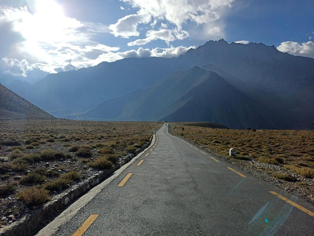
North of Jomsom, the road follows the Kali Gandaki to Kagbeni, where a river comes down from Muktinath to meet it. From there a paved road climbs through bare, dry hills to Ranipauwa, and pilgrims walk the last stretch up to the temple gate.
By Uncover Nepal Guide · Checked by our Kathmandu travel team · Updated 15 Nov 2026
The Jomsom to Muktinath distance is about 25 km by road: 13 km from Jomsom to Kagbeni, then a 12 km paved climb to Muktinath, according to Nepali press reports. Operators quote about 45 minutes to 1.5 hours by jeep. On foot, most people take two days and spend the night in Kagbeni.
Muktinath is one of the sites in our Nepal pilgrimage guide; this page covers the last leg and what is open in November 2026.
In this guide
- Key facts
- Jomsom to Muktinath distance by road
- Jomsom to Muktinath by jeep
- Is the Muktinath road open now?
- Walking from Jomsom to Muktinath
- Getting to Jomsom
- Altitude: why a day trip is gentler
- Ranipauwa and the temple
- Our Mustang trips
- Frequently asked questions
- Plan your visit with us
Key facts
- Road distance
- About 25 km: 13 km to Kagbeni, then 12 km to Muktinath (OnlineKhabar, May 2024; The Rising Nepal, January 2026, 13 November 2026)
- Jeep time
- About 45 minutes to 1.5 hours (operator figures) (Operator websites, 2026, 13 November 2026)
- On foot
- Two days, with a night in Kagbeni (Operator websites, 2026, 13 November 2026)
- Road ends
- Ranipauwa, below the temple (Operator website, October 2026, 13 November 2026)
- Jomsom
- About 2,740 m; airport 2,736 m (CAAN AIP, April 2026 (airport); DHM station figure (town), 13 November 2026)
- Muktinath
- About 3,800 m, according to NTB (Nepal Tourism Board, 13 November 2026)
- Permit
- ACAP only: NPR 3,000 foreign, NPR 1,000 SAARC (NTNC e-permit portal; NTB, 13 November 2026)
- Jomsom flights
- Regular flights suspended since October 2026 (Nepal News, 22 October 2026, 13 November 2026)
Jomsom to Muktinath distance by road
By road, Jomsom to Muktinath is about 25 km. The first 13 km run up the Kali Gandaki valley to Kagbeni. From there a "12-kilometre asphalt road" climbs to Muktinath (The Rising Nepal, January 2026). Some operators quote 18 to 22 km, which does not match the press figures.
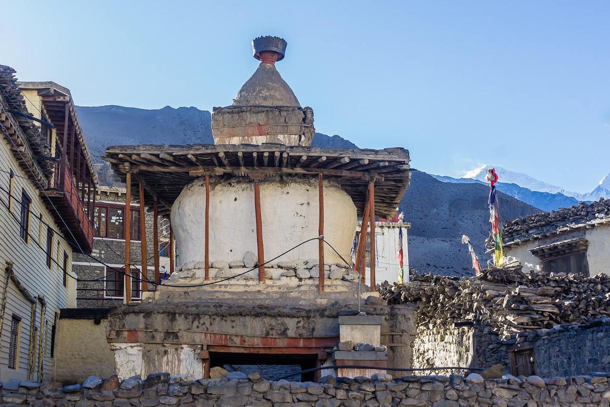
The Muktinath to Jomsom distance is the same. The Jomsom to Muktinath temple distance is a little more, because vehicles stop at Ranipauwa; we found no reliable figure for the walk up.
Jomsom to Muktinath by road, stage by stage
| Stop | Distance | Height | Notes |
|---|---|---|---|
| Jomsom | Start | About 2,740 m | District headquarters; ACAP check post; hospital |
| Eklebhatti | Between Jomsom and Kagbeni | Not published | On the Jomsom to Kagbeni road (OnlineKhabar, May 2024) |
| Kagbeni | 13 km | About 2,800 m | Junction for Lo Manthang; restricted area begins north |
| Jharkot | On the climb | Not published | ACAP area only |
| Ranipauwa | About 25 km | Not published | Road ends; jeeps and buses stop |
| Muktinath temple | On foot or horseback | About 3,800 m (NTB) | 108 waterspouts |
Jomsom to Muktinath by jeep
Operators give about 45 minutes to 1.5 hours by jeep, depending on the vehicle and your stops. We found no official Jomsom to Muktinath fare sheet, from a transport committee or in the press, and the operator figures online disagree with each other:
- Local bus: the cheapest and slowest way up, with only a few departures a day; check times locally.
- Reserved jeep: the vehicle is yours, so you choose when to leave and how long to stop.
- Fares: they vary with the vehicle, fuel prices and the season, so ask us for a current figure before you go.
Every vehicle stops at Ranipauwa, the village below the temple, where the road ends. From there you walk up to the temple gate or ride a horse. Take it slowly, even if you feel fine.
Is the Muktinath road open now?
We found no press report that the Jomsom to Muktinath road closed during Cyclone Arnab at the end of October 2026. The Beni to Jomsom road reopened in stages through October after floods, so expect slow and rough stretches. Through winter, snow can shut the Kagbeni to Muktinath road for a day or two, so check with us first.
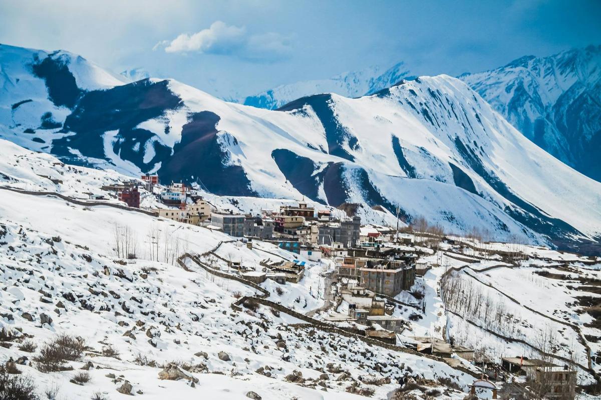
Winter is cold. At the Jomsom weather station, January nights average minus 1.9 °C (DHM normals, 1991 to 2020), and Muktinath is about 1,000 m higher and colder.
Walking from Jomsom to Muktinath
Most people walk it in two days, with a night in Kagbeni. Operators give about 4 to 5 hours to Kagbeni and about 5 to 6 hours from there up to Muktinath. NTB calls it "a five-hour walk from Jomsom to Muktinath", but splitting it puts the climb on fresh legs.
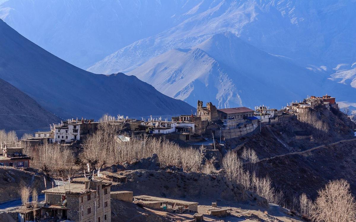
Jomsom to Kagbeni. Start early. Strong up-valley winds blow during the day; a field study (Egger and colleagues, Monthly Weather Review, 2000) found the strongest between Marpha and Chhusang, which includes this walk, at typically 15 to 20 metres per second.
Kagbeni. At about 2,800 m, Kagbeni sits on the old trail to Lo Manthang. Its Sakya monastery, Kag Chode Thubten Sampheling, was founded in 1429, according to Lonely Planet. The Upper Mustang restricted area begins north of here, at Chhusang (ward 3).
Kagbeni to Muktinath. The climb passes the village of Jharkot on its ridge. Sleeping at Muktinath raises your sleeping height by about 1,000 m, double the 500 m a night the CDC advises above 3,000 m.
Annapurna Circuit walkers arrive from the other side, down from Thorong La (5,416 m); our Thorong La guide covers that crossing. Carry your ACAP permit: it is checked at Jomsom.
Getting to Jomsom
For now, the practical way is by road. From Pokhara (about 820 m) the drive to Jomsom takes most of a day: operators quote about 7.5 to 10 hours in good conditions. NTB says "Beni is a 3 hour drive from Pokhara", and Beni to Jomsom is 76 km. Published Pokhara to Muktinath totals disagree, so we give none. From Kathmandu, add six to nine hours by road to Pokhara, or about 30 minutes by air.
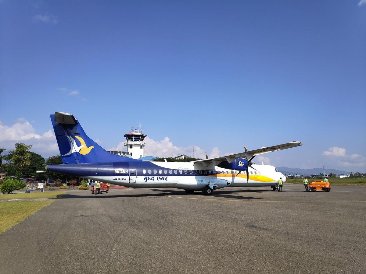
Regular Pokhara to Jomsom flights are suspended: Tara Air from 19 October 2026 "until further notice", Summit Air from 21 October "until the next season" (People's Review, 17 October; Himal Press, 19 October). Nepal News reported a pause of about five months, with charters continuing; up to 13 November we found no restart notice. Our Jomsom guide covers the town and its airport.
Helicopters also fly to Muktinath. Market range from operators, not ours (May and September 2026): about USD 3,000 to 3,800 to charter from Pokhara for up to five passengers, shared seats from about USD 650 to 750, and about USD 4,500 to 5,500 from Kathmandu. Read the altitude section first.
Altitude: why a day trip is gentler
Muktinath is about 3,800 m, according to NTB (other published figures run from about 3,710 m to 3,760 m). Jomsom airport is 2,736 m (8,976 ft), according to CAAN. Both are above about 2,450 m (8,000 ft), the sleeping height at which the CDC says altitude illness can affect anyone.
Where you sleep matters most. A day trip up to the temple and back to Jomsom keeps your sleeping height at about 2,740 m; sleeping at Muktinath instead adds about 1,000 m in one night. Fast arrivals are the bigger worry: a helicopter, or a flight to Jomsom and a jeep, can take you from about 820 m in Pokhara to about 3,800 m in a few hours. The NHS advises: "try not to travel from an altitude that's less than 1,200 metres to an altitude that's more than 3,500 metres in 1 day."
For older pilgrims, age alone is not a bar: the CDC says people over 50 have slightly less risk. Health matters more. The CDC advises anyone with coronary artery disease, chronic lung disease or low blood oxygen to see a doctor who knows high-altitude medicine, so ask your doctor before you book.
- Go up slowly: above 3,000 m, raise your sleeping height by no more than about 500 m a night, with a rest day every 3 to 4 days.
- Walk slowly, "bistarai, bistarai".
- Drink enough water and avoid alcohol early on.
- Know the symptoms: headache, nausea, tiredness, poor sleep.
- Never go higher with symptoms; go down if they get worse.
- Ask your doctor before the trip about preventive medicine, for example acetazolamide.
- Garlic soup is a comforting local tradition that helps you drink more, not a proven cure.
Confusion, breathlessness at rest or unsteady walking are severe signs: descend at once and get medical help. Our team arranges a rescue if needed. Mustang's hospital is in Jomsom, with a health unit at Muktinath. More in our altitude sickness guide.
Ranipauwa and the temple
Ranipauwa is named after a pilgrims' rest house that King Rana Bahadur Shah built in 1863 BS (about 1806 AD) in memory of his youngest queen, Lalitatripurasundari. It can still take up to 200 people at a time (The Kathmandu Post, May 2025).
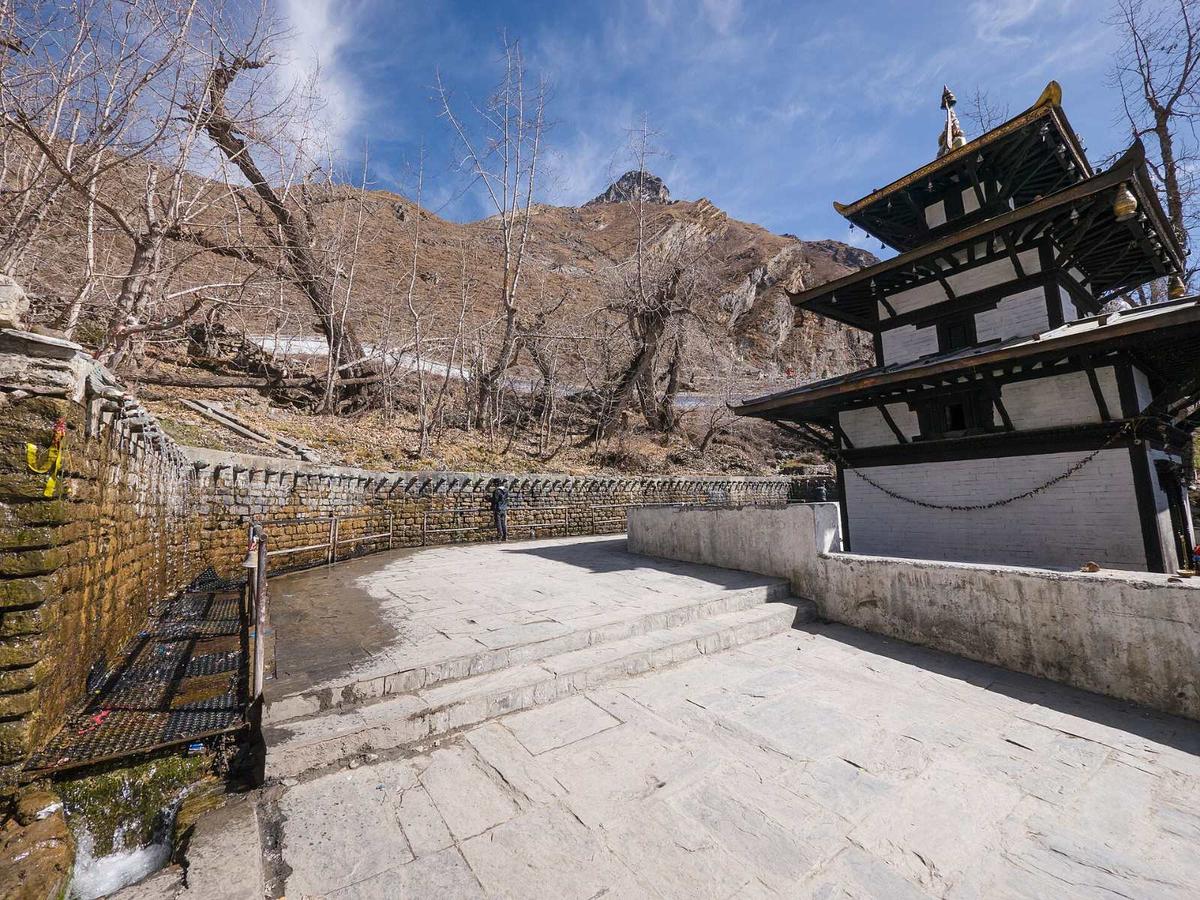
"The site is sacred to both Hindus and Buddhists."
Nepal Tourism Board, Muktinath, Mustang page, checked 13 November 2026
Hindus worship Vishnu here and Buddhists worship Avalokiteshwar. Pilgrims bathe at 108 sacred waterspouts, and NTB says an "eternal blue flame" keeps burning in the nearby Jwala Mai temple, which both faiths hold sacred. Our Muktinath Temple guide covers the temple in depth.
Our Mustang trips
Our 4-day Mustang and Pokhara Tour by Road and 5-day Mustang Tour by Flight and Road both visit Muktinath on day 3 as a day trip from Jomsom, with Kagbeni and Dhumba Lake, a sacred lake at the foot of Nilgiri, and you sleep in Jomsom. The Jomsom leg is by road on both (the 5-day trip flies between Kathmandu and Pokhara), so the flight suspension does not affect them.
Frequently asked questions
How far is Jomsom to Muktinath, and what is the jeep fare?
About 25 km by road: 13 km to Kagbeni, then 12 km up to Muktinath, according to Nepali press reports. Fares vary; ask us. We found no official fare sheet, and the operator figures online disagree with each other. The fare depends on the vehicle, fuel prices and the season, so we give you a current figure when you plan.
What is the Pokhara to Muktinath jeep fare?
Fares vary; ask us. We found no official rate for either leg. There is no direct service: you go from Pokhara to Jomsom by bus or jeep, a long day, then about 25 km more up to Muktinath. Each leg is priced separately, and fares change with the vehicle, fuel prices and the season.
How do I reach Muktinath from Kathmandu or Pokhara?
By road through Jomsom, for now. Regular Pokhara to Jomsom flights have been suspended since October 2026 and were expected to stay off for about five months; only charters run. Drive a long day from Pokhara to Jomsom, then take a jeep up. Helicopter charters run about USD 3,000 to 3,800 from Pokhara and USD 4,500 to 5,500 from Kathmandu (market range, not ours, May and September 2026).
What is the safest way from Pokhara to Upper Mustang: jeep or flight?
It depends on the season; neither is risk-free. Flights use a short morning window, stop in wind or bad weather, and are suspended for now. The road reopened in stages after the floods and is prone to monsoon landslides. Our trips go by road, and we suggest a spare day either way. Beyond Kagbeni you need the Upper Mustang permit, issued through a registered agency, with a licensed guide (Department of Immigration rules).
Do I need a permit for Muktinath?
Yes, the ACAP permit, because Muktinath is inside the Annapurna Conservation Area: NPR 3,000 for foreign nationals, NPR 1,000 for SAARC nationals including Indians, free under 10. It costs double at a check post. No restricted-area permit is needed for Muktinath or Kagbeni; that area starts north of Kagbeni, as our Mustang guide explains. We arrange the ACAP permit on our trips.
Plan your visit with us
At this time of year the road, snow and flights change week to week. Tell us your dates and who is travelling, and we will tell you honestly whether a day trip, the two-day walk or a longer trip suits you.
Our Upper Mustang Tour by Road passes Muktinath on the way to Lo Manthang and sleeps there, at about 3,800 m, the night after Jomsom, so ask us about the altitude first. For more temples, see the Nepal pilgrimage guide, then ask us on WhatsApp or through the enquiry form.