



Explore by activity
Not listed yet

We run Motorbiking & Overland trips — we just haven’t put the itinerary on the site yet. Tell us your dates and we’ll send a costed day-by-day plan.

Explore by experience
Explore by region
by gomayu
Search Tours or Places

Annapurna Circuit Altitude: Profile and Difficulty

12 min read Posted 28 Oct 2026Updated 28 Oct 2026
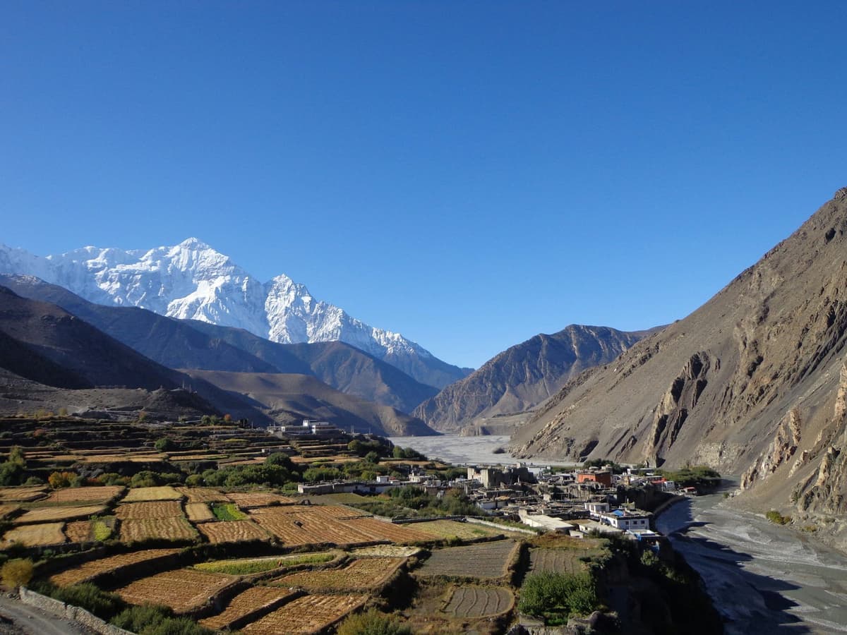
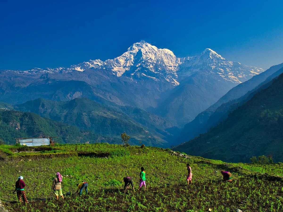
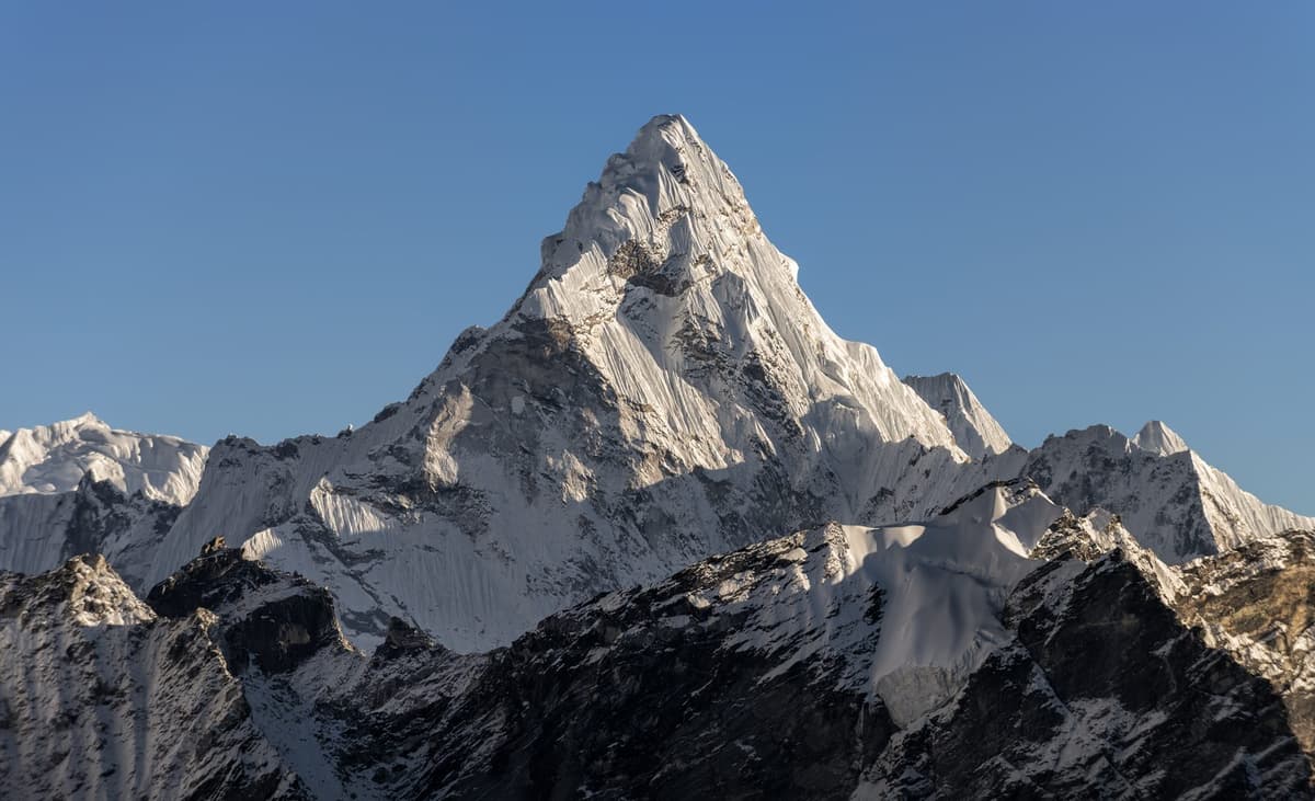
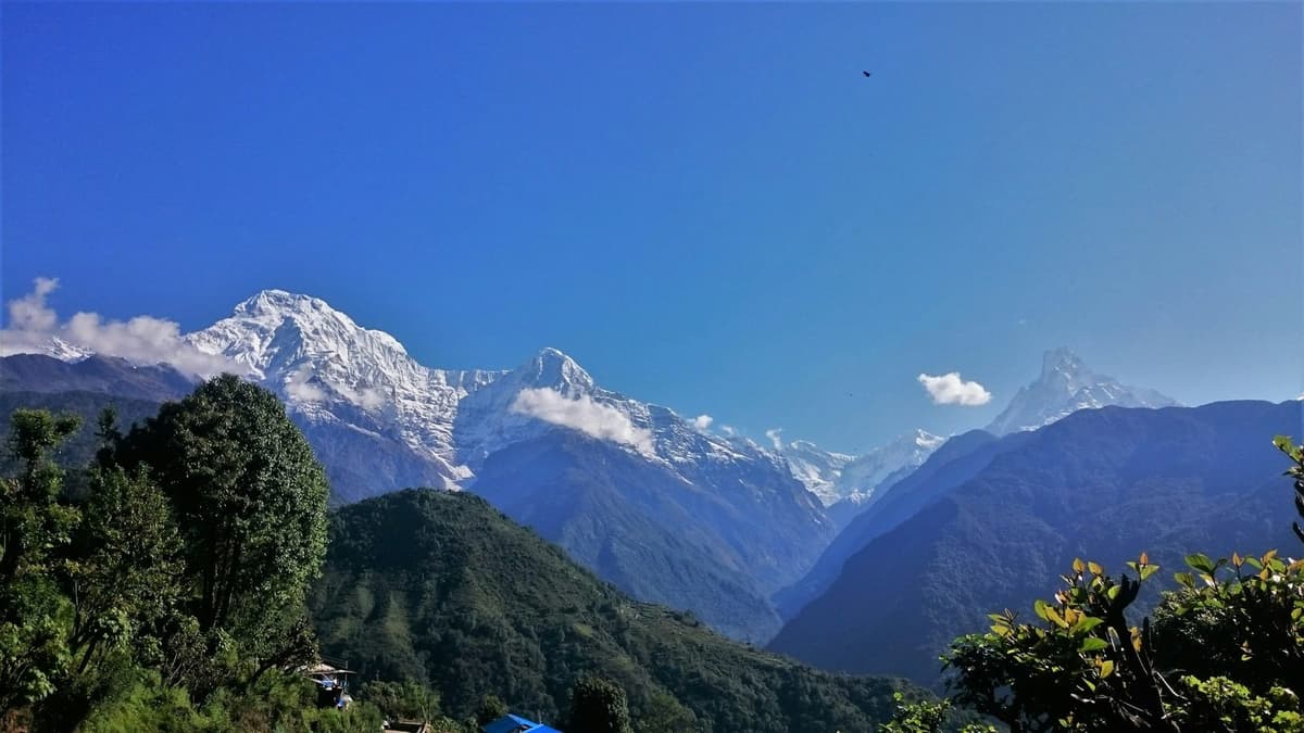
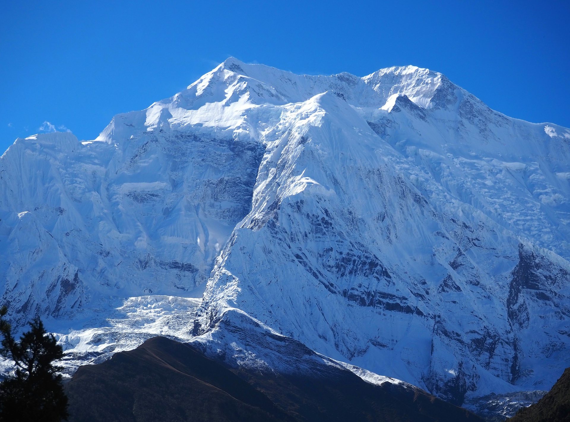
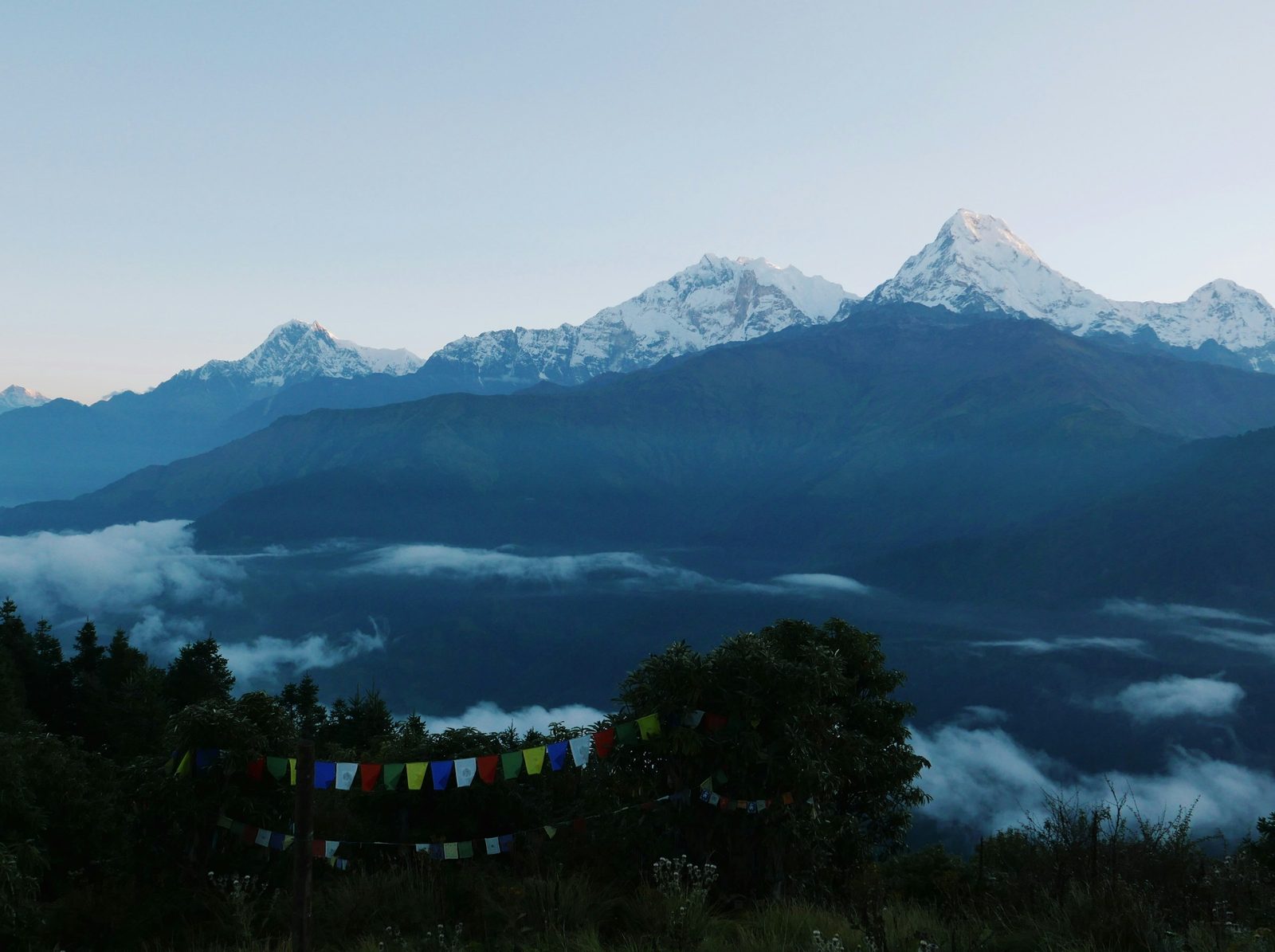
Annapurna II seen from Upper Pisang on the Annapurna Circuit

By Uncover Nepal Team · Checked by our Kathmandu travel team · Last checked 29 October 2026

On the crossing morning, headtorches move up the slope above Thorong Phedi in the dark; most groups leave between about 4 and 6 am. The air is thin and cold, and the only sounds are boots and hard breathing.

The Annapurna Circuit altitude profile starts at about 800 m in Besisahar, reaches Manang at about 3,500 m and tops out at 5,416 m (17,769 ft) on Thorong La, before dropping to Muktinath, about 3,800 m according to the Nepal Tourism Board (NTB). You rest in Manang and cross the pass in one long day.

Routes, dates and what we arrange are on our Annapurna Circuit trek page. This guide covers height, acclimatisation and difficulty.

Key facts

Highest point
Thorong La, 5,416 m (17,769 ft); NTB's Muktinath page gives 5,380 m (Annapurna Conservation Area Project (ACAP), via The Rising Nepal, 22 Jul 2026; NTB. Checked 29 Oct 2026)
Acclimatisation stop
Manang, about 3,500 m, with a rest day (Our trip pages; trekking companies' figures. Checked 29 Oct 2026)
Last lodges below the pass
Thorong Phedi, about 4,450 to 4,550 m (HRA gives 4,550 m); High Camp, about 4,850 to 4,925 m (Himalayan Rescue Association (HRA); Wikipedia; trekking companies. Checked 29 Oct 2026)
Permit
ACAP entry permit: NPR 3,000 foreign, NPR 1,000 South Asian (SAARC) (NTNC e-permit portal. Checked 29 Oct 2026)
Altitude illness
Possible from a sleeping altitude of 2,450 m (8,000 ft) (CDC Yellow Book (last reviewed 23 Apr 2025). Checked 29 Oct 2026)

In this guide

  • What is the Annapurna Circuit altitude profile, village by village?
  • Where and how do you acclimatise in Manang?
  • What is the Thorong La crossing day like?
  • How much of the Annapurna Circuit is road now?
  • Can you add Tilicho Lake to the Circuit?
  • How does it compare with Annapurna Base Camp and Manaslu?
  • How difficult is the Annapurna Circuit, and who does it suit?
  • How do you avoid altitude sickness on the Annapurna Circuit?
  • Frequently asked questions
  • Which Annapurna Circuit trip fits your days?

What is the Annapurna Circuit altitude profile, village by village?

The Annapurna Circuit trek altitude rises gently for the first days, then steeply from Manang to the pass. Village heights are sleeping heights; Thorong La and Tilicho Lake are day high points. Published figures differ by up to about 100 m, so we give ranges where sources disagree and name each source.
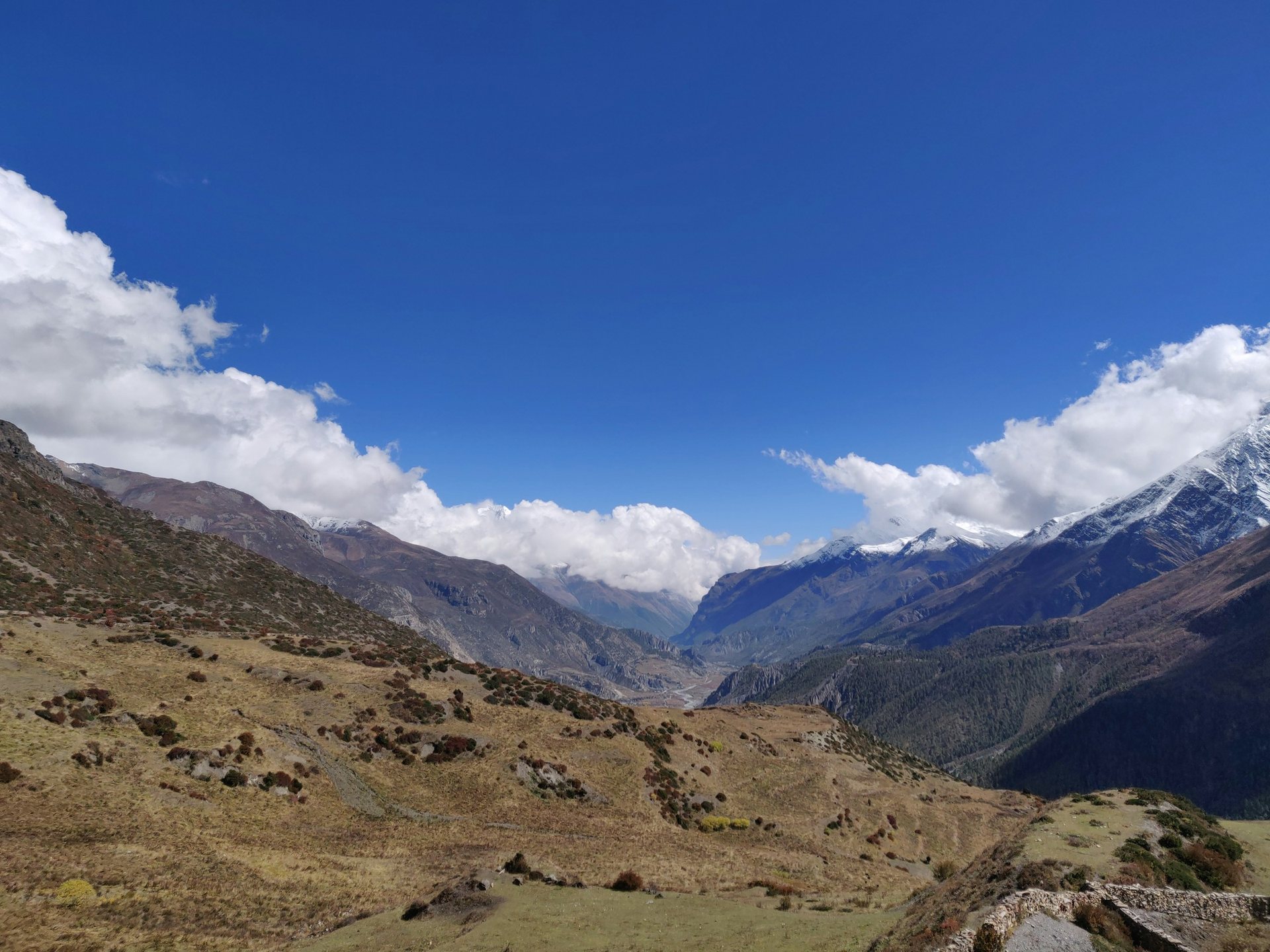
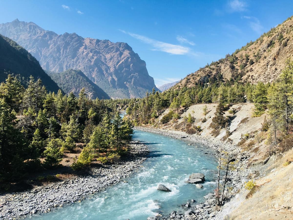
Yak Kharka valley in autumn on the Annapurna Circuit, between Manang and Thorong La
Yak Kharka, about 4,000 to 4,100 m, an overnight stop on our trips between Manang and the pass
Place About (m) Source
Besisahar 800 Trekking companies (Nepalgram, Marron Treks)
Dharapani 1,860 Our trip page; Nepal Hiking Team
Chame 2,650 (published 2,630 to 2,680) Our trip pages; trekking companies; Wikipedia
Pisang 3,250 to 3,300 Our trip pages; G Adventures; Wikipedia
Manang 3,500 (published 3,519 to 3,570) Our trip pages; G Adventures; Wikipedia
Yak Kharka 4,000 to 4,100 Our trip pages; trekking companies
Thorong Phedi 4,450 to 4,550 (HRA gives 4,550) HRA; Wikipedia; G Adventures; our trip pages
Thorong High Camp 4,850 to 4,925, published figures vary Wikipedia; our Tilicho trip page; two trekking companies
Thorong La (day high point) 5,416 ACAP Jomsom, via The Rising Nepal, 22 Jul 2026
Muktinath 3,800 NTB
Tilicho Lake (side trip, day high point) 4,919 Kathmandu Post, 28 Oct 2025; The Rising Nepal, 23 Jun 2026

Phedi is Nepali for the foot of a hill; a kharka is a high pasture.

Where and how do you acclimatise in Manang?

You acclimatise in Manang, about 3,500 m, with a full rest day before going higher. All three of our Circuit trips build it in. Rest means a short hike above the village and back down to sleep, so your body adapts without sleeping higher.
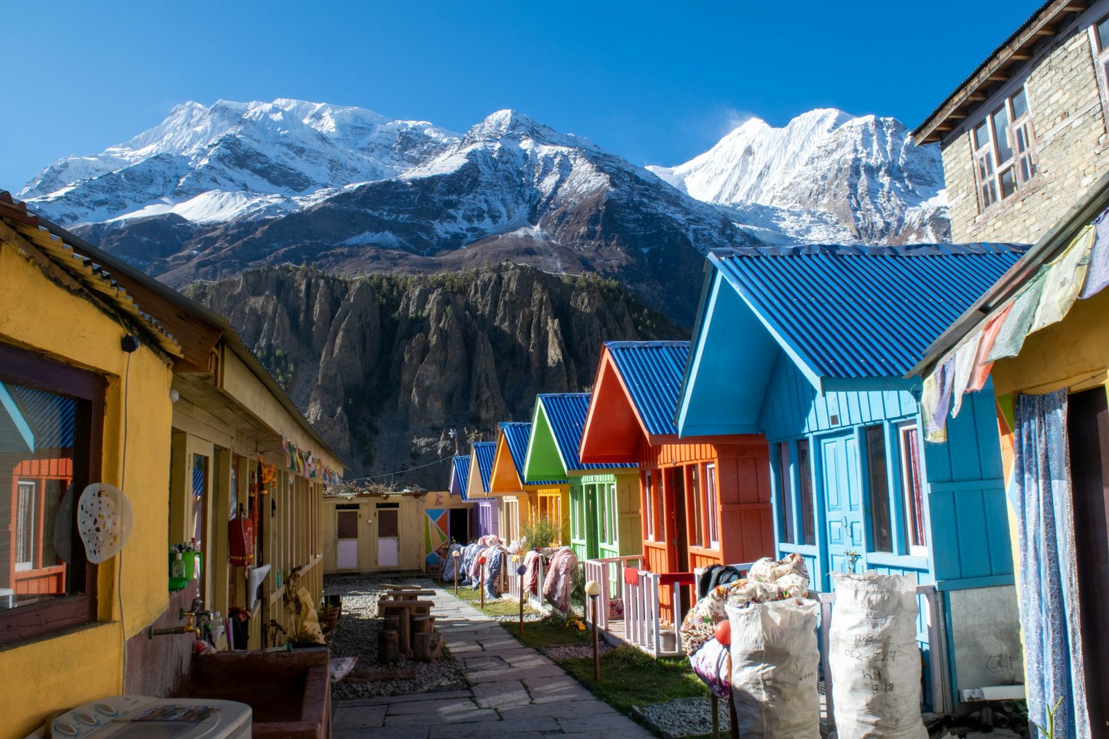
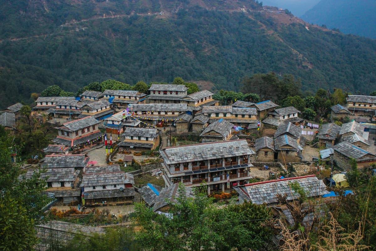
Stone houses in Manang village on the Annapurna Circuit
Manang, about 3,500 m, where all our Circuit trips take a rest day before going higher

HRA volunteer doctors at the Manang aid post offer 24-hour emergency care until the end of November, The Rising Nepal reported on 7 October 2026.

Why not drive straight to Manang?

Driving from Besisahar to Manang in a day breaks the US Centers for Disease Control and Prevention (CDC) advice against sleeping at 2,750 m (9,000 ft) or more after one day's ascent from low ground. ACAP's chief, Dr Rabin Kadel, said altitude sickness is particularly common among Nepali and Indian visitors who travel by road directly to high places such as Muktinath without proper acclimatisation (The Himalayan Times, 22 July 2026). Our 10-day and 11-day trips drive only to Chame, about 2,650 m, on day 1.

How do our nights compare with the 500 m guideline?

The CDC advises no more than 500 m of extra sleeping height a night above 3,000 m. By our own trip-page heights, two nights climb a little more: Chame to Pisang (about 630 m) and, on the 10-day and 11-day trips, Manang to Tilicho Base Camp (about 610 m). The Manang rest day and a second night at Tilicho Base Camp help offset them.

What is the Thorong La crossing day like?

The crossing is the longest and hardest day of the Circuit: commonly 8 to 12 hours from Thorong Phedi to Muktinath. You climb about 870 to 970 m from Phedi, or about 490 to 570 m from High Camp, to 5,416 m, then descend about 1,600 m to Muktinath.
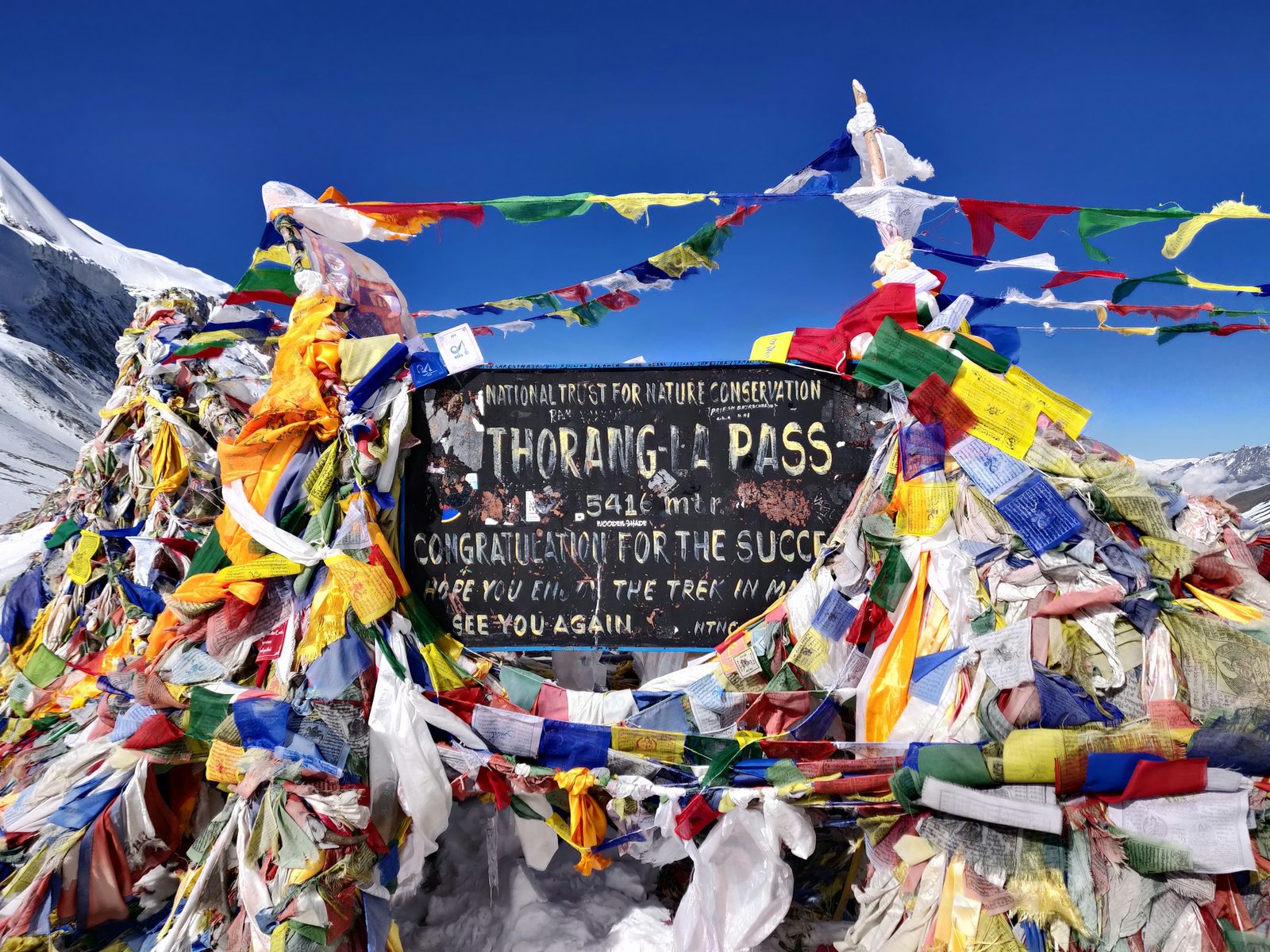
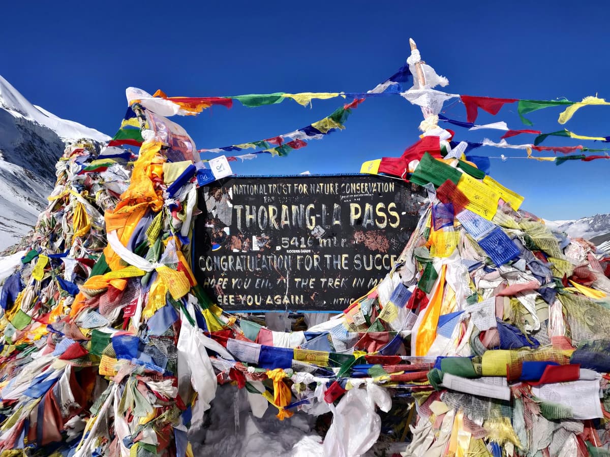
The sign at the top of Thorong La pass on the Annapurna Circuit
Thorong La, 5,416 m, the highest point of the Annapurna Circuit

Guides say the wind rises later in the day, hence the early start. The day ends at the Muktinath Temple.

The main seasons are March to May and September to November, yet snow shut the pass from 24 to 27 September 2026. In winter deep snow often covers it; we found no official closure date. In November, the Manang Airport weather station (3,401 m), about 2,000 m below the pass, has an average daily low of −4.4 °C (DHM, 1991 to 2020).

HRA says its Thorong Phedi clinic "has not been in operation now due to the technical reasons". On our trips, your guide, who knows the route, decides when and how to cross, based on snow and the forecast. More in our Thorong La crossing guide.

How much of the Annapurna Circuit is road now?

Roads now reach both sides of the pass: Upper Manang (Khangsar) on the east and Muktinath on the west; only the walk over Thorong La has no road. The district administration puts Besisahar to Chame at about 61.5 km and Chame to Manang and Khangsar at about 36 km (Kathmandu Post, 14 October 2026).

The walk from Besisahar to Thorong La once took around 21 days; roads have cut it to about one week (The Rising Nepal, 22 July 2026).

"Road expansion has diminished sections of the original trail and reduced the length of the trekking experience. If we want visitors to spend more time in the region, the road network along the classic trail should be limited."

Raju Lalchan, president of the Mustang Chamber of Commerce and Industry, The Rising Nepal, "11,800 trekkers cross Thorong La Pass in a year", 22 July 2026

Road status in late October 2026:

  • Besisahar to Chame: reopened after the September floods (Kathmandu Post, 7 October 2026).
  • Chame to Upper Manang: reopened on 13 October over a temporary timber deck, light vehicles only, an arrangement officials said would last "until Dashain is over" (Kathmandu Post, 14 October 2026). We found no later report: ask us for the latest, and be ready to walk this section.
  • Mustang side: NTB says buses run all the way to Muktinath; shared jeeps run between Muktinath and Jomsom.

Can you add Tilicho Lake to the Circuit?

Yes. Tilicho Lake, at 4,919 m (16,138 ft) in Manang district, is a side trip from Manang. On our itineraries it adds two days: you walk via Khangsar to Tilicho Base Camp, sleep there at 4,150 m, climb to the lake early and rejoin the main trail at Yak Kharka.

The trail crosses landslide-prone slopes, so it is walked only in settled weather. In late October 2025, heavy snow turned back hundreds of trekkers from Tilicho Base Camp (Kathmandu Post, 28 October 2025).

How does it compare with Annapurna Base Camp and Manaslu?

The Annapurna Circuit goes higher than either. Thorong La, 5,416 m, is above Larkya La on the Manaslu Circuit, 5,106 m (5,160 m is also published), and well above Annapurna Base Camp at 4,130 m, which has no pass to cross.

Manaslu needs a restricted-area permit plus Manaslu (MCAP) and ACAP permits and a local fee; the main Annapurna Circuit needs only the ACAP entry permit.

For a wider comparison, see ABC vs Circuit vs Poon Hill.

How difficult is the Annapurna Circuit, and who does it suit?

Annapurna Circuit difficulty comes from altitude and long days, not technique. Nepal has no official difficulty scale, so each company sets its own grade. We grade the Circuit strenuous: about 6 to 7 hours of walking a day, with no technical climbing. Other trekking companies grade it from moderate-hard to strenuous.

It suits you if:

  • You can walk 6 to 7 hours a day for about eight days running.
  • You are happy in teahouses (simple family-run lodges) with cold mornings.

Think twice if:

  • You have a heart or lung condition, or have had altitude illness before. Ask your doctor first.
  • You want to avoid one very long, very high day. Annapurna Base Camp, with no pass, may suit you better.

How do you avoid altitude sickness on the Annapurna Circuit?

Go up slowly, rest in Manang and never climb higher with symptoms. Altitude illness is possible from a sleeping altitude of about 2,450 m; every night of our 10-day trip is above that. Above 3,000 m (9,800 ft), raise your sleeping height by no more than about 500 m a night.
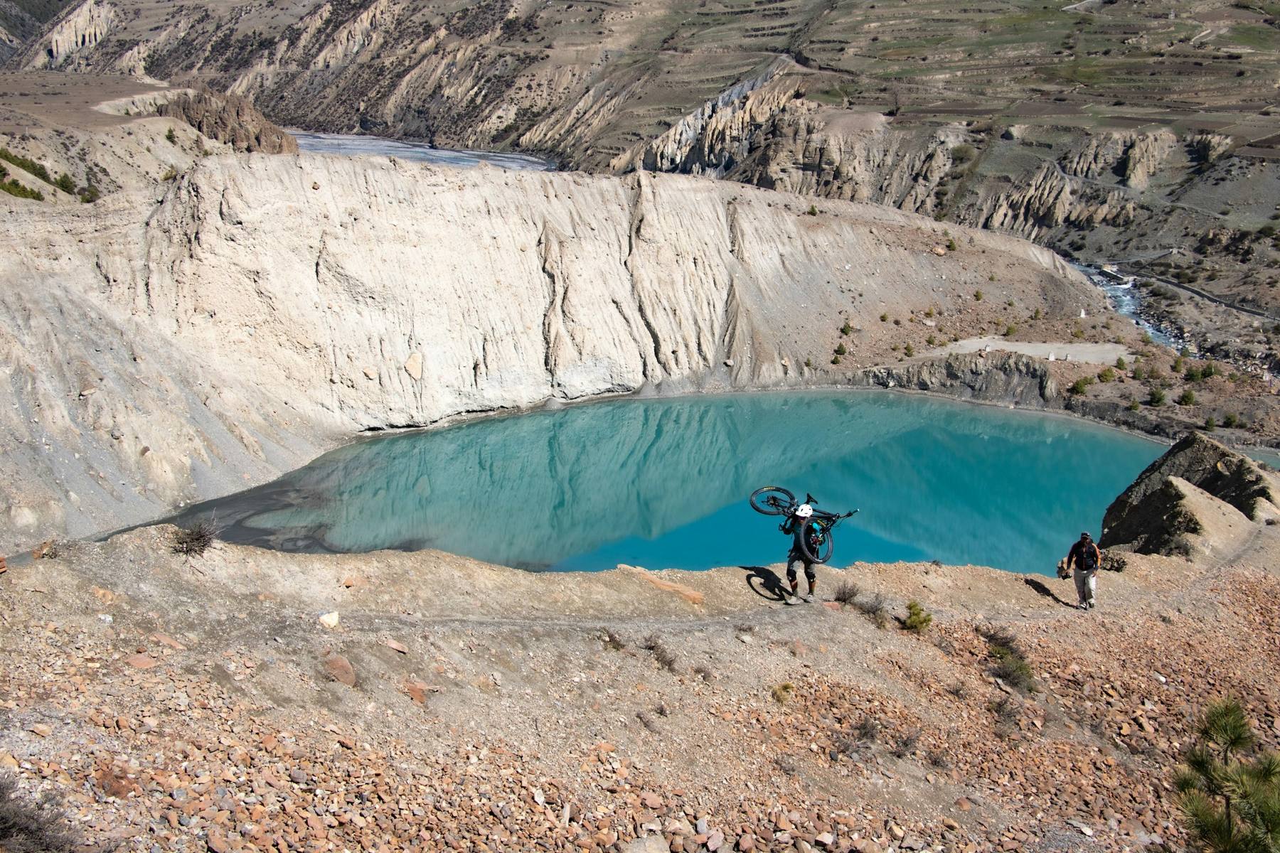
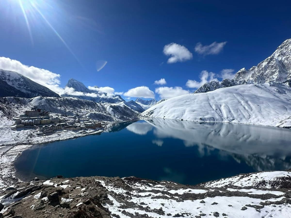
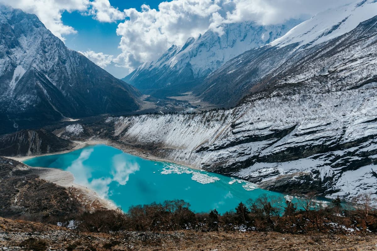
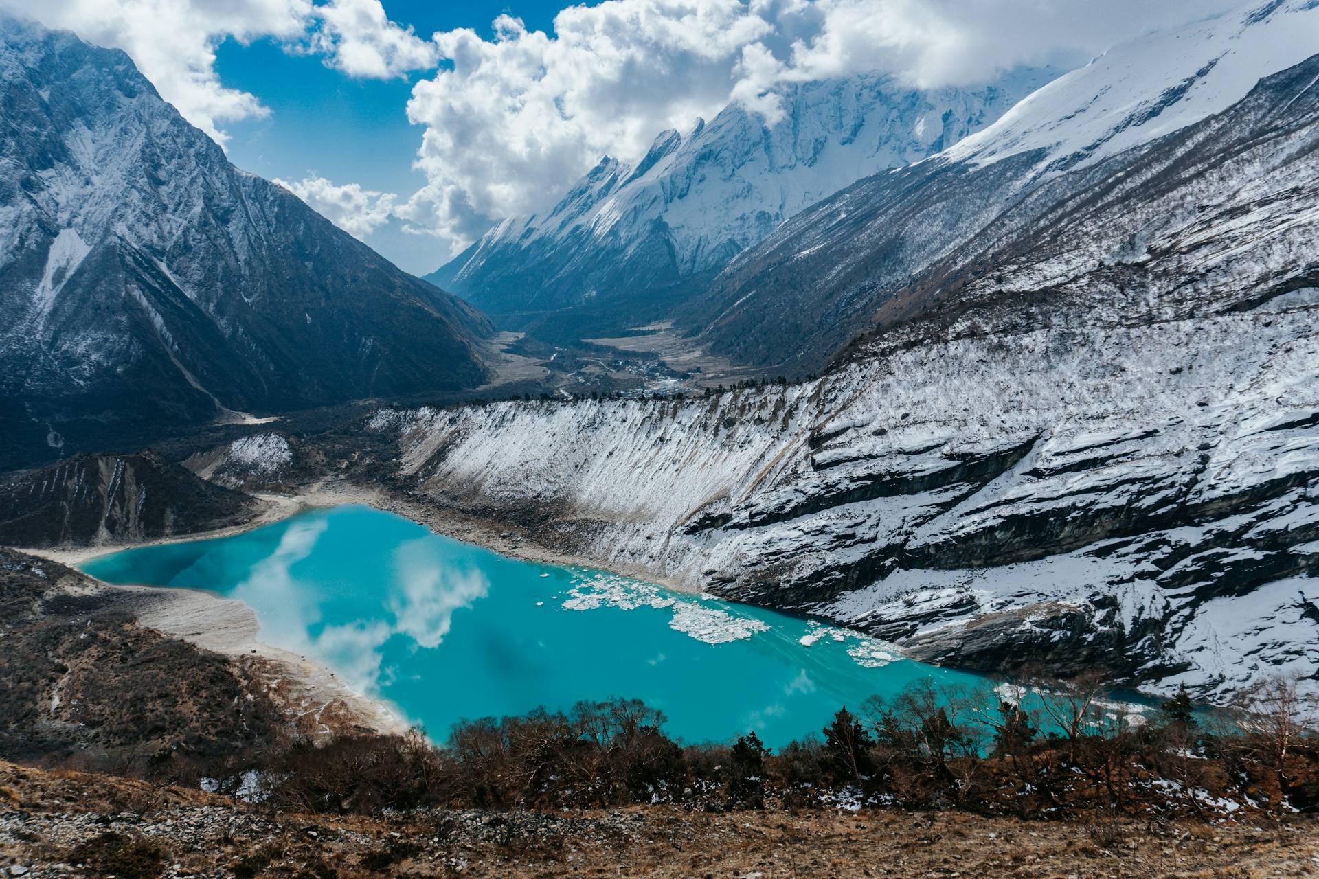
Gangapurna Lake at Manang on the Annapurna Circuit
Gangapurna Lake below the Gangapurna glacier at Manang

ACAP data show 25 tourists died of altitude sickness in the Annapurna Conservation Area in the 2025/26 fiscal year, eight in Manang (The Himalayan Times, 22 July 2026).

  1. Walk slowly: "bistarai, bistarai", Nepali for "slowly, slowly".
  2. Keep the Manang rest day; rest every 3 to 4 days higher up.
  3. Drink enough, and no alcohol early on. Hot garlic soup is a comforting local habit that helps you drink more, not a proven cure.
  4. Tell your guide early if you feel unwell. Never go higher with symptoms; if they get worse, go down.
  5. Ask your doctor before the trip about preventive medicine such as acetazolamide.
  6. If symptoms are severe, descend at once and get help. Our guide arranges a rescue if needed.
  7. Get insurance that covers the trek's altitude and helicopter evacuation. We recommend it; we do not sell it.

More in altitude sickness on Nepal treks and how to avoid altitude sickness.

Frequently asked questions

What is the shortest Annapurna Circuit, and how much of it is road now?

Ours is 10 days from Pokhara: a jeep to Chame on day 1, about eight days of walking including Tilicho Lake, and a drive out from Muktinath. Only the Thorong La crossing now has no road. Itineraries run about 10 to 18 days, depending on how much you drive.

How much does the Annapurna Circuit cost?

It depends on your days, driving and porters; our Annapurna Circuit trek cost guide has a dated breakdown. The fixed official fee is the ACAP entry permit: NPR 3,000 for foreign visitors, NPR 1,000 for SAARC nationals.

Should I do the Manaslu Circuit or the Annapurna Circuit?

Choose the Annapurna Circuit for the higher pass and simpler permit, Manaslu if you accept restricted-area rules: since 22 March 2026 its permit can be issued to one trekker through a registered agency, with a licensed guide. Fees are in our Manaslu Circuit trek cost guide.

What altitude is Annapurna Base Camp?

Annapurna Base Camp is at 4,130 m, a little above Yak Kharka on the Circuit, on a separate trek with no high pass. See our ABC trek difficulty guide.

How hard is the Tilicho Lake trek, and can I add it to the Circuit or go in winter?

It is a hard side trip to 4,919 m: Horizon Guides grades it moderate to difficult. It adds two days from Manang on our itineraries. We found no official winter closure, but one trekking company says snow often covers the trail in mid-winter and the lake freezes. Ask us about conditions before planning a winter trip.

Which Annapurna Circuit trip fits your days?

Start with how many days you have: compare the 10-day Circuit from Pokhara, the 11-day Circuit from Kathmandu and the 13-day Tilicho Lake route from Kathmandu. All three include Tilicho Lake and a rest day in Manang. A licensed guide walks with you on every trek we run.

Every route is on our Annapurna Circuit trek page. Ask us on WhatsApp or through the enquiry form with your dates, and we can tell you which suits you.
Tags
Annapurna CircuitThorong LaManangAltitude sicknessTilicho LakeTrek difficulty
Share
U
Uncover Nepal Team
Writer at Uncover Nepal
More in TreksSee all Treks

Annapurna Circuit Altitude: Profile and Difficulty

12 min read Posted 28 Oct 2026Updated 28 Oct 2026
Annapurna II seen from Upper Pisang on the Annapurna Circuit

By Uncover Nepal Team · Checked by our Kathmandu travel team · Last checked 29 October 2026

On the crossing morning, headtorches move up the slope above Thorong Phedi in the dark; most groups leave between about 4 and 6 am. The air is thin and cold, and the only sounds are boots and hard breathing.

The Annapurna Circuit altitude profile starts at about 800 m in Besisahar, reaches Manang at about 3,500 m and tops out at 5,416 m (17,769 ft) on Thorong La, before dropping to Muktinath, about 3,800 m according to the Nepal Tourism Board (NTB). You rest in Manang and cross the pass in one long day.

Routes, dates and what we arrange are on our Annapurna Circuit trek page. This guide covers height, acclimatisation and difficulty.

Key facts

Highest point
Thorong La, 5,416 m (17,769 ft); NTB's Muktinath page gives 5,380 m (Annapurna Conservation Area Project (ACAP), via The Rising Nepal, 22 Jul 2026; NTB. Checked 29 Oct 2026)
Acclimatisation stop
Manang, about 3,500 m, with a rest day (Our trip pages; trekking companies' figures. Checked 29 Oct 2026)
Last lodges below the pass
Thorong Phedi, about 4,450 to 4,550 m (HRA gives 4,550 m); High Camp, about 4,850 to 4,925 m (Himalayan Rescue Association (HRA); Wikipedia; trekking companies. Checked 29 Oct 2026)
Permit
ACAP entry permit: NPR 3,000 foreign, NPR 1,000 South Asian (SAARC) (NTNC e-permit portal. Checked 29 Oct 2026)
Altitude illness
Possible from a sleeping altitude of 2,450 m (8,000 ft) (CDC Yellow Book (last reviewed 23 Apr 2025). Checked 29 Oct 2026)

In this guide

  • What is the Annapurna Circuit altitude profile, village by village?
  • Where and how do you acclimatise in Manang?
  • What is the Thorong La crossing day like?
  • How much of the Annapurna Circuit is road now?
  • Can you add Tilicho Lake to the Circuit?
  • How does it compare with Annapurna Base Camp and Manaslu?
  • How difficult is the Annapurna Circuit, and who does it suit?
  • How do you avoid altitude sickness on the Annapurna Circuit?
  • Frequently asked questions
  • Which Annapurna Circuit trip fits your days?

What is the Annapurna Circuit altitude profile, village by village?

The Annapurna Circuit trek altitude rises gently for the first days, then steeply from Manang to the pass. Village heights are sleeping heights; Thorong La and Tilicho Lake are day high points. Published figures differ by up to about 100 m, so we give ranges where sources disagree and name each source.

Yak Kharka valley in autumn on the Annapurna Circuit, between Manang and Thorong La
Yak Kharka, about 4,000 to 4,100 m, an overnight stop on our trips between Manang and the pass
Place About (m) Source
Besisahar 800 Trekking companies (Nepalgram, Marron Treks)
Dharapani 1,860 Our trip page; Nepal Hiking Team
Chame 2,650 (published 2,630 to 2,680) Our trip pages; trekking companies; Wikipedia
Pisang 3,250 to 3,300 Our trip pages; G Adventures; Wikipedia
Manang 3,500 (published 3,519 to 3,570) Our trip pages; G Adventures; Wikipedia
Yak Kharka 4,000 to 4,100 Our trip pages; trekking companies
Thorong Phedi 4,450 to 4,550 (HRA gives 4,550) HRA; Wikipedia; G Adventures; our trip pages
Thorong High Camp 4,850 to 4,925, published figures vary Wikipedia; our Tilicho trip page; two trekking companies
Thorong La (day high point) 5,416 ACAP Jomsom, via The Rising Nepal, 22 Jul 2026
Muktinath 3,800 NTB
Tilicho Lake (side trip, day high point) 4,919 Kathmandu Post, 28 Oct 2025; The Rising Nepal, 23 Jun 2026

Phedi is Nepali for the foot of a hill; a kharka is a high pasture.

Where and how do you acclimatise in Manang?

You acclimatise in Manang, about 3,500 m, with a full rest day before going higher. All three of our Circuit trips build it in. Rest means a short hike above the village and back down to sleep, so your body adapts without sleeping higher.

Stone houses in Manang village on the Annapurna Circuit
Manang, about 3,500 m, where all our Circuit trips take a rest day before going higher

HRA volunteer doctors at the Manang aid post offer 24-hour emergency care until the end of November, The Rising Nepal reported on 7 October 2026.

Why not drive straight to Manang?

Driving from Besisahar to Manang in a day breaks the US Centers for Disease Control and Prevention (CDC) advice against sleeping at 2,750 m (9,000 ft) or more after one day's ascent from low ground. ACAP's chief, Dr Rabin Kadel, said altitude sickness is particularly common among Nepali and Indian visitors who travel by road directly to high places such as Muktinath without proper acclimatisation (The Himalayan Times, 22 July 2026). Our 10-day and 11-day trips drive only to Chame, about 2,650 m, on day 1.

How do our nights compare with the 500 m guideline?

The CDC advises no more than 500 m of extra sleeping height a night above 3,000 m. By our own trip-page heights, two nights climb a little more: Chame to Pisang (about 630 m) and, on the 10-day and 11-day trips, Manang to Tilicho Base Camp (about 610 m). The Manang rest day and a second night at Tilicho Base Camp help offset them.

What is the Thorong La crossing day like?

The crossing is the longest and hardest day of the Circuit: commonly 8 to 12 hours from Thorong Phedi to Muktinath. You climb about 870 to 970 m from Phedi, or about 490 to 570 m from High Camp, to 5,416 m, then descend about 1,600 m to Muktinath.

The sign at the top of Thorong La pass on the Annapurna Circuit
Thorong La, 5,416 m, the highest point of the Annapurna Circuit

Guides say the wind rises later in the day, hence the early start. The day ends at the Muktinath Temple.

The main seasons are March to May and September to November, yet snow shut the pass from 24 to 27 September 2026. In winter deep snow often covers it; we found no official closure date. In November, the Manang Airport weather station (3,401 m), about 2,000 m below the pass, has an average daily low of −4.4 °C (DHM, 1991 to 2020).

HRA says its Thorong Phedi clinic "has not been in operation now due to the technical reasons". On our trips, your guide, who knows the route, decides when and how to cross, based on snow and the forecast. More in our Thorong La crossing guide.

How much of the Annapurna Circuit is road now?

Roads now reach both sides of the pass: Upper Manang (Khangsar) on the east and Muktinath on the west; only the walk over Thorong La has no road. The district administration puts Besisahar to Chame at about 61.5 km and Chame to Manang and Khangsar at about 36 km (Kathmandu Post, 14 October 2026).

The walk from Besisahar to Thorong La once took around 21 days; roads have cut it to about one week (The Rising Nepal, 22 July 2026).

"Road expansion has diminished sections of the original trail and reduced the length of the trekking experience. If we want visitors to spend more time in the region, the road network along the classic trail should be limited."

Raju Lalchan, president of the Mustang Chamber of Commerce and Industry, The Rising Nepal, "11,800 trekkers cross Thorong La Pass in a year", 22 July 2026

Road status in late October 2026:

  • Besisahar to Chame: reopened after the September floods (Kathmandu Post, 7 October 2026).
  • Chame to Upper Manang: reopened on 13 October over a temporary timber deck, light vehicles only, an arrangement officials said would last "until Dashain is over" (Kathmandu Post, 14 October 2026). We found no later report: ask us for the latest, and be ready to walk this section.
  • Mustang side: NTB says buses run all the way to Muktinath; shared jeeps run between Muktinath and Jomsom.

Can you add Tilicho Lake to the Circuit?

Yes. Tilicho Lake, at 4,919 m (16,138 ft) in Manang district, is a side trip from Manang. On our itineraries it adds two days: you walk via Khangsar to Tilicho Base Camp, sleep there at 4,150 m, climb to the lake early and rejoin the main trail at Yak Kharka.

The trail crosses landslide-prone slopes, so it is walked only in settled weather. In late October 2025, heavy snow turned back hundreds of trekkers from Tilicho Base Camp (Kathmandu Post, 28 October 2025).

How does it compare with Annapurna Base Camp and Manaslu?

The Annapurna Circuit goes higher than either. Thorong La, 5,416 m, is above Larkya La on the Manaslu Circuit, 5,106 m (5,160 m is also published), and well above Annapurna Base Camp at 4,130 m, which has no pass to cross.

Manaslu needs a restricted-area permit plus Manaslu (MCAP) and ACAP permits and a local fee; the main Annapurna Circuit needs only the ACAP entry permit.

For a wider comparison, see ABC vs Circuit vs Poon Hill.

How difficult is the Annapurna Circuit, and who does it suit?

Annapurna Circuit difficulty comes from altitude and long days, not technique. Nepal has no official difficulty scale, so each company sets its own grade. We grade the Circuit strenuous: about 6 to 7 hours of walking a day, with no technical climbing. Other trekking companies grade it from moderate-hard to strenuous.

It suits you if:

  • You can walk 6 to 7 hours a day for about eight days running.
  • You are happy in teahouses (simple family-run lodges) with cold mornings.

Think twice if:

  • You have a heart or lung condition, or have had altitude illness before. Ask your doctor first.
  • You want to avoid one very long, very high day. Annapurna Base Camp, with no pass, may suit you better.

How do you avoid altitude sickness on the Annapurna Circuit?

Go up slowly, rest in Manang and never climb higher with symptoms. Altitude illness is possible from a sleeping altitude of about 2,450 m; every night of our 10-day trip is above that. Above 3,000 m (9,800 ft), raise your sleeping height by no more than about 500 m a night.

Gangapurna Lake at Manang on the Annapurna Circuit
Gangapurna Lake below the Gangapurna glacier at Manang

ACAP data show 25 tourists died of altitude sickness in the Annapurna Conservation Area in the 2025/26 fiscal year, eight in Manang (The Himalayan Times, 22 July 2026).

  1. Walk slowly: "bistarai, bistarai", Nepali for "slowly, slowly".
  2. Keep the Manang rest day; rest every 3 to 4 days higher up.
  3. Drink enough, and no alcohol early on. Hot garlic soup is a comforting local habit that helps you drink more, not a proven cure.
  4. Tell your guide early if you feel unwell. Never go higher with symptoms; if they get worse, go down.
  5. Ask your doctor before the trip about preventive medicine such as acetazolamide.
  6. If symptoms are severe, descend at once and get help. Our guide arranges a rescue if needed.
  7. Get insurance that covers the trek's altitude and helicopter evacuation. We recommend it; we do not sell it.

More in altitude sickness on Nepal treks and how to avoid altitude sickness.

Frequently asked questions

What is the shortest Annapurna Circuit, and how much of it is road now?

Ours is 10 days from Pokhara: a jeep to Chame on day 1, about eight days of walking including Tilicho Lake, and a drive out from Muktinath. Only the Thorong La crossing now has no road. Itineraries run about 10 to 18 days, depending on how much you drive.

How much does the Annapurna Circuit cost?

It depends on your days, driving and porters; our Annapurna Circuit trek cost guide has a dated breakdown. The fixed official fee is the ACAP entry permit: NPR 3,000 for foreign visitors, NPR 1,000 for SAARC nationals.

Should I do the Manaslu Circuit or the Annapurna Circuit?

Choose the Annapurna Circuit for the higher pass and simpler permit, Manaslu if you accept restricted-area rules: since 22 March 2026 its permit can be issued to one trekker through a registered agency, with a licensed guide. Fees are in our Manaslu Circuit trek cost guide.

What altitude is Annapurna Base Camp?

Annapurna Base Camp is at 4,130 m, a little above Yak Kharka on the Circuit, on a separate trek with no high pass. See our ABC trek difficulty guide.

How hard is the Tilicho Lake trek, and can I add it to the Circuit or go in winter?

It is a hard side trip to 4,919 m: Horizon Guides grades it moderate to difficult. It adds two days from Manang on our itineraries. We found no official winter closure, but one trekking company says snow often covers the trail in mid-winter and the lake freezes. Ask us about conditions before planning a winter trip.

Which Annapurna Circuit trip fits your days?

Start with how many days you have: compare the 10-day Circuit from Pokhara, the 11-day Circuit from Kathmandu and the 13-day Tilicho Lake route from Kathmandu. All three include Tilicho Lake and a rest day in Manang. A licensed guide walks with you on every trek we run.

Every route is on our Annapurna Circuit trek page. Ask us on WhatsApp or through the enquiry form with your dates, and we can tell you which suits you.
Tags
Annapurna CircuitThorong LaManangAltitude sicknessTilicho LakeTrek difficulty
Share
U
Uncover Nepal Team
Writer at Uncover Nepal
More in TreksSee all Treks