


Explore by activity
Not listed yet

We run Motorbiking & Overland trips — we just haven’t put the itinerary on the site yet. Tell us your dates and we’ll send a costed day-by-day plan.

Explore by experience
Explore by region
by gomayu
Search Tours or Places

Manaslu Circuit Route: Trail, Villages and Road Heads

10 min read Posted 29 Oct 2026Updated 29 Oct 2026
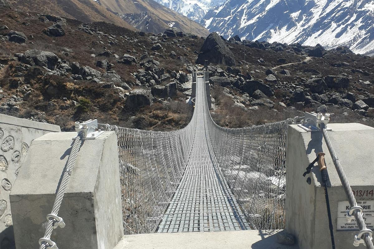
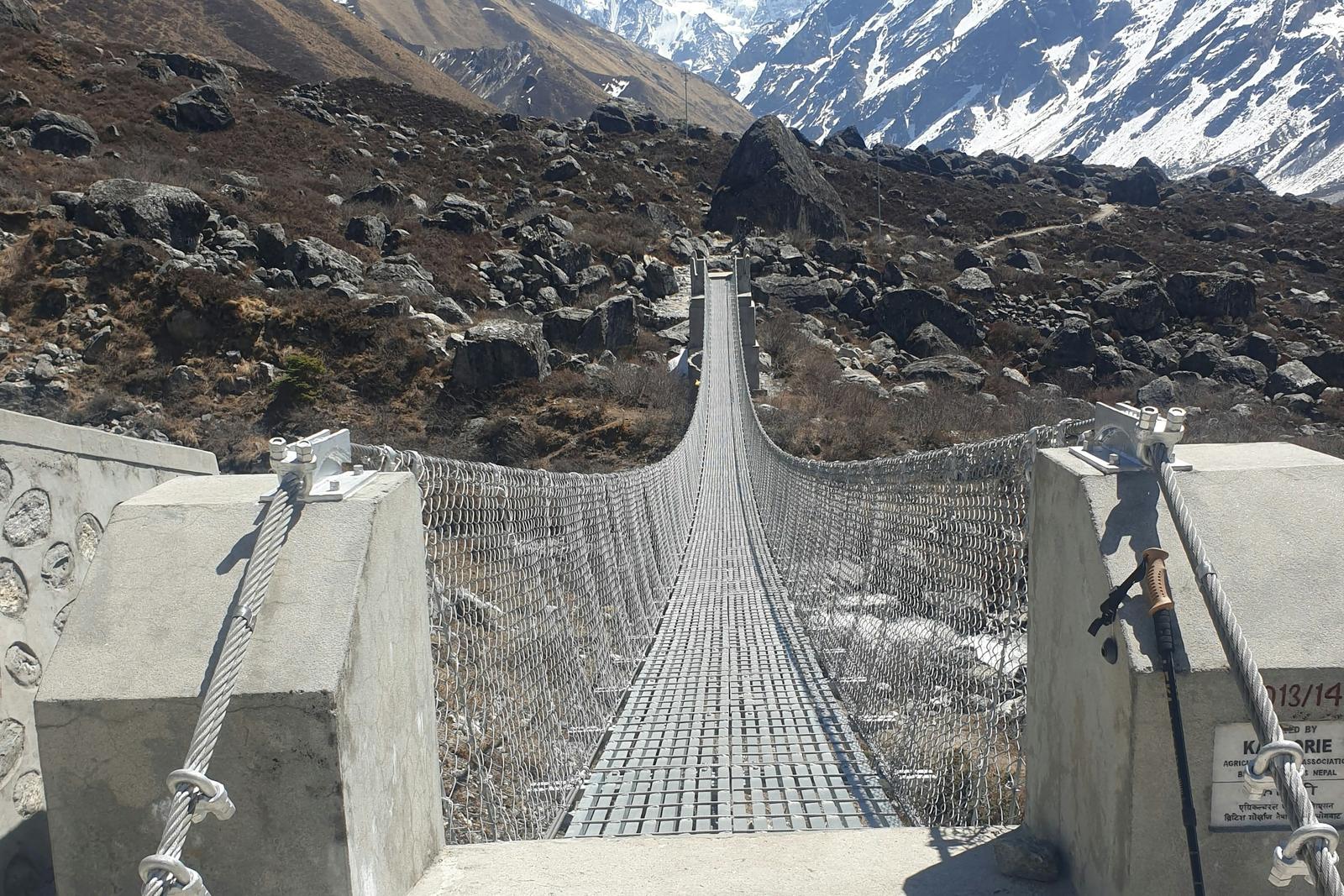
Trekkers crossing a suspension bridge over a river gorge on the Manaslu Circuit trek

By Uncover Nepal Team · Checked by our Kathmandu travel team · Last checked 30 October 2026

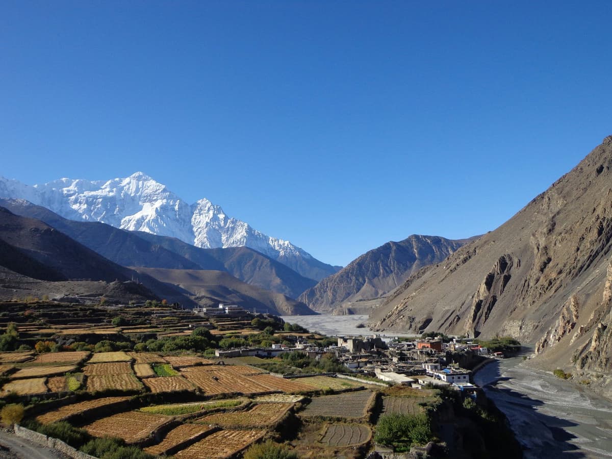
Where the jeep road gives out in the Budhi Gandaki valley, the walking starts. For the first days the trail follows the river upstream through a deep gorge, crossing it on suspension bridges. Higher up, the valley opens into stone villages hung with prayer flags, and at Samagaun the snow face of Manaslu stands over the rooftops.

The Manaslu Circuit route is a loop of about 177 km around the Manaslu massif, from Gorkha into Manang. The Manaslu trail climbs the Budhi Gandaki valley through Jagat, Namrung and Samagaun, crosses the Larkya La at 5,106 m (16,752 ft), and drops through Bimthang to Dharapani, where it meets the Annapurna Circuit road.

Dates and what is included are on our Manaslu Circuit trek page. This guide covers the ground: the road head after the October 2026 flood, each stage, village heights and the side trips.

Key facts

Route
A loop of about 177 km around the Manaslu massif: up the Budhi Gandaki, down the Dudh Khola and Marsyangdi (Wikipedia, 30 Oct 2026)
Highest point
Larkya La (Larke Pass), 5,106 m (16,752 ft); 5,160 m is also published (DNPWC, 30 Oct 2026)
Start
Road head in the Budhi Gandaki valley: Machha Khola or Khorlabesi on 25 Oct 2026 (TAAN (Nepal News); MCAP (The Kathmandu Post), 30 Oct 2026)
Finish
Dharapani on the Annapurna Circuit road, then a jeep to Besisahar (Our trip pages, 30 Oct 2026)
Permits
Manaslu restricted-area permit (through a registered agency; solo since 22 Mar 2026, with a licensed guide), MCAP, ACAP (NTB; TAAN; The Kathmandu Post, 30 Oct 2026)

In this guide

  • What is the Manaslu Circuit route, stage by stage?
  • Where does the Manaslu trail start, and how far does the road go?
  • What is each section of the trail like?
  • Which side trips leave the main route?
  • How does our 12-day trip walk the route?
  • Frequently asked questions
  • Which Manaslu trip should you ask us about?

What is the Manaslu Circuit route, stage by stage?

The Manaslu Circuit route climbs the Budhi Gandaki valley from a road head at about 900 m, through the Kutang and Nubri villages to Samagaun and Samdo, crosses the Larkya La from Dharmasala, and comes down to Bimthang and Dharapani on the Manang side. The table follows the night stops on our 12-day trip.
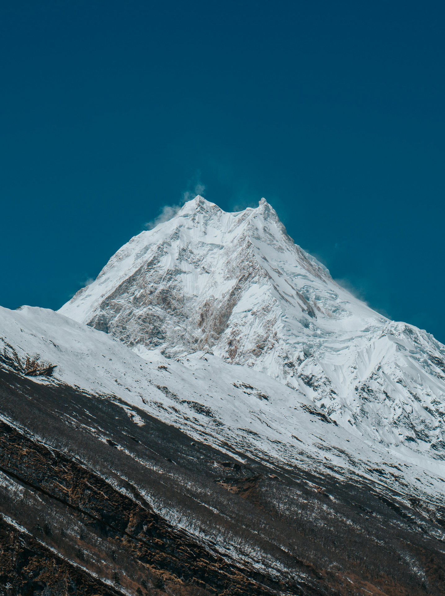
Manaslu summit seen from Samagaun on the Manaslu Circuit
Manaslu from Samagaun, the main stop on the upper part of the route.
Stage Approximate altitude Notes
Machha Khola About 900 m Road head and our first night
Jagat About 1,340 m (1,290 to 1,410 m published) Conservation area entrance and check post
Deng About 1,800 to 1,900 m Night stop on our trip
Namrung About 2,630 m Night stop on our trip
Shyala About 3,480 to 3,500 m Night stop on our trip, via the Nubri village of Lho
Samagaun 3,530 m Second MCAP check post; acclimatisation base
Samdo 3,875 m (3,860 m in some sources) Last permanent village before the pass
Dharmasala (Larkya Phedi) About 4,460 m Basic stone-and-tin shelters
Larkya La 5,106 m (5,160 m is also published) Highest point of the circuit
Bimthang About 3,720 m (3,750 m in some sources) First night on the Manang side
Dharapani About 1,860 to 1,960 m by source Joins the Annapurna Circuit road

Treat these as close guides: only the pass (DNPWC) and Samagaun (conservation project boards) have official figures; others vary by source.

Where does the Manaslu trail start, and how far does the road go?

The Manaslu trail starts wherever the jeep road up the Budhi Gandaki ends, and that point keeps moving. Our trips drive from Kathmandu to Machha Khola, at about 900 m, in a long day. On 25 October TAAN said vehicles reached Machha Khola; MCAP said Khorlabesi, lower down.

This is the Benighat-Arughat-Larke road: 154 km to the Chinese border near Larke, with 97 km open to four-wheel vehicles in January 2025, and planned to link Jagat with Sirdibas, Bihi, Prok, Samagaun and Samdo (OnlineKhabar).

The flood took out the Manbu to Soti road bridge and the approach to the Arughat bridge (The Kathmandu Post, 12 October). An Army Bailey bridge had larger vehicles crossing at Arughat again from 26 October, but the Army was still clearing a 1.5 km stretch of debris on the road from Salleri to Jagat (OnlineKhabar, 27 October).

"Tourists have started arriving again since October 16. They are travelling from Jagat through Philim towards the Nubri Valley and Larkya La pass."

Bhuwan Ojha, information officer, Manaslu Conservation Area Project, quoted in The Kathmandu Post, 25 October 2026

We found no official road times or fares. At the far end, the trail meets the Annapurna Circuit road at Dharapani, inside the Annapurna Conservation Area (hence the ACAP permit); on our trips a jeep takes you down to Besisahar.

What is each section of the trail like?

Three parts: the low gorge up to Namrung, where the flood damage is; the high villages from Lho to Samdo, where you acclimatise; and the pass, with the long descent to Dharapani.
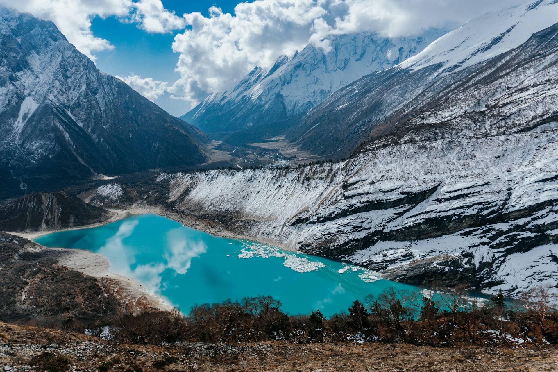
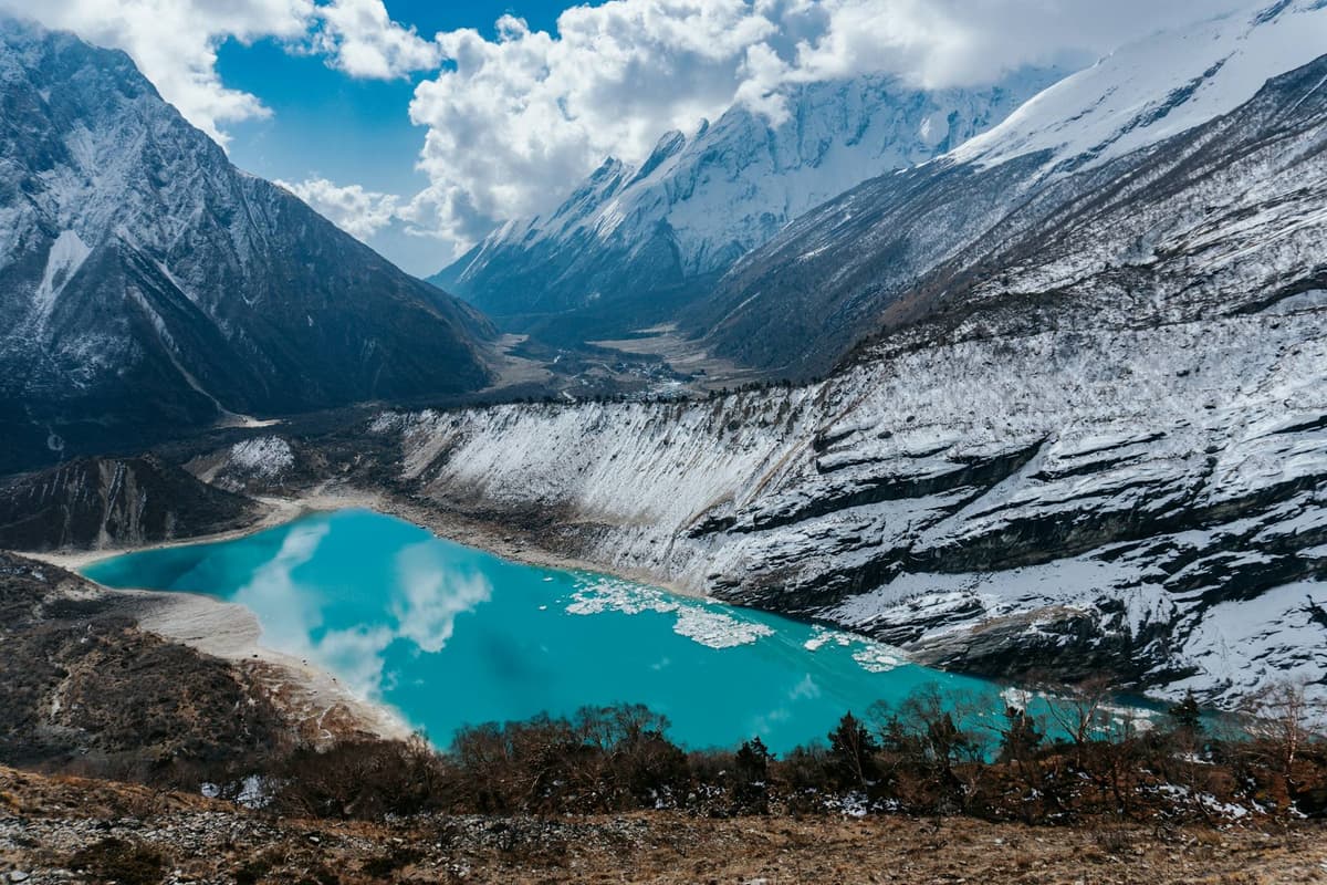
Birendra Tal glacier lake below Manaslu near Samagaun
Birendra Tal, the glacier lake below Manaslu, a short walk from Samagaun.

Road head to Namrung

The lower trail follows an old salt-trading route. At Jagat you enter the Manaslu Conservation Area, declared in 1998 (DNPWC), and your permits are checked. The flood took the Machha Khola to Kerauja and Nagchet to Philim bridges (The Kathmandu Post, 12 October), and TAAN has warned about temporary bridges. A Jagat hotel owner told the same paper on 25 October that "although people can walk along the trail, mules cannot pass".

Higher up, the trail passes from Kutang, the area of Bihi ward, into Nubri, the villages of Prok, Lho and Samagaun (NTNC).

Lho to Samdo

These are the high villages below Manaslu, 8,163 m (26,781 ft), which our Mount Manaslu guide covers. Every night here is above 3,000 m, where the CDC advises raising your sleeping height by no more than about 500 m a night; our altitude sickness guide explains the symptoms.

Over the pass to Dharapani

Crossing day starts before dawn at Dharmasala: about 650 m up, then about 1,400 m down to Bimthang, 8 to 11 hours by operators' estimates, longer in snow. Your guide, who knows the route, decides when and how to cross, based on snow and the forecast. Our Larke Pass guide covers the day. From Bimthang the trail follows the Dudh Khola down to the Marsyangdi and Dharapani.

Which side trips leave the main route?

From Samagaun, the acclimatisation day offers Manaslu Base Camp, Pungyen Gompa or Birendra Tal. Lower down, the Tsum Valley branches off at Lokpa, above Philim: a separate restricted area with its own permit, which on our trips turns the 12-day circuit into 16 days.
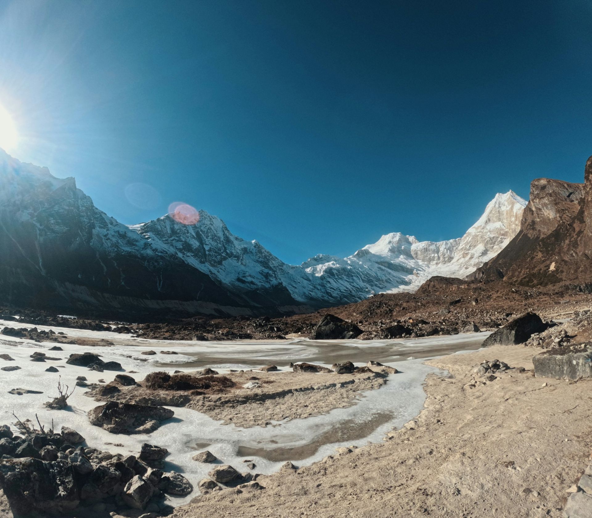
Manaslu and its glacier valley from near Pungyen Gompa above Samagaun
The valley below Manaslu near Pungyen Gompa, one of the side trips from Samagaun.
Side trip Leaves from Height What to know
Manaslu Base Camp Samagaun About 4,800 m (operator figure) Hardest: a long, steep day out and back
Pungyen Gompa Samagaun, or from Shyala About 4,000 m (3,700 to 4,050 m published) Monastery below Manaslu
Birendra Tal Samagaun 3,691 m Lake near the village; gentlest
Tsum Valley Lokpa Mu Gompa about 3,700 m (operator figures) Own permit; open to trekkers since 2008

Our Manaslu Base Camp guide compares the three Samagaun walks. On 25 October Nepal News reported Tsum reopened as far as Chhekampar and Mu Gompa, while MCAP said it needed another eight to 10 days; our Tsum Valley guide has more.

How does our 12-day trip walk the route?

Our 12-day trip drives to Machha Khola, sleeps at the villages in the table, spends two nights at Samagaun (walking in via Pungyen Gompa, then hiking towards Manaslu Base Camp), crosses to Bimthang in roughly 8 to 10 hours, and drives back from Dharapani. It is one way to pace the route.

The step from Samdo up to Dharmasala is a little over the CDC's guide of about 500 m a night, so if you acclimatise slowly, ask us about an extra night at Samdo. A licensed guide walks with you on every trek we run.

Our 16-day trip turns off at Lokpa, spends two nights in upper Tsum for Mu Gompa and Rachen Gompa, then rejoins the circuit at Deng.

Frequently asked questions

What is the Manaslu trail like right now?

In the latest reports we had seen on 30 October 2026, the main circuit had reopened on repaired trail and temporary bridges (TAAN, 21 and 25 October), with the road head at Machha Khola (TAAN) or Khorlabesi (MCAP). Restricted-area permits were not issued from 29 to 31 October because of Cyclone Arnab. On rescue, the Department of Immigration said that "The facilitating agency will be fully responsible for emergency rescue and logistical arrangements" (The Kathmandu Post, 22 March 2026).

Is the Manaslu Circuit worth it compared with the Annapurna Circuit?

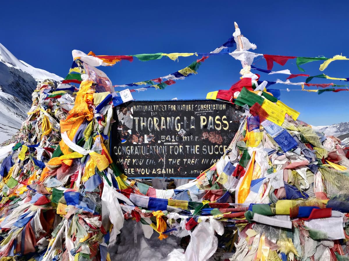
We think so, if you want more trail, less road and can accept the restricted-area rules. Roads to Upper Manang and Muktinath have cut the Annapurna Circuit to about seven to 10 days (The Kathmandu Post, 29 October 2026), and its pass, the Thorong La, is 5,416 m (NTB). Manaslu is not empty: 17,710 foreign trekkers entered in 2025, the most of any restricted area (Department of Immigration figures, via The Rising Nepal).

Which permits does the Manaslu Circuit need, what do they cost, and is there a minimum group size?

Three. The Manaslu restricted-area permit costs USD 100 per person for the first week from September to November, then USD 15 a day; from December to August, USD 75 and USD 10. MCAP and ACAP cost NPR 3,000 each for foreign nationals, NPR 1,000 for SAARC nationals. There has been no minimum group size since 22 March 2026; see our Manaslu trek permit guide.

Can I trek the Manaslu Circuit solo or without a guide?

Solo, yes; without a guide, no. Since 22 March 2026 one trekker alone can be issued the restricted-area permit, but only through a registered agency, and a licensed guide must walk with you (The Kathmandu Post). The paper also reported a limit of seven trekkers per guide. A licensed guide walks with you on every trek we run.

How much does the Manaslu Circuit cost?

In autumn the permits come to USD 100 for up to a week in the restricted area, plus NPR 3,000 each for MCAP and ACAP per foreign trekker. Guide, transport, teahouses (simple family-run lodges) and food make up the rest; our Manaslu Circuit trek cost guide sets out sourced ranges. For a trip with us, ask us for a quote.

Which Manaslu trip should you ask us about?

For the circuit, start with our Manaslu Circuit trek from Kathmandu, 12 days. To add the Tsum Valley, ask about our 16-day Manaslu Circuit and Tsum Valley trip. Both are on our Manaslu Circuit trek page. Conditions are changing fast this autumn: ask us on WhatsApp or through the enquiry form where the road reaches and whether permits are being issued for your dates.
Tags
Manaslu CircuitManaslu trailLarkya LaBudhi GandakiSamagaunGorkha
Share
U
Uncover Nepal Team
Writer at Uncover Nepal
More in TreksSee all Treks

Manaslu Circuit Route: Trail, Villages and Road Heads

10 min read Posted 29 Oct 2026Updated 29 Oct 2026
Trekkers crossing a suspension bridge over a river gorge on the Manaslu Circuit trek

By Uncover Nepal Team · Checked by our Kathmandu travel team · Last checked 30 October 2026

Where the jeep road gives out in the Budhi Gandaki valley, the walking starts. For the first days the trail follows the river upstream through a deep gorge, crossing it on suspension bridges. Higher up, the valley opens into stone villages hung with prayer flags, and at Samagaun the snow face of Manaslu stands over the rooftops.

The Manaslu Circuit route is a loop of about 177 km around the Manaslu massif, from Gorkha into Manang. The Manaslu trail climbs the Budhi Gandaki valley through Jagat, Namrung and Samagaun, crosses the Larkya La at 5,106 m (16,752 ft), and drops through Bimthang to Dharapani, where it meets the Annapurna Circuit road.

Dates and what is included are on our Manaslu Circuit trek page. This guide covers the ground: the road head after the October 2026 flood, each stage, village heights and the side trips.

Key facts

Route
A loop of about 177 km around the Manaslu massif: up the Budhi Gandaki, down the Dudh Khola and Marsyangdi (Wikipedia, 30 Oct 2026)
Highest point
Larkya La (Larke Pass), 5,106 m (16,752 ft); 5,160 m is also published (DNPWC, 30 Oct 2026)
Start
Road head in the Budhi Gandaki valley: Machha Khola or Khorlabesi on 25 Oct 2026 (TAAN (Nepal News); MCAP (The Kathmandu Post), 30 Oct 2026)
Finish
Dharapani on the Annapurna Circuit road, then a jeep to Besisahar (Our trip pages, 30 Oct 2026)
Permits
Manaslu restricted-area permit (through a registered agency; solo since 22 Mar 2026, with a licensed guide), MCAP, ACAP (NTB; TAAN; The Kathmandu Post, 30 Oct 2026)

In this guide

  • What is the Manaslu Circuit route, stage by stage?
  • Where does the Manaslu trail start, and how far does the road go?
  • What is each section of the trail like?
  • Which side trips leave the main route?
  • How does our 12-day trip walk the route?
  • Frequently asked questions
  • Which Manaslu trip should you ask us about?

What is the Manaslu Circuit route, stage by stage?

The Manaslu Circuit route climbs the Budhi Gandaki valley from a road head at about 900 m, through the Kutang and Nubri villages to Samagaun and Samdo, crosses the Larkya La from Dharmasala, and comes down to Bimthang and Dharapani on the Manang side. The table follows the night stops on our 12-day trip.

Manaslu summit seen from Samagaun on the Manaslu Circuit
Manaslu from Samagaun, the main stop on the upper part of the route.
Stage Approximate altitude Notes
Machha Khola About 900 m Road head and our first night
Jagat About 1,340 m (1,290 to 1,410 m published) Conservation area entrance and check post
Deng About 1,800 to 1,900 m Night stop on our trip
Namrung About 2,630 m Night stop on our trip
Shyala About 3,480 to 3,500 m Night stop on our trip, via the Nubri village of Lho
Samagaun 3,530 m Second MCAP check post; acclimatisation base
Samdo 3,875 m (3,860 m in some sources) Last permanent village before the pass
Dharmasala (Larkya Phedi) About 4,460 m Basic stone-and-tin shelters
Larkya La 5,106 m (5,160 m is also published) Highest point of the circuit
Bimthang About 3,720 m (3,750 m in some sources) First night on the Manang side
Dharapani About 1,860 to 1,960 m by source Joins the Annapurna Circuit road

Treat these as close guides: only the pass (DNPWC) and Samagaun (conservation project boards) have official figures; others vary by source.

Where does the Manaslu trail start, and how far does the road go?

The Manaslu trail starts wherever the jeep road up the Budhi Gandaki ends, and that point keeps moving. Our trips drive from Kathmandu to Machha Khola, at about 900 m, in a long day. On 25 October TAAN said vehicles reached Machha Khola; MCAP said Khorlabesi, lower down.

This is the Benighat-Arughat-Larke road: 154 km to the Chinese border near Larke, with 97 km open to four-wheel vehicles in January 2025, and planned to link Jagat with Sirdibas, Bihi, Prok, Samagaun and Samdo (OnlineKhabar).

The flood took out the Manbu to Soti road bridge and the approach to the Arughat bridge (The Kathmandu Post, 12 October). An Army Bailey bridge had larger vehicles crossing at Arughat again from 26 October, but the Army was still clearing a 1.5 km stretch of debris on the road from Salleri to Jagat (OnlineKhabar, 27 October).

"Tourists have started arriving again since October 16. They are travelling from Jagat through Philim towards the Nubri Valley and Larkya La pass."

Bhuwan Ojha, information officer, Manaslu Conservation Area Project, quoted in The Kathmandu Post, 25 October 2026

We found no official road times or fares. At the far end, the trail meets the Annapurna Circuit road at Dharapani, inside the Annapurna Conservation Area (hence the ACAP permit); on our trips a jeep takes you down to Besisahar.

What is each section of the trail like?

Three parts: the low gorge up to Namrung, where the flood damage is; the high villages from Lho to Samdo, where you acclimatise; and the pass, with the long descent to Dharapani.

Birendra Tal glacier lake below Manaslu near Samagaun
Birendra Tal, the glacier lake below Manaslu, a short walk from Samagaun.

Road head to Namrung

The lower trail follows an old salt-trading route. At Jagat you enter the Manaslu Conservation Area, declared in 1998 (DNPWC), and your permits are checked. The flood took the Machha Khola to Kerauja and Nagchet to Philim bridges (The Kathmandu Post, 12 October), and TAAN has warned about temporary bridges. A Jagat hotel owner told the same paper on 25 October that "although people can walk along the trail, mules cannot pass".

Higher up, the trail passes from Kutang, the area of Bihi ward, into Nubri, the villages of Prok, Lho and Samagaun (NTNC).

Lho to Samdo

These are the high villages below Manaslu, 8,163 m (26,781 ft), which our Mount Manaslu guide covers. Every night here is above 3,000 m, where the CDC advises raising your sleeping height by no more than about 500 m a night; our altitude sickness guide explains the symptoms.

Over the pass to Dharapani

Crossing day starts before dawn at Dharmasala: about 650 m up, then about 1,400 m down to Bimthang, 8 to 11 hours by operators' estimates, longer in snow. Your guide, who knows the route, decides when and how to cross, based on snow and the forecast. Our Larke Pass guide covers the day. From Bimthang the trail follows the Dudh Khola down to the Marsyangdi and Dharapani.

Which side trips leave the main route?

From Samagaun, the acclimatisation day offers Manaslu Base Camp, Pungyen Gompa or Birendra Tal. Lower down, the Tsum Valley branches off at Lokpa, above Philim: a separate restricted area with its own permit, which on our trips turns the 12-day circuit into 16 days.

Manaslu and its glacier valley from near Pungyen Gompa above Samagaun
The valley below Manaslu near Pungyen Gompa, one of the side trips from Samagaun.
Side trip Leaves from Height What to know
Manaslu Base Camp Samagaun About 4,800 m (operator figure) Hardest: a long, steep day out and back
Pungyen Gompa Samagaun, or from Shyala About 4,000 m (3,700 to 4,050 m published) Monastery below Manaslu
Birendra Tal Samagaun 3,691 m Lake near the village; gentlest
Tsum Valley Lokpa Mu Gompa about 3,700 m (operator figures) Own permit; open to trekkers since 2008

Our Manaslu Base Camp guide compares the three Samagaun walks. On 25 October Nepal News reported Tsum reopened as far as Chhekampar and Mu Gompa, while MCAP said it needed another eight to 10 days; our Tsum Valley guide has more.

How does our 12-day trip walk the route?

Our 12-day trip drives to Machha Khola, sleeps at the villages in the table, spends two nights at Samagaun (walking in via Pungyen Gompa, then hiking towards Manaslu Base Camp), crosses to Bimthang in roughly 8 to 10 hours, and drives back from Dharapani. It is one way to pace the route.

The step from Samdo up to Dharmasala is a little over the CDC's guide of about 500 m a night, so if you acclimatise slowly, ask us about an extra night at Samdo. A licensed guide walks with you on every trek we run.

Our 16-day trip turns off at Lokpa, spends two nights in upper Tsum for Mu Gompa and Rachen Gompa, then rejoins the circuit at Deng.

Frequently asked questions

What is the Manaslu trail like right now?

In the latest reports we had seen on 30 October 2026, the main circuit had reopened on repaired trail and temporary bridges (TAAN, 21 and 25 October), with the road head at Machha Khola (TAAN) or Khorlabesi (MCAP). Restricted-area permits were not issued from 29 to 31 October because of Cyclone Arnab. On rescue, the Department of Immigration said that "The facilitating agency will be fully responsible for emergency rescue and logistical arrangements" (The Kathmandu Post, 22 March 2026).

Is the Manaslu Circuit worth it compared with the Annapurna Circuit?

We think so, if you want more trail, less road and can accept the restricted-area rules. Roads to Upper Manang and Muktinath have cut the Annapurna Circuit to about seven to 10 days (The Kathmandu Post, 29 October 2026), and its pass, the Thorong La, is 5,416 m (NTB). Manaslu is not empty: 17,710 foreign trekkers entered in 2025, the most of any restricted area (Department of Immigration figures, via The Rising Nepal).

Which permits does the Manaslu Circuit need, what do they cost, and is there a minimum group size?

Three. The Manaslu restricted-area permit costs USD 100 per person for the first week from September to November, then USD 15 a day; from December to August, USD 75 and USD 10. MCAP and ACAP cost NPR 3,000 each for foreign nationals, NPR 1,000 for SAARC nationals. There has been no minimum group size since 22 March 2026; see our Manaslu trek permit guide.

Can I trek the Manaslu Circuit solo or without a guide?

Solo, yes; without a guide, no. Since 22 March 2026 one trekker alone can be issued the restricted-area permit, but only through a registered agency, and a licensed guide must walk with you (The Kathmandu Post). The paper also reported a limit of seven trekkers per guide. A licensed guide walks with you on every trek we run.

How much does the Manaslu Circuit cost?

In autumn the permits come to USD 100 for up to a week in the restricted area, plus NPR 3,000 each for MCAP and ACAP per foreign trekker. Guide, transport, teahouses (simple family-run lodges) and food make up the rest; our Manaslu Circuit trek cost guide sets out sourced ranges. For a trip with us, ask us for a quote.

Which Manaslu trip should you ask us about?

For the circuit, start with our Manaslu Circuit trek from Kathmandu, 12 days. To add the Tsum Valley, ask about our 16-day Manaslu Circuit and Tsum Valley trip. Both are on our Manaslu Circuit trek page. Conditions are changing fast this autumn: ask us on WhatsApp or through the enquiry form where the road reaches and whether permits are being issued for your dates.

Tags
Manaslu CircuitManaslu trailLarkya LaBudhi GandakiSamagaunGorkha
Share
U
Uncover Nepal Team
Writer at Uncover Nepal
More in TreksSee all Treks