
by gomayu
Search Tours or Places

Everest Three Passes Trek Map: Route and Stages

14 min read Posted 10 Nov 2026Updated 08 Nov 2026
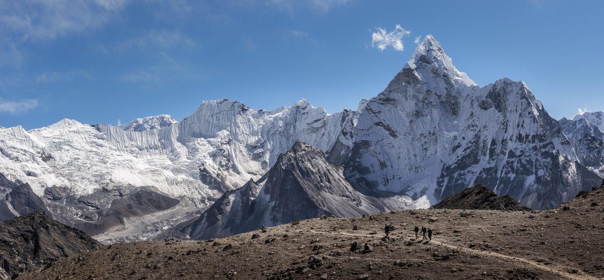
View from the Kongma La trail towards Ama Dablam in the Everest region of Nepal

Above Chhukung the trail to Kongma La turns to loose moraine, and every step slides a little before it holds. Turn round and Ama Dablam fills the view behind you, and near the top a small glacial lake lies still. This is the first of three high crossings that turn the Everest Base Camp walk into a full loop of the Khumbu.

By Uncover Nepal Team · Checked by our Kathmandu travel team · Last checked 9 November 2026

This three passes trek map sets out the loop as a stage table: Lukla to Chhukung, over Kongma La to Base Camp, across Cho La to Gokyo, then over Renjo La and down through Thame. It is the Everest Base Camp trek with three high passes and the Gokyo lakes added.

Key facts

Highest pass
Kongma La, 5,535 m (about 18,160 ft), linking Chhukung and Lobuche (The Himalayan Times, 29 Oct 2026 (checked 9 Nov 2026))
Middle pass
Cho La, 5,420 m (about 17,780 ft), between Dzongla and Thagnak (Wikipedia "Cho La (Nepal)"; World Expeditions, Exodus (checked 9 Nov 2026))
Western pass
Renjo La, about 5,360 m (about 17,590 ft); some give up to about 5,440 m (Operators incl. World Expeditions; 10Adventures (checked 9 Nov 2026))
Start and finish
Lukla airstrip, 2,846 m (about 9,340 ft) (CAAN AIP AMDT 02/2026 (house fact, checked 9 Nov 2026))
Highest night
Gorak Shep, about 5,140 to 5,180 m (Intrepid, World Expeditions, Exodus (checked 9 Nov 2026))
Length
Usually 20 to 22 days door to door, about 17 to 18 on foot (World Expeditions, Nepal Hiking Team (checked 9 Nov 2026))
Distance
No official figure; one operator gives about 146 to 150 km (Nepal Hiking Team (checked 9 Nov 2026))
Permits
Sagarmatha National Park permit NPR 3,000 (SAARC NPR 1,500); Khumbu Trek-Card NPR 3,000 (SAARC and China NPR 2,000) (NTB; Khumbu Pasang Lhamu Rural Municipality (checked 9 Nov 2026))
Lukla flights
In peak seasons many leave from Ramechhap (Manthali); all are weather-dependent (Kantipur, 4 Oct 2026; house fact (checked 9 Nov 2026))

In this guide

  • What does the three passes trek map look like?
  • Which direction is better: anticlockwise or clockwise?
  • The route in order, stage by stage
  • How hard are the three passes?
  • How long and how far is the Three Passes trek?
  • When can you cross the passes?
  • Getting to Lukla and back
  • What does the Three Passes trek cost in permits and extras?
  • Frequently asked questions
  • Plan your trek

What does the three passes trek map look like?

The Everest three passes trek map is a loop, not a line. You walk up the Khumbu valley to Chhukung, cross Kongma La to Lobuche and Base Camp, cross Cho La west to Gokyo, cross Renjo La to Lungden, then drop through Thame back to Namche and Lukla. The table below is that map, stop by stop.

Operators' heights for the same village differ by tens of metres, so the table gives "about" plus the range we found. A stage is the usual overnight hop; extra acclimatisation nights and spare days stretch it to the length operators list.

Stage From To Sleeping height (about) Pass Notes
1 Lukla Phakding 2,610 m None Fly in to Lukla (2,846 m), from Kathmandu or, in peak seasons, Ramechhap
2 Phakding Namche Bazaar 3,440 m None Acclimatisation stop; ATMs here, but they often go offline
3 Namche Bazaar Tengboche 3,860 m None Monastery village
4 Tengboche Dingboche 4,360 to 4,410 m None Nights here and at Chhukung build acclimatisation
5 Dingboche Chhukung 4,730 m None Base for the first pass
6 Chhukung Lobuche 4,910 to 4,940 m Kongma La, 5,535 m No teahouses on the crossing; glacier near the end of the day
7 Lobuche Gorak Shep 5,140 to 5,180 m None Highest night; side trip to Base Camp (5,364 m)
8 Gorak Shep Dzongla 4,830 m None Kala Patthar at dawn, then down past Lobuche
9 Dzongla Thagnak 4,700 m Cho La, 5,420 m Steep, glaciated, some scrambling
10 Thagnak Gokyo 4,750 m None Crosses the Ngozumpa glacier
11 Gokyo Gokyo 4,750 m None Optional climb of Gokyo Ri (5,357 m)
12 Gokyo Lungden 4,370 m Renjo La, about 5,360 m (some give up to about 5,440 m) Climb starts at the lakeside
13 Lungden Thame 3,800 to 3,820 m None Down the valley towards Namche
14 Thame Namche Bazaar 3,440 m None The loop closes
15 Namche Bazaar Lukla 2,846 m (airstrip) None Fly out; keep spare days for weather

If you are still choosing between this loop and the shorter options, our guide to Everest trekking routes compared sets them side by side.

Which direction is better: anticlockwise or clockwise?

Most operators run the loop anticlockwise, crossing Kongma La first after nights in Dingboche and Chhukung. Operators say that leaves you better acclimatised before the hardest climbs, and Base Camp is still in reach if snow shuts a pass. Clockwise starts with Renjo La from Lungden, after less time at height.
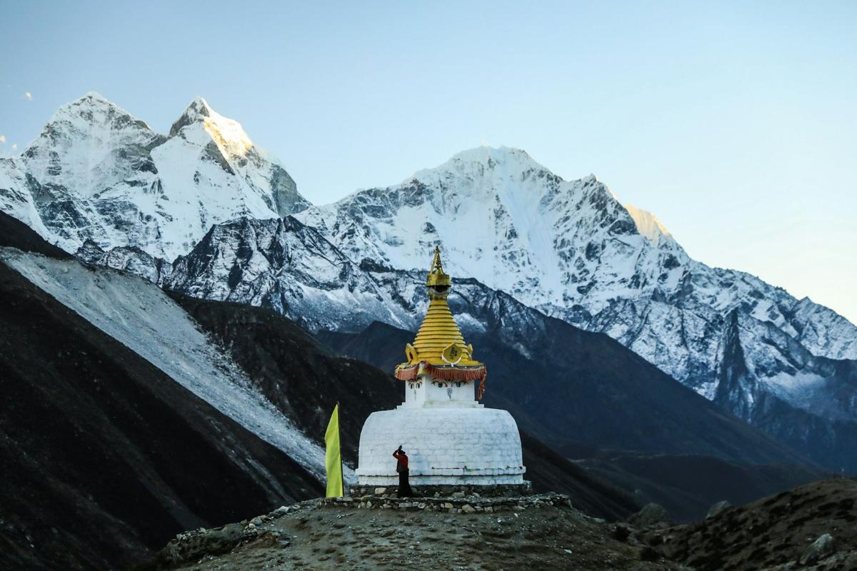
Stupa at Dingboche below snow peaks in the Khumbu
Dingboche, one of the nights that builds acclimatisation before Kongma La on the anticlockwise loop.

Anticlockwise and clockwise compared

Anticlockwise (Kongma La first) Clockwise (Renjo La first)
First pass Kongma La, 5,535 m, from Chhukung Renjo La, about 5,360 m, from Lungden
Time at height before it More: Namche, Dingboche and Chhukung come first Less: Thame and Lungden come soon after Namche
Base Camp Reached after the first pass Reached only after Renjo La and Cho La
If snow shuts a pass Base Camp and Kala Patthar stay in reach Base Camp is still two passes away
Who runs it this way World Expeditions and Nepal Hiking Team, among others Third Rock Adventures, among others

Footprint Adventure says most trekkers choose the anticlockwise route, and that Renjo La is usually seen as the toughest pass when you approach it clockwise. The stage table above runs anticlockwise.

The route in order, stage by stage

The loop has four parts, and each ends at a pass or a big viewpoint that needs a settled weather window. Heights are in the table above.

Lukla to Chhukung: the build-up

From Lukla the trail drops to Phakding, then climbs to Namche Bazaar, where you stop to acclimatise. Tengboche and Dingboche follow, then Chhukung, the last stop before the first pass. These slow nights are where your body catches up with the height.
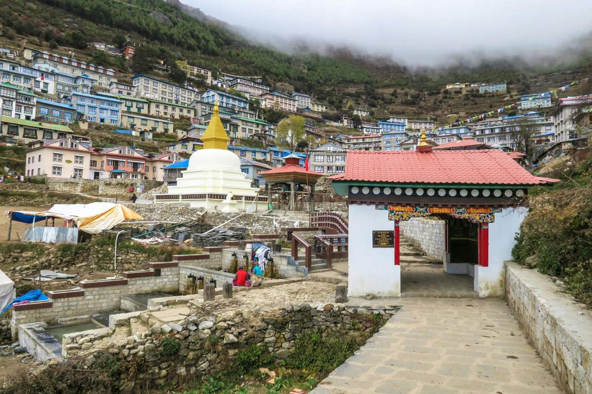
Stupa and entrance gate at Namche Bazaar in the Everest region
The gate and stupa at Namche Bazaar, where the loop starts and ends.

Kongma La to Base Camp

Kongma La links Chhukung and Lobuche. The Himalayan Times describes rugged moraine slopes and loose footing; World Expeditions says it is harder if snow is present, with a glacier crossing near the end of the day. Nepal Hiking Team notes there are no teahouses on the crossing, so carry water and lunch. On 27 October 2026 an Australian trekker badly injured in a fall near Kongma La was flown by helicopter from Lobuche to Kathmandu (The Himalayan Times, 29 October 2026).
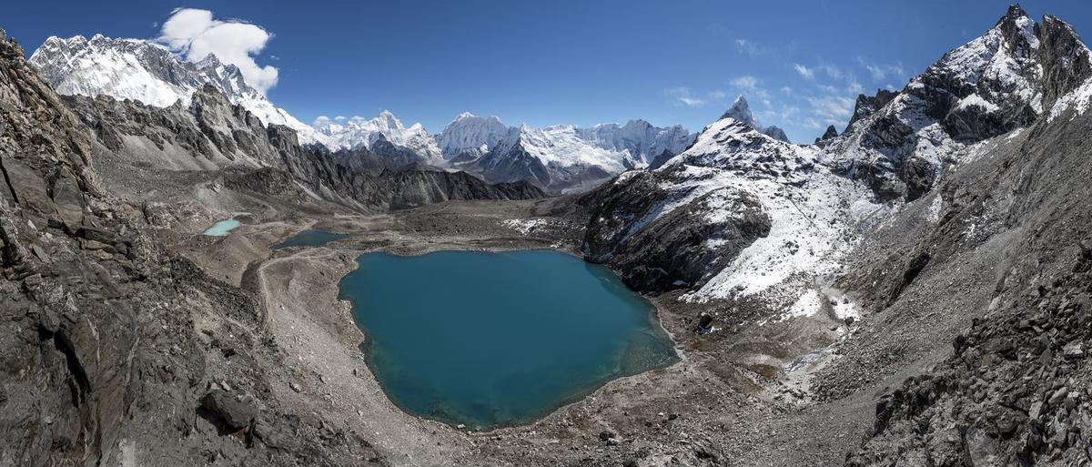
Glacial lake and peaks below Kongma La pass in the Everest region
The glacial lake below Kongma La, the highest of the three passes.

From Lobuche you walk on to Gorak Shep, the highest night of the loop. Everest Base Camp, at 5,364 m (about 17,600 ft), is a side trip from there.

Cho La and the Ngozumpa glacier

After Kala Patthar at dawn, you drop past Lobuche to Dzongla. Cho La is the crossing to Thagnak. Exodus describes very steep, rocky ground with some scrambling below a glaciated top, where crampons or microspikes may be needed on the slippery ice. 10Adventures considers it the most demanding of the three. It is a long day. Our Cho La pass guide covers it in detail. From Thagnak you cross the Ngozumpa glacier, about 18 km long, to Gokyo.
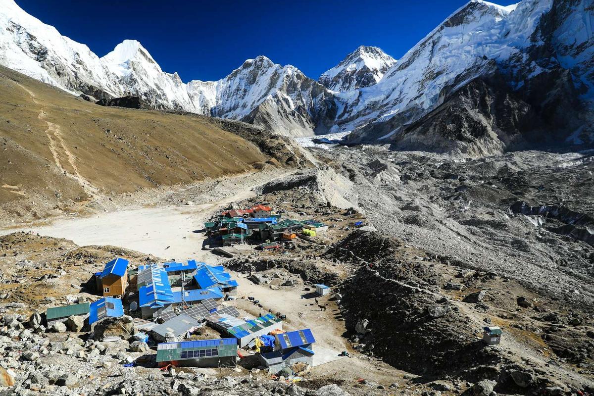
Gorak Shep on the Everest Base Camp route
Gorak Shep, the highest night on the loop and the start of the walk towards Cho La.

Gokyo, Renjo La and the way down

Gokyo sits beside the lakes, and Gokyo Ri, 5,357 m (about 17,580 ft), is the viewpoint above the village. Our Gokyo Lakes guide has more on both. Renjo La climbs straight out of Gokyo; beyond it you drop to Lungden, then Thame, and back to Namche.
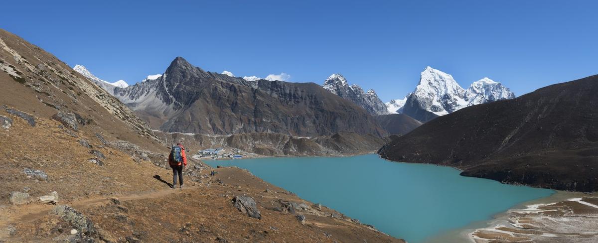
Renjo La trail climbing above Gokyo Lake in the Everest region
The trail to Renjo La climbs straight out of Gokyo, above the lake.

How hard are the three passes?

The Three Passes is a hard trek. There is no official grading scale in Nepal, but World Expeditions rates it 7/10, Challenging, and Nepal Hiking Team calls it Strenuous. You cross three passes above 5,300 m on loose moraine and glacier, and many of the nights are at around 4,700 m or higher.

What the passes ask of you

  • Long days on moraine and rock, with glacier on Cho La and on the Ngozumpa crossing to Gokyo.
  • Snow that can change a pass from one day to the next.
  • No teahouses on the Kongma La crossing, so you carry water and lunch.
  • Cold mornings: you start each crossing early.

On every pass, your guide, who knows the route, decides when and how to cross, based on snow and the forecast. A licensed guide walks with you on every trek we run.

Altitude on the loop

Lukla is already above 2,450 m, the height at which the CDC says altitude sickness becomes a risk. Above 3,000 m, raise your sleeping height by about 500 m a night at most and take a rest day every three to four days. Drink water, skip alcohol early on, never go higher with symptoms and descend if they get worse. Ask your doctor about medicine before you travel. Garlic soup and hot soups are a comforting local tradition, not a proven cure. The Himalayan Rescue Association aid post at Pheriche, at about 4,240 m, is staffed in the main trekking seasons; this autumn it runs to the end of November 2026.

How long and how far is the Three Passes trek?

Most operators list the Three Passes at 20 to 22 days door to door, with about 17 to 18 days on foot. There is no official distance for the loop. One operator, Nepal Hiking Team, puts it at about 146 to 150 km; others print daily distances only.

A 3 passes trek itinerary is longer than the classic route because it adds Chhukung, Dzongla, Gokyo and Lungden to the Base Camp walk. 10Adventures lists a shorter 14 to 15 days.

When can you cross the passes?

The best window is October and November, after the monsoon, when NTB says Nepal's skies are clearest. World Expeditions runs the Three Passes from September to May, calls October and November the most stable, and December to February cold but clear. Exodus warns that upper Cho La can be snow- and ice-covered, particularly after November and in spring.

The monsoon normally runs from about 13 June to 2 October (DHM); in 2026 it fully withdrew on 14 October. Snow comes outside it too. On 26 September 2026 heavy snow fell in the upper Khumbu, more than 50 cm in higher areas, and trekkers near Imja Tse had to be rescued (The Rising Nepal).

"People are advised not to go further up unnecessarily in risky conditions."

Laxman Adhikari, ward chairperson, Khumbu Pasang Lhamu Rural Municipality-4, The Rising Nepal, 26 September 2026

High up it stays cold all year: the Ev-K2-CNR Pyramid station at 5,035 m recorded a mean annual temperature of minus 2.5 °C over 1994 to 2023.

Conditions after Cyclone Arnab, November 2026

After Cyclone Arnab at the end of October 2026, snow lay on the trails around Dingboche and Gokyo, and a lodge in Gokyo reported that fresh snow had made the usual glacier crossing towards Dragnag less safe (ExplorersWeb, 4 November 2026). No official notice on the three passes had been issued when we checked on 9 November 2026. The Department of Immigration had asked permit holders not to trek in high mountain areas from 29 to 31 October, and the Department of Tourism had advised avoiding high areas from 28 October to 1 November; both periods are over. Your guide, who knows the route, decides when and how to cross, based on snow and the forecast.

Getting to Lukla and back

You start and finish at Lukla, 2,846 m. In peak seasons many Lukla flights leave from Ramechhap (Manthali) rather than Kathmandu, and every flight is weather-dependent. Kathmandu to Lukla is about 30 minutes in the air; Ramechhap to Lukla about 20 minutes.

The drive to Manthali usually takes about 4 to 5 hours, longer when the BP Highway is blocked and traffic takes the longer mid-hill road; some operators currently add a night in Manthali. Our Lukla airport guide explains flights, Ramechhap and delays.

What does the Three Passes trek cost in permits and extras?

The fixed official costs are two permits: the Sagarmatha National Park permit at NPR 3,000 for foreign nationals (NPR 1,500 SAARC, children under 10 free) and the Khumbu Trek-Card at NPR 3,000 (NPR 2,000 SAARC and China), a simple total of NPR 6,000 for foreign nationals. We arrange both. Other costs on the trail are lodge extras, and you need insurance.

Lodge extra What operators list (market, not ours) Source
Device charging About NPR 200 to 500 per device Exodus, Nepal Hiking Team
Hot shower About NPR 250 to 600 Exodus, Intrepid
Lodge Wi-Fi About NPR 500 for up to 12 hours Intrepid

The Trek-Card is issued in Lukla against your passport and a recent photo. Make sure your insurance covers helicopter rescue at these heights; the UK FCDO says rescue helicopters cost GBP 1,000 to 2,000 or more per flying hour.

Frequently asked questions

How hard is the Everest Three Passes trek, which direction is better, and can I do it in September or January?

It is hard: World Expeditions grades it 7/10, Challenging. Most operators go anticlockwise, Kongma La first, for better acclimatisation and a fallback to Base Camp if snow shuts a pass. September can still bring rain, haze and early snow, as on 26 September 2026. January is cold, many lodges close and no authority publishes pass closures, so crossings depend on the snow.

Can I charge devices and get safe drinking water on the Three Passes?

Yes, mostly. Lodges charge devices, usually in the dining room, for about NPR 200 to 500 per device (operators' figures), and high lodges run on solar, so charging can fail in cloud. Lodges sell boiled water; treat any other water with tablets or a filter. The Khumbu municipality announced a ban on plastic drinking bottles from 2020, so bring a refillable bottle.

Do I need a guide, and which permits do I need for the Everest region?

You need two permits: the Sagarmatha National Park permit and the Khumbu Pasang Lhamu Rural Municipality Trek-Card. We arrange both. On guides there are two positions: the Nepal Tourism Board rule requiring a licensed guide, in force from 1 April 2023 (NTB lists 31 March 2023), and the municipality, which says a guide is not compulsory and issues Trek-Cards to trekkers. A licensed guide walks with you on every trek we run.

Where is the last ATM on the Everest trek, and how much cash should I carry?

There are ATMs in Lukla and Namche, and Footprint Adventure calls Namche the last reliable stop. Both depend on satellite links and often go offline, so do not count on them. We do not give a fixed amount, because spending varies. Carry enough rupees from Kathmandu for lodges, Wi-Fi, charging and showers for the whole loop.

What is Kala Patthar, and is it the best view of Everest?

Kala Patthar is the rocky viewpoint above Gorak Shep, at about 5,550 m (about 18,210 ft; some sources give 5,545 m). It is not a peak. Wikipedia describes it as the most accessible close view of Everest, because from much of the region Everest's summit is hidden behind Nuptse. On the Three Passes you climb it at dawn from Gorak Shep before heading to Dzongla.

Plan your trek

Our Everest Three Passes trek page lists the Three Passes trips we run, with their length and price. If three passes feel like too much, the Everest Base Camp trek follows the same valley to Kala Patthar and back without the high crossings. Send us your dates on WhatsApp or through the enquiry form, and we will tell you honestly which route fits your days and experience.

Your Nepal visa and international flights are your own arrangements; official visa information is on the Nepal Tourism Board tourist-visa page.
Tags
Everest regionThree Passes trekKongma LaCho LaRenjo LaGokyo
Share
U
Uncover Nepal Team
Writer at Uncover Nepal
More in TreksSee all Treks

Everest Three Passes Trek Map: Route and Stages

14 min read Posted 10 Nov 2026Updated 08 Nov 2026
View from the Kongma La trail towards Ama Dablam in the Everest region of Nepal

Above Chhukung the trail to Kongma La turns to loose moraine, and every step slides a little before it holds. Turn round and Ama Dablam fills the view behind you, and near the top a small glacial lake lies still. This is the first of three high crossings that turn the Everest Base Camp walk into a full loop of the Khumbu.

By Uncover Nepal Team · Checked by our Kathmandu travel team · Last checked 9 November 2026

This three passes trek map sets out the loop as a stage table: Lukla to Chhukung, over Kongma La to Base Camp, across Cho La to Gokyo, then over Renjo La and down through Thame. It is the Everest Base Camp trek with three high passes and the Gokyo lakes added.

Key facts

Highest pass
Kongma La, 5,535 m (about 18,160 ft), linking Chhukung and Lobuche (The Himalayan Times, 29 Oct 2026 (checked 9 Nov 2026))
Middle pass
Cho La, 5,420 m (about 17,780 ft), between Dzongla and Thagnak (Wikipedia "Cho La (Nepal)"; World Expeditions, Exodus (checked 9 Nov 2026))
Western pass
Renjo La, about 5,360 m (about 17,590 ft); some give up to about 5,440 m (Operators incl. World Expeditions; 10Adventures (checked 9 Nov 2026))
Start and finish
Lukla airstrip, 2,846 m (about 9,340 ft) (CAAN AIP AMDT 02/2026 (house fact, checked 9 Nov 2026))
Highest night
Gorak Shep, about 5,140 to 5,180 m (Intrepid, World Expeditions, Exodus (checked 9 Nov 2026))
Length
Usually 20 to 22 days door to door, about 17 to 18 on foot (World Expeditions, Nepal Hiking Team (checked 9 Nov 2026))
Distance
No official figure; one operator gives about 146 to 150 km (Nepal Hiking Team (checked 9 Nov 2026))
Permits
Sagarmatha National Park permit NPR 3,000 (SAARC NPR 1,500); Khumbu Trek-Card NPR 3,000 (SAARC and China NPR 2,000) (NTB; Khumbu Pasang Lhamu Rural Municipality (checked 9 Nov 2026))
Lukla flights
In peak seasons many leave from Ramechhap (Manthali); all are weather-dependent (Kantipur, 4 Oct 2026; house fact (checked 9 Nov 2026))

In this guide

  • What does the three passes trek map look like?
  • Which direction is better: anticlockwise or clockwise?
  • The route in order, stage by stage
  • How hard are the three passes?
  • How long and how far is the Three Passes trek?
  • When can you cross the passes?
  • Getting to Lukla and back
  • What does the Three Passes trek cost in permits and extras?
  • Frequently asked questions
  • Plan your trek

What does the three passes trek map look like?

The Everest three passes trek map is a loop, not a line. You walk up the Khumbu valley to Chhukung, cross Kongma La to Lobuche and Base Camp, cross Cho La west to Gokyo, cross Renjo La to Lungden, then drop through Thame back to Namche and Lukla. The table below is that map, stop by stop.

Operators' heights for the same village differ by tens of metres, so the table gives "about" plus the range we found. A stage is the usual overnight hop; extra acclimatisation nights and spare days stretch it to the length operators list.

Stage From To Sleeping height (about) Pass Notes
1 Lukla Phakding 2,610 m None Fly in to Lukla (2,846 m), from Kathmandu or, in peak seasons, Ramechhap
2 Phakding Namche Bazaar 3,440 m None Acclimatisation stop; ATMs here, but they often go offline
3 Namche Bazaar Tengboche 3,860 m None Monastery village
4 Tengboche Dingboche 4,360 to 4,410 m None Nights here and at Chhukung build acclimatisation
5 Dingboche Chhukung 4,730 m None Base for the first pass
6 Chhukung Lobuche 4,910 to 4,940 m Kongma La, 5,535 m No teahouses on the crossing; glacier near the end of the day
7 Lobuche Gorak Shep 5,140 to 5,180 m None Highest night; side trip to Base Camp (5,364 m)
8 Gorak Shep Dzongla 4,830 m None Kala Patthar at dawn, then down past Lobuche
9 Dzongla Thagnak 4,700 m Cho La, 5,420 m Steep, glaciated, some scrambling
10 Thagnak Gokyo 4,750 m None Crosses the Ngozumpa glacier
11 Gokyo Gokyo 4,750 m None Optional climb of Gokyo Ri (5,357 m)
12 Gokyo Lungden 4,370 m Renjo La, about 5,360 m (some give up to about 5,440 m) Climb starts at the lakeside
13 Lungden Thame 3,800 to 3,820 m None Down the valley towards Namche
14 Thame Namche Bazaar 3,440 m None The loop closes
15 Namche Bazaar Lukla 2,846 m (airstrip) None Fly out; keep spare days for weather

If you are still choosing between this loop and the shorter options, our guide to Everest trekking routes compared sets them side by side.

Which direction is better: anticlockwise or clockwise?

Most operators run the loop anticlockwise, crossing Kongma La first after nights in Dingboche and Chhukung. Operators say that leaves you better acclimatised before the hardest climbs, and Base Camp is still in reach if snow shuts a pass. Clockwise starts with Renjo La from Lungden, after less time at height.

Stupa at Dingboche below snow peaks in the Khumbu
Dingboche, one of the nights that builds acclimatisation before Kongma La on the anticlockwise loop.

Anticlockwise and clockwise compared

Anticlockwise (Kongma La first) Clockwise (Renjo La first)
First pass Kongma La, 5,535 m, from Chhukung Renjo La, about 5,360 m, from Lungden
Time at height before it More: Namche, Dingboche and Chhukung come first Less: Thame and Lungden come soon after Namche
Base Camp Reached after the first pass Reached only after Renjo La and Cho La
If snow shuts a pass Base Camp and Kala Patthar stay in reach Base Camp is still two passes away
Who runs it this way World Expeditions and Nepal Hiking Team, among others Third Rock Adventures, among others

Footprint Adventure says most trekkers choose the anticlockwise route, and that Renjo La is usually seen as the toughest pass when you approach it clockwise. The stage table above runs anticlockwise.

The route in order, stage by stage

The loop has four parts, and each ends at a pass or a big viewpoint that needs a settled weather window. Heights are in the table above.

Lukla to Chhukung: the build-up

From Lukla the trail drops to Phakding, then climbs to Namche Bazaar, where you stop to acclimatise. Tengboche and Dingboche follow, then Chhukung, the last stop before the first pass. These slow nights are where your body catches up with the height.

Stupa and entrance gate at Namche Bazaar in the Everest region
The gate and stupa at Namche Bazaar, where the loop starts and ends.

Kongma La to Base Camp

Kongma La links Chhukung and Lobuche. The Himalayan Times describes rugged moraine slopes and loose footing; World Expeditions says it is harder if snow is present, with a glacier crossing near the end of the day. Nepal Hiking Team notes there are no teahouses on the crossing, so carry water and lunch. On 27 October 2026 an Australian trekker badly injured in a fall near Kongma La was flown by helicopter from Lobuche to Kathmandu (The Himalayan Times, 29 October 2026).

Glacial lake and peaks below Kongma La pass in the Everest region
The glacial lake below Kongma La, the highest of the three passes.

From Lobuche you walk on to Gorak Shep, the highest night of the loop. Everest Base Camp, at 5,364 m (about 17,600 ft), is a side trip from there.

Cho La and the Ngozumpa glacier

After Kala Patthar at dawn, you drop past Lobuche to Dzongla. Cho La is the crossing to Thagnak. Exodus describes very steep, rocky ground with some scrambling below a glaciated top, where crampons or microspikes may be needed on the slippery ice. 10Adventures considers it the most demanding of the three. It is a long day. Our Cho La pass guide covers it in detail. From Thagnak you cross the Ngozumpa glacier, about 18 km long, to Gokyo.

Gorak Shep on the Everest Base Camp route
Gorak Shep, the highest night on the loop and the start of the walk towards Cho La.

Gokyo, Renjo La and the way down

Gokyo sits beside the lakes, and Gokyo Ri, 5,357 m (about 17,580 ft), is the viewpoint above the village. Our Gokyo Lakes guide has more on both. Renjo La climbs straight out of Gokyo; beyond it you drop to Lungden, then Thame, and back to Namche.

Renjo La trail climbing above Gokyo Lake in the Everest region
The trail to Renjo La climbs straight out of Gokyo, above the lake.

How hard are the three passes?

The Three Passes is a hard trek. There is no official grading scale in Nepal, but World Expeditions rates it 7/10, Challenging, and Nepal Hiking Team calls it Strenuous. You cross three passes above 5,300 m on loose moraine and glacier, and many of the nights are at around 4,700 m or higher.

What the passes ask of you

  • Long days on moraine and rock, with glacier on Cho La and on the Ngozumpa crossing to Gokyo.
  • Snow that can change a pass from one day to the next.
  • No teahouses on the Kongma La crossing, so you carry water and lunch.
  • Cold mornings: you start each crossing early.

On every pass, your guide, who knows the route, decides when and how to cross, based on snow and the forecast. A licensed guide walks with you on every trek we run.

Altitude on the loop

Lukla is already above 2,450 m, the height at which the CDC says altitude sickness becomes a risk. Above 3,000 m, raise your sleeping height by about 500 m a night at most and take a rest day every three to four days. Drink water, skip alcohol early on, never go higher with symptoms and descend if they get worse. Ask your doctor about medicine before you travel. Garlic soup and hot soups are a comforting local tradition, not a proven cure. The Himalayan Rescue Association aid post at Pheriche, at about 4,240 m, is staffed in the main trekking seasons; this autumn it runs to the end of November 2026.

How long and how far is the Three Passes trek?

Most operators list the Three Passes at 20 to 22 days door to door, with about 17 to 18 days on foot. There is no official distance for the loop. One operator, Nepal Hiking Team, puts it at about 146 to 150 km; others print daily distances only.

A 3 passes trek itinerary is longer than the classic route because it adds Chhukung, Dzongla, Gokyo and Lungden to the Base Camp walk. 10Adventures lists a shorter 14 to 15 days.

When can you cross the passes?

The best window is October and November, after the monsoon, when NTB says Nepal's skies are clearest. World Expeditions runs the Three Passes from September to May, calls October and November the most stable, and December to February cold but clear. Exodus warns that upper Cho La can be snow- and ice-covered, particularly after November and in spring.

The monsoon normally runs from about 13 June to 2 October (DHM); in 2026 it fully withdrew on 14 October. Snow comes outside it too. On 26 September 2026 heavy snow fell in the upper Khumbu, more than 50 cm in higher areas, and trekkers near Imja Tse had to be rescued (The Rising Nepal).

"People are advised not to go further up unnecessarily in risky conditions."

Laxman Adhikari, ward chairperson, Khumbu Pasang Lhamu Rural Municipality-4, The Rising Nepal, 26 September 2026

High up it stays cold all year: the Ev-K2-CNR Pyramid station at 5,035 m recorded a mean annual temperature of minus 2.5 °C over 1994 to 2023.

Conditions after Cyclone Arnab, November 2026

After Cyclone Arnab at the end of October 2026, snow lay on the trails around Dingboche and Gokyo, and a lodge in Gokyo reported that fresh snow had made the usual glacier crossing towards Dragnag less safe (ExplorersWeb, 4 November 2026). No official notice on the three passes had been issued when we checked on 9 November 2026. The Department of Immigration had asked permit holders not to trek in high mountain areas from 29 to 31 October, and the Department of Tourism had advised avoiding high areas from 28 October to 1 November; both periods are over. Your guide, who knows the route, decides when and how to cross, based on snow and the forecast.

Getting to Lukla and back

You start and finish at Lukla, 2,846 m. In peak seasons many Lukla flights leave from Ramechhap (Manthali) rather than Kathmandu, and every flight is weather-dependent. Kathmandu to Lukla is about 30 minutes in the air; Ramechhap to Lukla about 20 minutes.

The drive to Manthali usually takes about 4 to 5 hours, longer when the BP Highway is blocked and traffic takes the longer mid-hill road; some operators currently add a night in Manthali. Our Lukla airport guide explains flights, Ramechhap and delays.

What does the Three Passes trek cost in permits and extras?

The fixed official costs are two permits: the Sagarmatha National Park permit at NPR 3,000 for foreign nationals (NPR 1,500 SAARC, children under 10 free) and the Khumbu Trek-Card at NPR 3,000 (NPR 2,000 SAARC and China), a simple total of NPR 6,000 for foreign nationals. We arrange both. Other costs on the trail are lodge extras, and you need insurance.

Lodge extra What operators list (market, not ours) Source
Device charging About NPR 200 to 500 per device Exodus, Nepal Hiking Team
Hot shower About NPR 250 to 600 Exodus, Intrepid
Lodge Wi-Fi About NPR 500 for up to 12 hours Intrepid

The Trek-Card is issued in Lukla against your passport and a recent photo. Make sure your insurance covers helicopter rescue at these heights; the UK FCDO says rescue helicopters cost GBP 1,000 to 2,000 or more per flying hour.

Frequently asked questions

How hard is the Everest Three Passes trek, which direction is better, and can I do it in September or January?

It is hard: World Expeditions grades it 7/10, Challenging. Most operators go anticlockwise, Kongma La first, for better acclimatisation and a fallback to Base Camp if snow shuts a pass. September can still bring rain, haze and early snow, as on 26 September 2026. January is cold, many lodges close and no authority publishes pass closures, so crossings depend on the snow.

Can I charge devices and get safe drinking water on the Three Passes?

Yes, mostly. Lodges charge devices, usually in the dining room, for about NPR 200 to 500 per device (operators' figures), and high lodges run on solar, so charging can fail in cloud. Lodges sell boiled water; treat any other water with tablets or a filter. The Khumbu municipality announced a ban on plastic drinking bottles from 2020, so bring a refillable bottle.

Do I need a guide, and which permits do I need for the Everest region?

You need two permits: the Sagarmatha National Park permit and the Khumbu Pasang Lhamu Rural Municipality Trek-Card. We arrange both. On guides there are two positions: the Nepal Tourism Board rule requiring a licensed guide, in force from 1 April 2023 (NTB lists 31 March 2023), and the municipality, which says a guide is not compulsory and issues Trek-Cards to trekkers. A licensed guide walks with you on every trek we run.

Where is the last ATM on the Everest trek, and how much cash should I carry?

There are ATMs in Lukla and Namche, and Footprint Adventure calls Namche the last reliable stop. Both depend on satellite links and often go offline, so do not count on them. We do not give a fixed amount, because spending varies. Carry enough rupees from Kathmandu for lodges, Wi-Fi, charging and showers for the whole loop.

What is Kala Patthar, and is it the best view of Everest?

Kala Patthar is the rocky viewpoint above Gorak Shep, at about 5,550 m (about 18,210 ft; some sources give 5,545 m). It is not a peak. Wikipedia describes it as the most accessible close view of Everest, because from much of the region Everest's summit is hidden behind Nuptse. On the Three Passes you climb it at dawn from Gorak Shep before heading to Dzongla.

Plan your trek

Our Everest Three Passes trek page lists the Three Passes trips we run, with their length and price. If three passes feel like too much, the Everest Base Camp trek follows the same valley to Kala Patthar and back without the high crossings. Send us your dates on WhatsApp or through the enquiry form, and we will tell you honestly which route fits your days and experience.

Your Nepal visa and international flights are your own arrangements; official visa information is on the Nepal Tourism Board tourist-visa page.

Tags
Everest regionThree Passes trekKongma LaCho LaRenjo LaGokyo
Share
U
Uncover Nepal Team
Writer at Uncover Nepal
More in TreksSee all Treks