
 Trekking
 Visa copy
 Best time to Trek in Nepal-bug
 Articles
 Travel Information
 Nepal
NepalJomsom Muktinath Trek
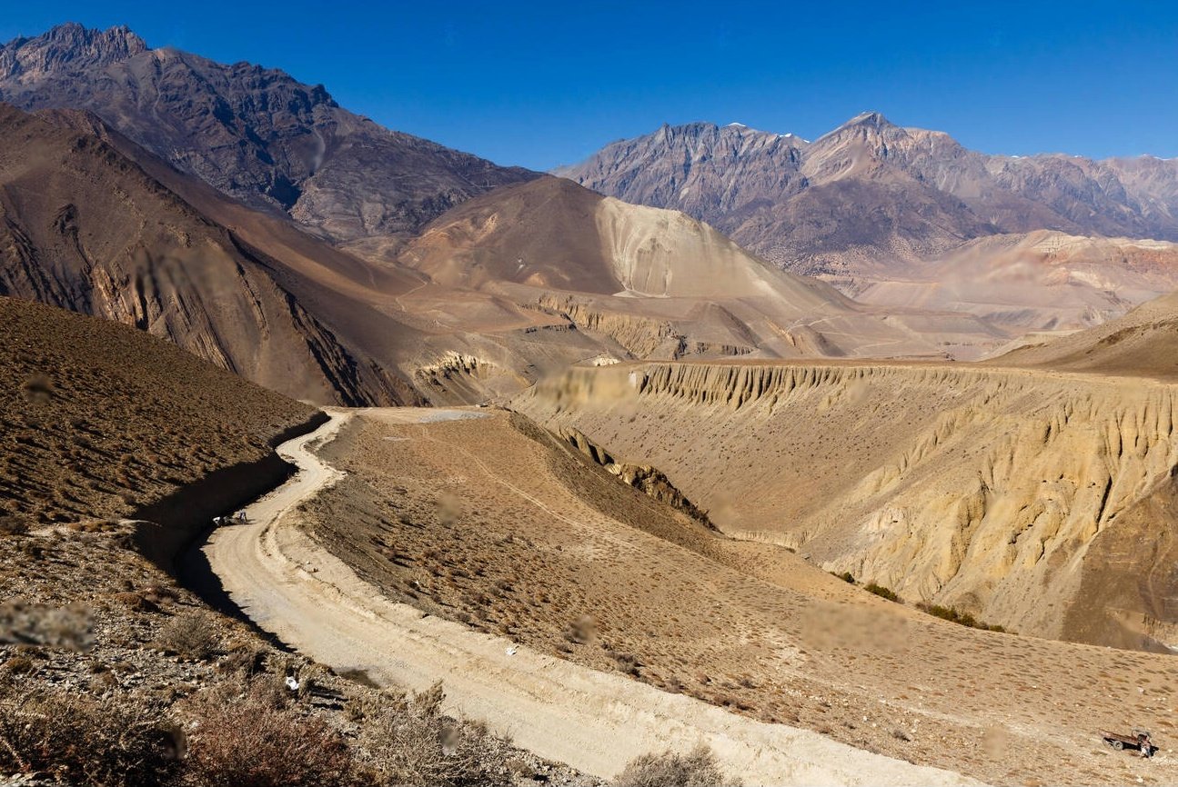
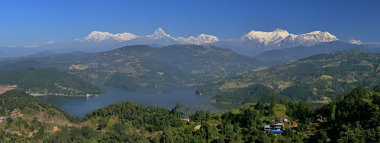
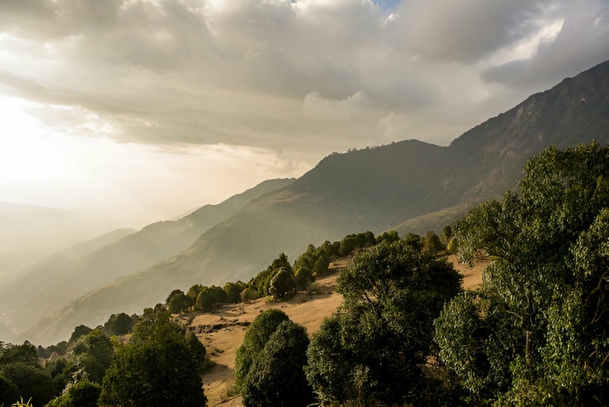
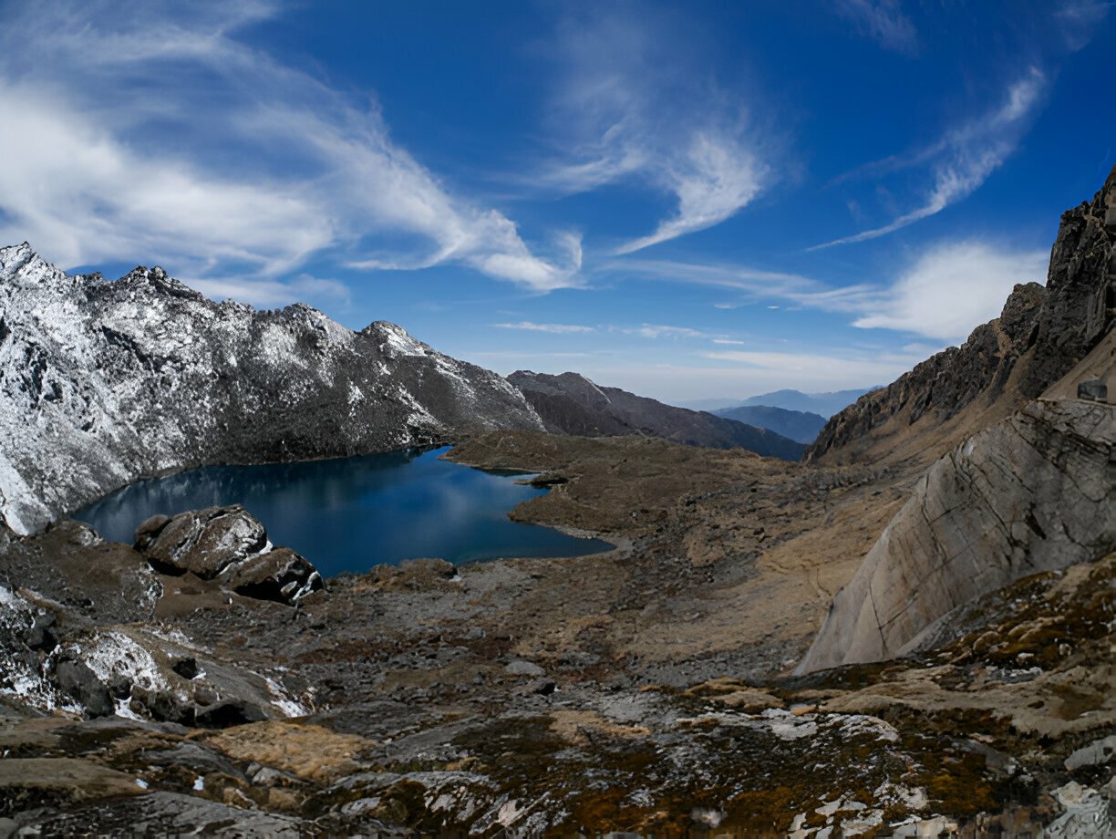
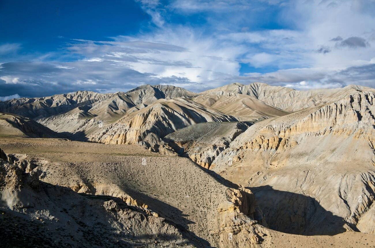
The Jomsom Muktinath Trek offers a spectacular journey through the trans-Himalayan region of Lower Mustang, providing trekkers with dramatic desert landscapes, fascinating cultural experiences, and magnificent mountain views within a relatively short timeframe. This remarkable adventure captures the essence of the renowned Annapurna Circuit's western portion while requiring less time and lower altitude acclimatization than many Himalayan treks. The journey traverses the world's deepest gorge, the Kali Gandaki Valley, which separates the massive peaks of Annapurna and Dhaulagiri, creating an awe-inspiring corridor where powerful afternoon winds sweep between 8,000-meter giants. Culturally, the trek provides immersion into a fascinating transitional zone where traditional Hindu influences from the south blend with Tibetan Buddhist cultures from the north, creating unique customs, architecture, and religious practices seen in villages like Kagbeni, Jomsom, and Marpha. The region's position in the rain shadow of the Annapurna massif creates an arid, high-desert landscape reminiscent of Tibet or Ladakh, with colorful eroded cliffs, vast gravel plains, and dramatic rock formations contrasting sharply with the lush temperate regions south of the Himalayan divide. The pilgrimage site of Muktinath (3,800m) highlights the journey, with its sacred temple complex featuring natural gas flames and 108 water spouts where Hindu and Buddhist pilgrims perform ritual purifications. The trek also passes through charming villages like Marpha, famous for its whitewashed buildings, neat flagstone streets, and delicious apple products including juice, brandy, and dried fruit cultivated in surrounding orchards. This moderately challenging 5-7 day trek can be tailored into various itineraries, with many travelers opting to begin with a spectacular flight to Jomsom or a jeep ride to maximize time in the region. The Jomsom Muktinath Trek is particularly rewarding during monsoon season (June-August) when other trekking areas are rain-affected, as its location in the Himalayan rain shadow ensures mostly dry conditions year-round, with the post-monsoon period (September-November) offering the clearest mountain views and pleasant temperatures.


Want to Build you own Trip?
Discover tailored experiences across Nepal’s diverse landscapes based on your preferred adventure location.
 About this Trip
The Jomsom Muktinath Trek represents a perfect introduction to the dramatic landscapes and cultures of Nepal's trans-Himalayan regions, offering what many experienced guides consider an ideal balance of accessibility, diversity, and cultural richness. What makes this trek exceptional is its ability to deliver the essence of a high-mountain Himalayan experience without the extended timeframe and extreme altitudes required by many of Nepal's famous trekking routes.
The trek follows the ancient trade route that once connected the Tibetan plateau with the lowlands of Nepal and India, traversing the remarkable Kali Gandaki gorge between the towering massifs of Annapurna and Dhaulagiri. This historic pathway creates a journey of continuous visual drama, as trekkers experience the stark beauty of an arid landscape sculpted by wind and water over millennia, with colorful sedimentary layers exposed in eroded cliff faces and vast gravel plains stretching between settlements. The daily rhythm of powerful afternoon winds sweeping up the valley becomes a defining feature of the experience, a natural phenomenon that has shaped both the physical landscape and the cultural adaptations of communities in the region.
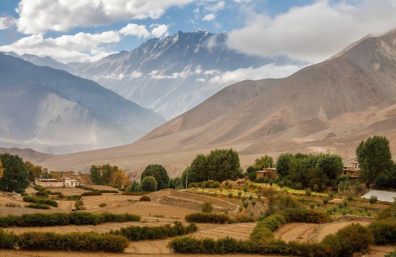
The cultural dimension of this trek is particularly extraordinary. The region exists at a fascinating crossroads where Hindu and Buddhist traditions have intermingled for centuries, creating unique syncretic practices visible in temples, villages, and daily life. Architecture transitions from typical Nepali styles in the south to distinctly Tibetan-influenced structures with flat roofs, whitewashed walls, and decorative elements that reflect the arid climate and cultural connections to Tibet. The Thakali people of the central valley are renowned for their entrepreneurial spirit and distinctive cuisine, while settlements closer to Muktinath showcase stronger Tibetan cultural influences in dress, religious practices, and social organization.
Physically, the trek presents a comfortable challenge accessible to reasonably fit trekkers without specialized mountaineering skills. Daily walking segments generally range from 5-6 hours over varied terrain, with gradual ascents and descents rather than the extreme elevation changes that characterize many Himalayan journeys. The highest point at Muktinath (3,800m) requires some acclimatization but remains below the threshold where severe altitude sickness becomes a common concern, making the route suitable for trekkers with limited high-altitude experience.
Perhaps most distinctively, the Jomsom Muktinath trek offers exceptional flexibility in itinerary design. The availability of flights into Jomsom and jeep transportation on sections of the route allows trekkers to customize their journey based on available time, physical preferences, and specific interests. This adaptability makes the trek accessible to a wider range of travelers than many Nepali trekking routes, from those seeking a short introduction to Himalayan landscapes to enthusiasts wishing to explore the region's cultural and natural dimensions in greater depth.
This combination of dramatic landscapes, cultural richness, physical accessibility, and itinerary flexibility creates what many consider the perfect "sampler" of Nepal's trans-Himalayan regions, delivering a genuinely rewarding mountain experience without requiring weeks of commitment or extreme physical challenges.
The Jomsom Muktinath Trek represents a perfect introduction to the dramatic landscapes and cultures of Nepal's trans-Himalayan regions, offering what many experienced guides consider an ideal balance of accessibility, diversity, and cultural richness. What makes this trek exceptional is its ability to deliver the essence of a high-mountain Himalayan experience without the extended timeframe and extreme altitudes required by many of Nepal's famous trekking routes.
The trek follows the ancient trade route that once connected the Tibetan plateau with the lowlands of Nepal and India, traversing the remarkable Kali Gandaki gorge between the towering massifs of Annapurna and Dhaulagiri. This historic pathway creates a journey of continuous visual drama, as trekkers experience the stark beauty of an arid landscape sculpted by wind and water over millennia, with colorful sedimentary layers exposed in eroded cliff faces and vast gravel plains stretching between settlements. The daily rhythm of powerful afternoon winds sweeping up the valley becomes a defining feature of the experience, a natural phenomenon that has shaped both the physical landscape and the cultural adaptations of communities in the region.
The cultural dimension of this trek is particularly extraordinary. The region exists at a fascinating crossroads where Hindu and Buddhist traditions have intermingled for centuries, creating unique syncretic practices visible in temples, villages, and daily life. Architecture transitions from typical Nepali styles in the south to distinctly Tibetan-influenced structures with flat roofs, whitewashed walls, and decorative elements that reflect the arid climate and cultural connections to Tibet. The Thakali people of the central valley are renowned for their entrepreneurial spirit and distinctive cuisine, while settlements closer to Muktinath showcase stronger Tibetan cultural influences in dress, religious practices, and social organization.
Physically, the trek presents a comfortable challenge accessible to reasonably fit trekkers without specialized mountaineering skills. Daily walking segments generally range from 5-6 hours over varied terrain, with gradual ascents and descents rather than the extreme elevation changes that characterize many Himalayan journeys. The highest point at Muktinath (3,800m) requires some acclimatization but remains below the threshold where severe altitude sickness becomes a common concern, making the route suitable for trekkers with limited high-altitude experience.
Perhaps most distinctively, the Jomsom Muktinath trek offers exceptional flexibility in itinerary design. The availability of flights into Jomsom and jeep transportation on sections of the route allows trekkers to customize their journey based on available time, physical preferences, and specific interests. This adaptability makes the trek accessible to a wider range of travelers than many Nepali trekking routes, from those seeking a short introduction to Himalayan landscapes to enthusiasts wishing to explore the region's cultural and natural dimensions in greater depth.
This combination of dramatic landscapes, cultural richness, physical accessibility, and itinerary flexibility creates what many consider the perfect "sampler" of Nepal's trans-Himalayan regions, delivering a genuinely rewarding mountain experience without requiring weeks of commitment or extreme physical challenges.

From $0
Price Varies from Group Size
Success
Here goes about why the success toast occurred.
Itinerary
Arrival in Kathmandu (1,400m)
Your Jomsom Muktinath adventure begins in Nepal's vibrant capital. After airport pickup, settle into your hotel and attend a pre-trek briefing with your guide, who will outline the journey ahead through the trans-Himalayan region of Lower Mustang. Take time to explore Kathmandu's cultural heritage sites and gather any last-minute supplies. The evening provides an opportunity to enjoy authentic Nepali cuisine and prepare mentally for the trek ahead. Accommodation: Comfortable hotel in Kathmandu with modern amenities.
Kathmandu to Pokhara (820m)
After breakfast, depart for Pokhara by tourist bus, a scenic 6-7 hour journey through the middle hills of Nepal, following river valleys and passing through traditional villages. Alternatively, take a short 25-minute flight for magnificent aerial views of the Himalayan foothills. Upon arrival in Pokhara, enjoy the relaxed atmosphere of this lakeside city with optional boating on Phewa Lake or visits to local temples. The evening offers a last chance to enjoy the comforts of a tourist hub before entering more remote regions. Accommodation: Tourist-class hotel in Pokhara.
Pokhara to Jomsom (2,720m) to Kagbeni (2,810m)
Take an early morning 20-minute flight from Pokhara to Jomsom, one of the world's most spectacular short flights, passing between Annapurna and Dhaulagiri with breathtaking mountain views. The dramatic change in landscape becomes immediately apparent as you land in the arid, windy environment of Jomsom, the administrative headquarters of Mustang district. After orienting yourself and perhaps enjoying breakfast at a local teahouse, begin a 3-4 hour trek to Kagbeni, following the Kali Gandaki river through a broad valley with views of Nilgiri and Dhaulagiri. Kagbeni, a medieval-looking village that guards the entrance to Upper Mustang, features narrow alleyways, a centuries-old monastery, and traditional houses with prayer flags fluttering from rooftops. Accommodation: Teahouse in Kagbeni.
Kagbeni to Muktinath (3,800m)
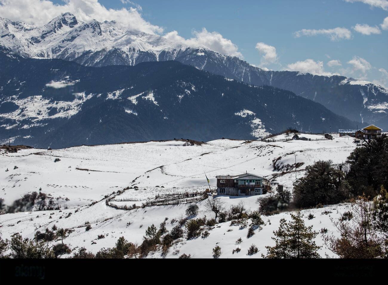
Today's 4-5 hour trek ascends steadily from the Kali Gandaki valley to Muktinath, an important pilgrimage site for both Hindus and Buddhists. The trail climbs through increasingly barren landscape with dramatic views back toward Kagbeni and the Kali Gandaki valley. As you gain altitude, the panoramic mountain views become more expansive. Reach Muktinath by afternoon, allowing time to visit its temple complex featuring 108 water spouts where pilgrims perform ritual ablutions, an eternal flame fueled by natural gas, and several shrines honoring both Hindu and Buddhist traditions, demonstrating the remarkable religious syncretism of the region. Accommodation: Teahouse in Muktinath.
Muktinath to Jhong to Jomsom (2,720m)
Rather than simply retracing steps down to Jomsom, take a less-traveled route through the village of Jhong. This 6-7 hour journey begins with a visit to the Muktinath temple complex in the early morning, when pilgrims perform rituals and the mountains are clearly visible. Then descend via a different trail to Jhong, featuring a remarkable ancient fortress and monastery with spectacular views across the valley. Continue descending through changing landscapes back to Jomsom for overnight, experiencing the famous afternoon winds that blow up the Kali Gandaki gorge. Accommodation: Teahouse in Jomsom with improved facilities.
Jomsom to Marpha (2,680m)
A relatively shorter 3-4 hour walking day follows the Kali Gandaki downstream to Marpha, one of the most charming villages in the region. Marpha is famous for its pristine whitewashed houses with flat roofs and narrow cobbled streets designed to provide shelter from the valley's powerful winds. The village is renowned for its apple products, including juices, brandy, and dried fruit. Visit the local monastery perched above the village and learn about the distinctive culture of the Thakali people, historical controllers of the salt trade through the Kali Gandaki corridor. Accommodation: Teahouse in Marpha.
Marpha to Kalopani (2,530m)
Continue trekking downstream for 5-6 hours through the dramatic Kali Gandaki gorge. The trail passes between the towering peaks of Dhaulagiri and Annapurna, which rise more than 7,000 meters above the valley floor, creating the world's deepest gorge. As you move south, the arid landscape gradually gives way to more vegetation. Reach Kalopani by afternoon, a pleasant village offering spectacular views of Dhaulagiri, Nilgiri, and Annapurna I, particularly magnificent at sunset and sunrise. Accommodation: Teahouse in Kalopani.
Kalopani to Tatopani (1,190m)
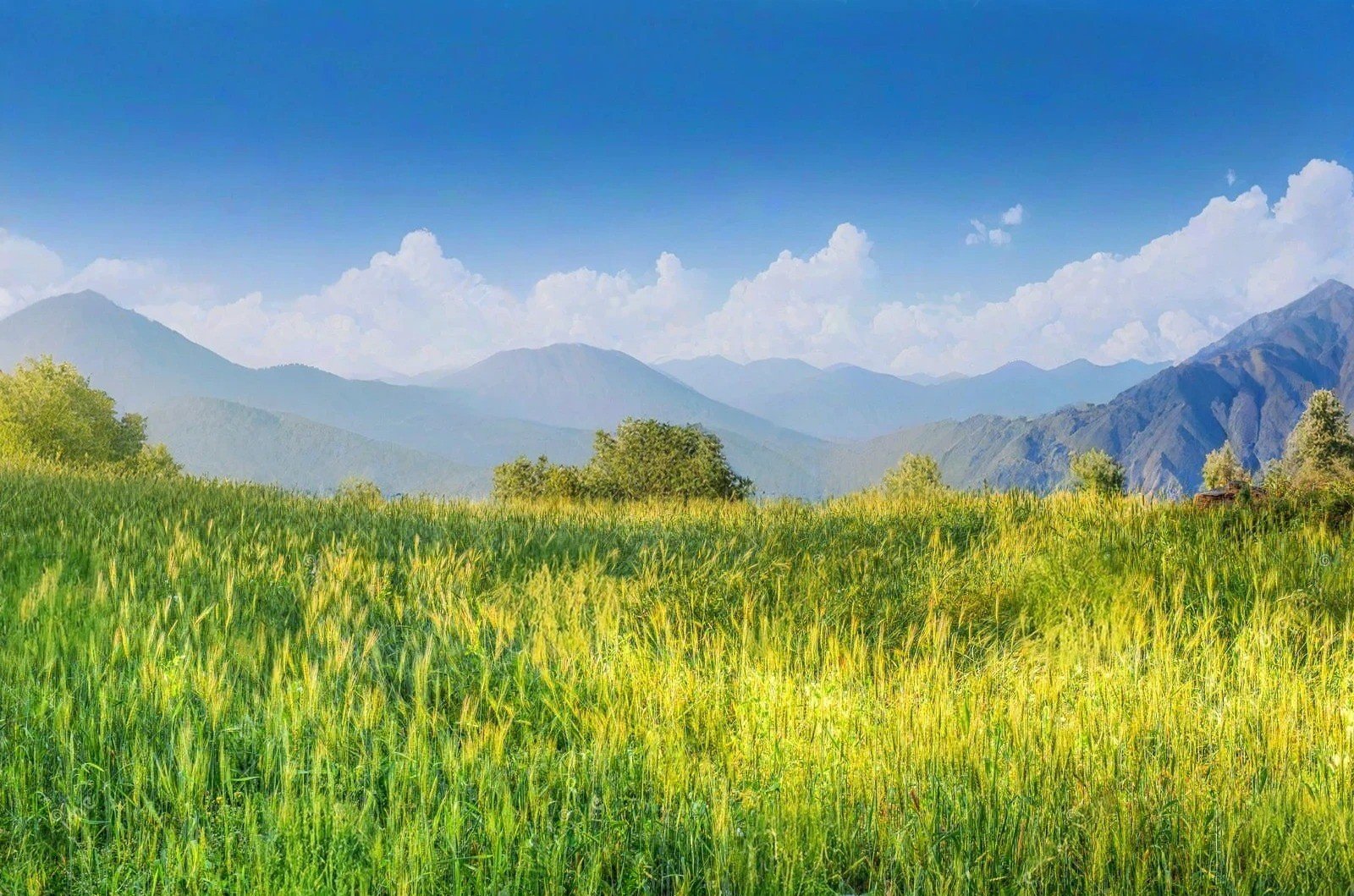
Descend for 5-6 hours through beautiful forest to Tatopani, meaning "hot water" in Nepali, named for its natural hot springs. The trail follows the increasingly powerful Kali Gandaki river, crossing suspension bridges and passing through traditional villages where the architecture begins to show more traditional Nepali influences and less Tibetan styling. The dramatic descent brings you from arid trans-Himalayan landscapes to lush subtropical environments in a single day, highlighting the remarkable ecological diversity of the region. Upon reaching Tatopani, enjoy a relaxing soak in the natural hot springs to ease your muscles after days of trekking. Accommodation: Teahouse in Tatopani.
Tatopani to Ghorepani (2,840m)
Today presents a challenging 7-8 hour climb of over 1,600 meters through rhododendron and oak forests to the popular trekking hub of Ghorepani. The ascent reveals dramatically different ecosystems from the arid Mustang region, with lush forests that bloom spectacularly with rhododendrons in spring. The trail passes through small farming villages with traditional stone houses and terraced fields, offering a stark contrast to the fortress-like settlements of Mustang. Ghorepani offers comfortable facilities and spectacular mountain views. Accommodation: Teahouse in Ghorepani with good facilities.
Ghorepani to Poon Hill (3,210m) to Nayapul (1,070m) to Pokhara
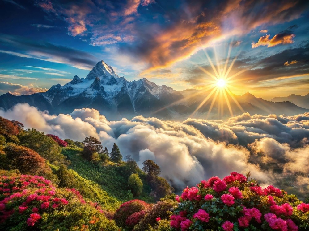
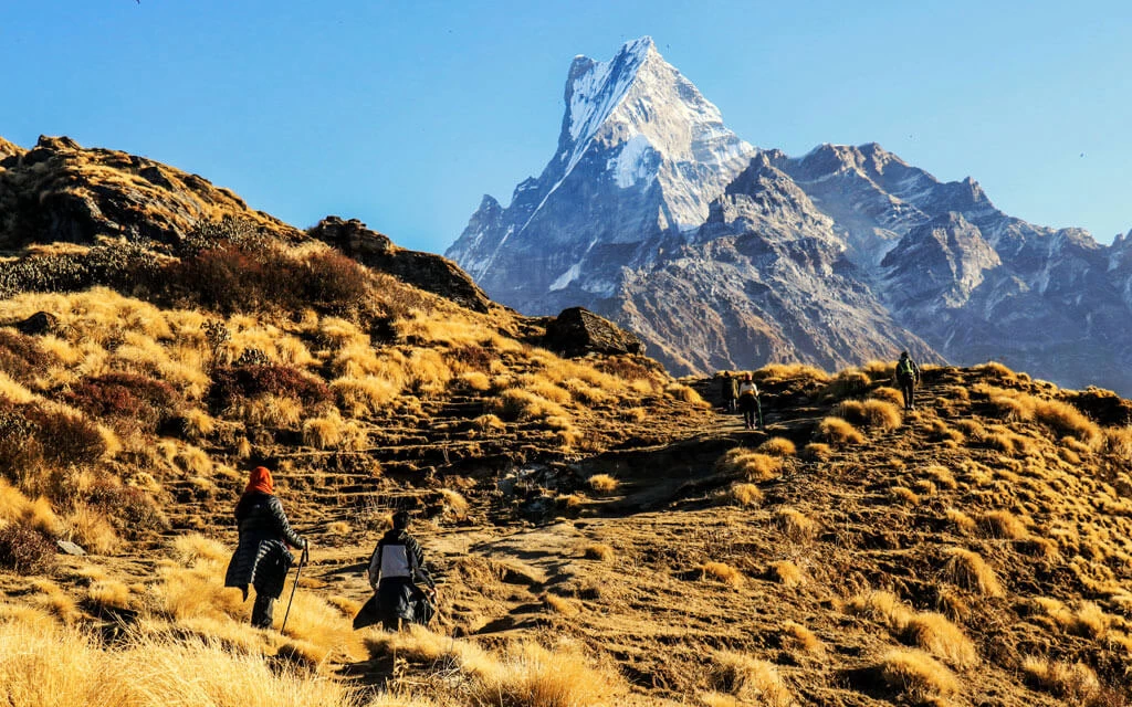
Rise before dawn for a 45-minute hike to Poon Hill, one of Nepal's most famous viewpoints, to witness a spectacular sunrise over the Himalayan range. The panorama encompasses Dhaulagiri, the Annapurna range, and Machapuchare (Fishtail Mountain), providing a fitting climax to your trekking journey. After returning to Ghorepani for breakfast, descend for 5-6 hours through beautiful rhododendron forest and traditional villages to Nayapul, where vehicles wait to return you to Pokhara (approximately 1.5 hours). Back in Pokhara, enjoy the comforts of hot showers, varied cuisine, and the opportunity to reflect on your journey through one of Nepal's most spectacular and culturally fascinating regions. Accommodation: Tourist-class hotel in Pokhara.
Pokhara
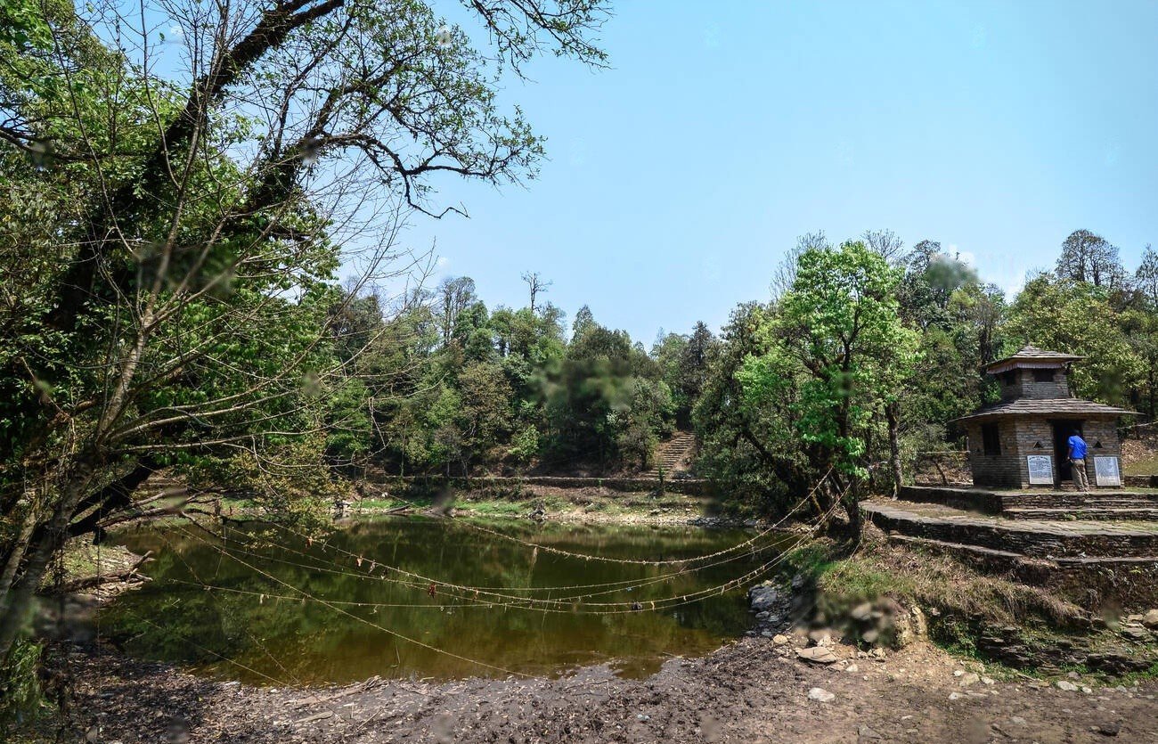
Take a well-deserved rest day in Pokhara. Options include boating on Phewa Lake, visiting the World Peace Pagoda for panoramic views, exploring the International Mountain Museum, or simply relaxing in lakeside cafes and restaurants. This day allows time to absorb the diverse experiences of your journey through the remarkable landscapes and cultures of the Kali Gandaki corridor. Accommodation: Same hotel in Pokhara.
Pokhara to Kathmandu
Return to Kathmandu by tourist bus (6-7 hours) or a short flight (25 minutes). The afternoon in Kathmandu offers opportunities for souvenir shopping in Thamel or additional sightseeing. A farewell dinner provides a chance to celebrate your Jomsom Muktinath adventure with guides and fellow trekkers. Accommodation: Comfortable hotel in Kathmandu.
Departure from Kathmandu
Your Jomsom Muktinath adventure concludes with a transfer to Kathmandu International Airport for your departure flight. Depending on your schedule, you might have time for last-minute shopping or sightseeing in Kathmandu before leaving Nepal with memories of your journey through this extraordinary trans-Himalayan region.
 Services
Includes
- Specialized bilingual guide familiar with the Jomsom Muktinath region
- Private Transport where applicable
- Flight from Pokhara to Jomsom
- Daily meals on the trek: breakfast, lunch, and dinner
- Services of an experienced guide and porter during the trek
- All essential trekking permits, including ACAP (Annapurna Conservation Area Permit) and TIMS
- Accommodation throughout the trek (teahouses)
Excludes
- Additional accommodation due to weather delays (particularly flight delays to/from Jomsom)
- Comprehensive travel and medical insurance for the trek
- Gratuities for the guides, porters, and trekking support staff
- International flights and entry visa fees for Nepal
- Personal trekking equipment and gear (sleeping bags, jackets, etc.)
- Extra food and drinks beyond the standard meals provided
- Hot showers and battery charging at teahouses (pay per use)
- Costs associated with emergency evacuation or alternate transportation if needed
- Temple entrance fees at Muktinath
 Good To Know
The infamous winds of the Kali Gandaki valley blow strongly from late morning through the afternoon; start walking early when possible and bring sunglasses and a buff/scarf for wind protection. Flights to Jomsom operate only in early morning before winds strengthen and can be delayed by weather, so build buffer days into your schedule. The trek can be done in reverse (starting with a trek up to Ghorepani and ending with a flight from Jomsom) or shortened by using jeep transportation for certain sections. The region is significantly drier than most Nepal trekking areas; moisturizer and lip balm are essential. ATMs are available in Jomsom but become scarce elsewhere; carry sufficient cash. Muktinath is an important pilgrimage site; dress respectfully when visiting the temple complex (shoulders and knees covered). The trek's relatively moderate altitude makes altitude sickness less concerning than on higher treks, but proper hydration remains important. Teahouse facilities are relatively good throughout this route compared to more remote treks. Consider bringing a small souvenir from your home country for your host family in homestays.
Wildlife Encounters
Himalayan griffon vultures soaring on thermal currents
Lammergeier (bearded vulture) with impressive wingspans
Various species of eagles and hawks
Choughs and crows adapted to high elevations
Blue sheep (bharal) on rocky slopes in higher regions
Pika (small rabbit-like mammals) in rocky areas
Marmots whistling from rocky outcrops
Diverse butterfly species in lower forested regions
Lizards and small reptiles in the arid zones
Various small bird species adapted to different ecological zones
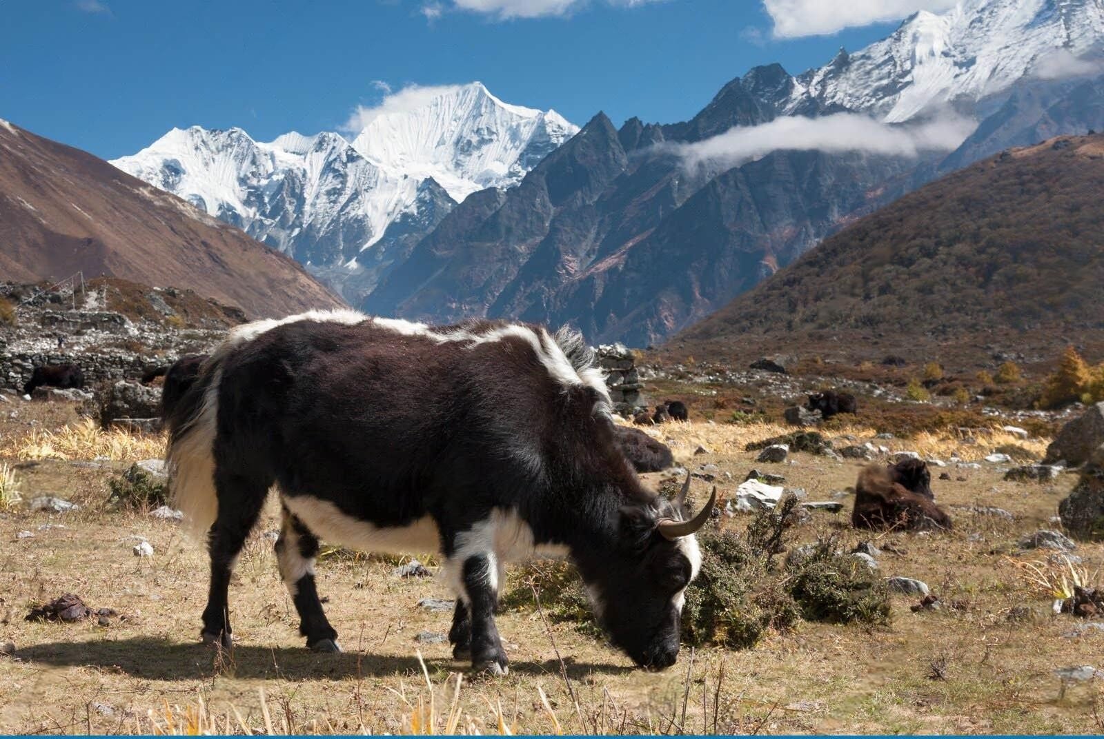
Domesticated yaks and yak-cow hybrids (dzo) in higher villages
 Reviews
FAQs (Frequently Asked Questions)
Your queries are answered.
How physically demanding is the trek?
Easy to moderate difficulty suitable for reasonably fit beginners. Daily hiking: 4-7 hours with some significant ascents/descents, particularly from Tatopani to Ghorepani. Maximum altitude (3,800m) requires basic acclimatization but is lower than many Himalayan treks.
Best time to visit?
September-November offers clearest mountain views and stable weather. March-May brings pleasant temperatures and wildflowers in lower regions. A major advantage is it remains trekable during monsoon (June-August) when other routes are problematic due to its rain shadow location.
How reliable are Jomsom flights?
Flights operate only in the early morning before valley winds strengthen. Delays and cancellations are common, especially during peak tourist seasons. Build buffer days into your itinerary and consider alternative transportation options like jeeps.
What permits are needed?
Annapurna Conservation Area Permit (ACAP, approximately $30) and TIMS (Trekkers' Information Management System) card (approximately $10), obtainable through trekking agencies or in Kathmandu/Pokhara.
Accommodation quality?
Generally better than many trekking regions with relatively well-developed facilities. Private rooms with basic beds and blankets, shared bathrooms, and dining areas serving varied menus. Electricity and sometimes WiFi available in larger villages.
Can the itinerary be shortened?
Yes, highly adaptable. Common variations include flying both ways, using jeep transportation for sections, or focusing on specific highlights. Can be completed in as few as 5 days with strategic transportation use.
Altitude sickness risk?
Lower than many Himalayan treks. Maximum elevation at Muktinath (3,800m) requires basic acclimatization but is below the threshold where severe altitude problems typically occur.
Food variety?
Excellent by trekking standards. Traditional dal bhat (rice and lentils), Tibetan dishes like momos (dumplings) and thukpa (noodle soup), and increasingly Western options. Marpha's apple products including juice, brandy, and pies are regional specialties.
Cultural highlights not to miss?
Muktinath temple complex with ritual bathing fountains. Kagbeni's medieval Tibetan-influenced village. Marpha's traditional architecture and apple distillery. Local festivals if timing aligns. Traditional weaving and seasonal agricultural activities. Monastery visits in several villages.
Experience the Best of Jomsom Muktinath with Uncover Nepal
Related Packages you might like
Upper Mustang Trek
-
 Mustang Region
-
 Days
Days
-
 5
5
Lower Mustang Trek
-
Mustang Region
-
Days
-
5
Machapuchhre Base Camp Trek-15 Days
-
Annapurna Region
-
7 Days
-
4
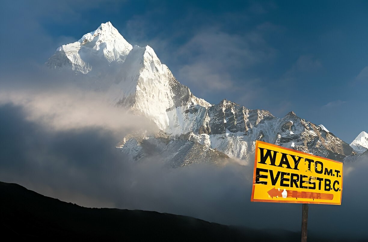
Everest Base Camp Trek
-
Everest Region
-
15 Days
-
5
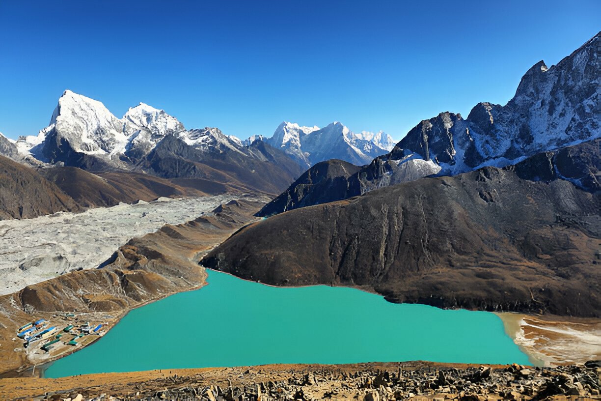
Gokyo Lake Trek
-
Everest Region
-
14 Days
-
5